


<< Other Photo Pages >> Red Elk Rock Shelter - Rock Art in United States in The Northwest Mountains
Submitted by bat400 on Thursday, 21 June 2012 Page Views: 7999
Rock ArtSite Name: Red Elk Rock Shelter Alternative Name: 10NP287Country: United States Region: The Northwest Mountains Type: Rock Art
Nearest Town: Lewiston, ID
Latitude: 46.340000N Longitude: 117.04W
Condition:
| 5 | Perfect |
| 4 | Almost Perfect |
| 3 | Reasonable but with some damage |
| 2 | Ruined but still recognisable as an ancient site |
| 1 | Pretty much destroyed, possibly visible as crop marks |
| 0 | No data. |
| -1 | Completely destroyed |
| 5 | Superb |
| 4 | Good |
| 3 | Ordinary |
| 2 | Not Good |
| 1 | Awful |
| 0 | No data. |
| 5 | Can be driven to, probably with disabled access |
| 4 | Short walk on a footpath |
| 3 | Requiring a bit more of a walk |
| 2 | A long walk |
| 1 | In the middle of nowhere, a nightmare to find |
| 0 | No data. |
| 5 | co-ordinates taken by GPS or official recorded co-ordinates |
| 4 | co-ordinates scaled from a detailed map |
| 3 | co-ordinates scaled from a bad map |
| 2 | co-ordinates of the nearest village |
| 1 | co-ordinates of the nearest town |
| 0 | no data |
Internal Links:
External Links:
I have visited· I would like to visit
bat400 would like to visit
")
Red pigmented pictographs in a rock shelter along the Snake River in Hell's Canyon. Other archaeological finds in this area are associated with the Nex Perce people. The rockart in this shelter is variously dated based on occupation and use finds
(which are as old as 2500 years) and C14 dating (only back to the early historic period, although this appears to be based on only 1 test sample.)
This site is included in a larger National Register of Historic Places Archaeological District.
The figures depict animal figures and geometric shapes. The main concentration of rock art is along a 20 meter stretch of wall.
In 2010 three men defaced the site with heavy coats of spray paint. A request for proposal is open for contractors to remove the paint and restore the figures as much as possible. The vadals were convicted and recieved sentences ranging from 3 years to 3 months in prison, with added home detention and community service.
Sources:
Nez Perce Snake River Archeological District, #78001086, National Register of Historic Places
"Snake River Flow Augmentation Impact Analysis Appendix," Feb 1999.
Canadian Archaeological Radiocarbon Database, C14 database compiled, 2001-2005, by Dr. Richard E. Morlan and Matthew Betts, Canadian Museum of Civilization
Information on this website is © 1996-2005.
Note: The location is not accurate for the site, with is described as being 10 km upstream from Lewiston, ID. The specific location is under the jurisdiction of the Army Corp of Engineers. News reports indicate the location as south of Hell's Gate State Park. This location will be updated as information is available.
Note: Third vandal sentenced for defacing pictographs - Spray-painting damaged tribal site on Snake River
You may be viewing yesterday's version of this page. To see the most up to date information please register for a free account.
Do not use the above information on other web sites or publications without permission of the contributor.
Nearby Images from Flickr

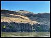

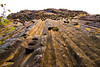
The above images may not be of the site on this page, but were taken nearby. They are loaded from Flickr so please click on them for image credits.
Click here to see more info for this site
Nearby sites
Click here to view sites on an interactive map of the areaKey: Red: member's photo, Blue: 3rd party photo, Yellow: other image, Green: no photo - please go there and take one, Grey: site destroyed
Download sites to:
KML (Google Earth)
GPX (GPS waypoints)
CSV (Garmin/Navman)
CSV (Excel)
To unlock full downloads you need to sign up as a Contributory Member. Otherwise downloads are limited to 50 sites.
Turn off the page maps and other distractions
Nearby sites listing. In the following links * = Image available
69.2km SE 134° Cooper's Ferry Archaeological Site* Ancient Village or Settlement
115.2km SSE 165° Snake River Archaeological Site* Rock Art
152.2km S 175° Hells Canyon Archeological District* Rock Art
163.7km W 266° Columbia Park* Ancient Village or Settlement
164.1km NNW 348° Indian Painted Rocks (Spokane) Rock Art
183.9km WSW 256° Matalam Ancient Village or Settlement
222.0km W 280° Whale Island Petroglyphs Rock Art
236.1km WNW 288° Vantage Petroglyphs* Rock Art
248.3km N 3° Priest Lake Pictographs Rock Art
274.2km NW 321° Balance Rock Omak* Natural Stone / Erratic / Other Natural Feature
299.5km WSW 257° Maryhill Stonehenge* Modern Stone Circle etc
316.3km NNE 30° Crystal Lakes Golf Course Stonehenge* Modern Stone Circle etc
323.5km WSW 258° Columbia Hills State Park* Rock Art
330.1km SSW 201° Stinkingwater Medicine Wheels* Stone Circle
339.4km W 260° Lower Memaloose Island* Barrow Cemetery
340.6km S 173° Celebration Park (Idaho)* Rock Art
390.7km E 85° Megaliths Of Helena* Natural Stone / Erratic / Other Natural Feature
397.9km SW 236° Redmond Lava Caves Cave or Rock Shelter
403.0km WNW 285° Skystone* Natural Stone / Erratic / Other Natural Feature
412.2km SSE 148° Shoshone Ice Caves* Cave or Rock Shelter
418.6km SSE 149° Idaho's Mammoth Cave* Cave or Rock Shelter
425.7km WNW 292° Burke Museum of Natural History and Culture* Museum
437.6km ENE 71° First Peoples Buffalo Jump* Natural Stone / Erratic / Other Natural Feature
444.4km WNW 292° Haleets* Rock Art
445.9km W 260° Portland Art Museum* Museum
View more nearby sites and additional images


 We would like to know more about this location. Please feel free to add a brief description and any relevant information in your own language.
 Wir möchten mehr über diese Stätte erfahren. Bitte zögern Sie nicht, eine kurze Beschreibung und relevante Informationen in Deutsch hinzuzufügen.
 Nous aimerions en savoir encore un peu sur les lieux. S'il vous plaît n'hesitez pas à ajouter une courte description et tous les renseignements pertinents dans votre propre langue.
 Quisieramos informarnos un poco más de las lugares. No dude en añadir una breve descripción y otros datos relevantes en su propio idioma.