

<< Our Photo Pages >> Mouse's Tank Canyon - Natural Stone / Erratic / Other Natural Feature in United States in The Southwest
Submitted by mfrincu on Sunday, 17 May 2015 Page Views: 1812
Natural PlacesSite Name: Mouse's Tank CanyonCountry: United States
NOTE: This site is 117.819 km away from the location you searched for.
Region: The Southwest Type: Natural Stone / Erratic / Other Natural Feature
Nearest Town: Las Vegas
Latitude: 36.440833N Longitude: 114.516389W
Condition:
| 5 | Perfect |
| 4 | Almost Perfect |
| 3 | Reasonable but with some damage |
| 2 | Ruined but still recognisable as an ancient site |
| 1 | Pretty much destroyed, possibly visible as crop marks |
| 0 | No data. |
| -1 | Completely destroyed |
| 5 | Superb |
| 4 | Good |
| 3 | Ordinary |
| 2 | Not Good |
| 1 | Awful |
| 0 | No data. |
| 5 | Can be driven to, probably with disabled access |
| 4 | Short walk on a footpath |
| 3 | Requiring a bit more of a walk |
| 2 | A long walk |
| 1 | In the middle of nowhere, a nightmare to find |
| 0 | No data. |
| 5 | co-ordinates taken by GPS or official recorded co-ordinates |
| 4 | co-ordinates scaled from a detailed map |
| 3 | co-ordinates scaled from a bad map |
| 2 | co-ordinates of the nearest village |
| 1 | co-ordinates of the nearest town |
| 0 | no data |
Internal Links:
External Links:
")
Mouse's Tank is named for a Southern Paiute Indian renegade (Little Mouse who used Valley of Fire as a hideout in the 1890's after he was accused of killing two prospectors and other crimes in the area. It is named ‘The Mouse’s Tank’ because an alleged Southern Paiute Indian renegade named ‘Little Mouse’ hid out there in the 1890’s. He was accused of gunning down two prospectors and many other crimes.
Source, extract from the Official Web Site
As a personal note, the place offers a splendid example of petroglyphs including anthropomorphic, zoomorphic, and abstract figures. Hundreds of them are spread throughout the canyon and even more may be hidden out of sight. You can see several spirals which may be related to the Sun's position at specific dates (solstices, and equinoxes) as demonstrated in other places such as Chaco Canyon NM. Some of them are damaged by time and possible humans. The red rock offers quite a spectacle contrasting the blue sky.
You may be viewing yesterday's version of this page. To see the most up to date information please register for a free account.
")
")
Do not use the above information on other web sites or publications without permission of the contributor.
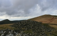
Nearby Images from Flickr


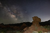


The above images may not be of the site on this page, but were taken nearby. They are loaded from Flickr so please click on them for image credits.
Click here to see more info for this site
Nearby sites
Click here to view sites on an interactive map of the areaKey: Red: member's photo, Blue: 3rd party photo, Yellow: other image, Green: no photo - please go there and take one, Grey: site destroyed
Download sites to:
KML (Google Earth)
GPX (GPS waypoints)
CSV (Garmin/Navman)
CSV (Excel)
To unlock full downloads you need to sign up as a Contributory Member. Otherwise downloads are limited to 50 sites.
Turn off the page maps and other distractions
Nearby sites listing. In the following links * = Image available
3.6km WSW 237° Valley of Fire - Atlatl Rock* Rock Art
42.0km SW 235° Gypsum Cave Cave or Rock Shelter
76.8km SW 220° Sloan Petroglyph Site* Rock Art
88.4km WSW 248° Lost Creek* Rock Art
105.2km NE 49° Bloomington Petroglyph Park* Rock Art
107.8km NE 43° Land Hill Petroglyphs* Rock Art
109.5km NE 50° Fort Pearce Wash Petroglyphs* Rock Art
109.6km NE 56° Little Black Mountain* Rock Art
123.0km ENE 66° Antelope Cave Cave or Rock Shelter
135.8km S 187° Grapevine Canyon* Rock Art
172.5km SSW 206° Tortoise Shell Mountain* Rock Art
174.6km SSW 207° Hole-in-the-Wall* Rock Art
183.9km SW 222° 17 Mile Point* Rock Art
187.4km ENE 68° Dupont Cave* Cave or Rock Shelter
191.9km S 179° Topock Maze* Misc. Earthwork
216.9km E 101° Bright Angel Trail* Rock Art
242.4km E 101° Tusayan Ruins* Ancient Village or Settlement
260.4km ESE 119° Keyhole Sink* Rock Art
264.2km E 79° Glen Canyon - Descending Sheep Panel Petroglyph Site* Rock Art
275.4km E 97° Tutuveni* Rock Art
278.2km WSW 241° Inscription Canyon* Rock Art
282.0km W 261° Coso Petroglyphs* Rock Art
286.8km SSW 210° Archaeology and Paleontology Curation Center Museum
289.9km ESE 117° Museum of Northern Arizona* Museum
290.3km ESE 108° Box Canyon Pueblo Ancient Village or Settlement
View more nearby sites and additional images


 We would like to know more about this location. Please feel free to add a brief description and any relevant information in your own language.
 Wir möchten mehr über diese Stätte erfahren. Bitte zögern Sie nicht, eine kurze Beschreibung und relevante Informationen in Deutsch hinzuzufügen.
 Nous aimerions en savoir encore un peu sur les lieux. S'il vous plaît n'hesitez pas à ajouter une courte description et tous les renseignements pertinents dans votre propre langue.
 Quisieramos informarnos un poco más de las lugares. No dude en añadir una breve descripción y otros datos relevantes en su propio idioma.