


<< Our Photo Pages >> Crystal Lakes Golf Course Stonehenge - Modern Stone Circle etc in United States in The Northwest Mountains
Submitted by Aluta on Thursday, 04 October 2018 Page Views: 3047
Modern SitesSite Name: Crystal Lakes Golf Course Stonehenge Alternative Name: Montana's StonehengeCountry: United States
NOTE: This site is 179.655 km away from the location you searched for.
Region: The Northwest Mountains Type: Modern Stone Circle etc
Nearest Town: Trego, Montana Nearest Village: Fortine, Montana
Latitude: 48.786080N Longitude: 114.88849W
Condition:
| 5 | Perfect |
| 4 | Almost Perfect |
| 3 | Reasonable but with some damage |
| 2 | Ruined but still recognisable as an ancient site |
| 1 | Pretty much destroyed, possibly visible as crop marks |
| 0 | No data. |
| -1 | Completely destroyed |
| 5 | Superb |
| 4 | Good |
| 3 | Ordinary |
| 2 | Not Good |
| 1 | Awful |
| 0 | No data. |
| 5 | Can be driven to, probably with disabled access |
| 4 | Short walk on a footpath |
| 3 | Requiring a bit more of a walk |
| 2 | A long walk |
| 1 | In the middle of nowhere, a nightmare to find |
| 0 | No data. |
| 5 | co-ordinates taken by GPS or official recorded co-ordinates |
| 4 | co-ordinates scaled from a detailed map |
| 3 | co-ordinates scaled from a bad map |
| 2 | co-ordinates of the nearest village |
| 1 | co-ordinates of the nearest town |
| 0 | no data |
Internal Links:
External Links:
")
This is almost certainly the prettiest Stonehenge replica in the States. The white limestone 'sarsens' stand out beautifully on the golfing green. Some effort is made toward accuracy, with the three-lintel stretch included and the trilithon horseshoe opening toward it, but it's pretty simple, with no bluestones.
Unfortunately, this Stonehenge is on private property, with no access for the public. Bob LeBlanc's beautiful photos make this all the more regrettable.
This article gives a few details about it and claims:
"...Mr. Smith had built a full-size and almost identical replica of the Stonehenge right in the middle of the golf course. It was constructed right down to the 13-degree adjustment to make up for the latitude so it would line up correctly during the equinox."
Some very interesting pictures of the replica, including one from inside, can also be seen at that link. If I could only visit one replica in North America, this would probably be it. Second and third would be the replica at Odessa Texas (which is not Stonehenge II) and the Circle of Life in Connecticut.
You may be viewing yesterday's version of this page. To see the most up to date information please register for a free account.
Do not use the above information on other web sites or publications without permission of the contributor.
Nearby Images from Flickr
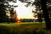
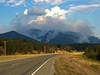
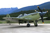

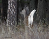
The above images may not be of the site on this page, but were taken nearby. They are loaded from Flickr so please click on them for image credits.
Click here to see more info for this site
Nearby sites
Click here to view sites on an interactive map of the areaKey: Red: member's photo, Blue: 3rd party photo, Yellow: other image, Green: no photo - please go there and take one, Grey: site destroyed
Download sites to:
KML (Google Earth)
GPX (GPS waypoints)
CSV (Garmin/Navman)
CSV (Excel)
To unlock full downloads you need to sign up as a Contributory Member. Otherwise downloads are limited to 50 sites.
Turn off the page maps and other distractions
Nearby sites listing. In the following links * = Image available
136.1km NE 41° Head-Smashed-In Buffalo Jump* Ancient Mine, Quarry or other Industry
147.5km W 261° Priest Lake Pictographs Rock Art
213.5km NE 46° Sundial Medicine Wheel* Ring Cairn
221.3km NNE 15° Big Rock (Alberta) Rock Art
222.9km WSW 241° Indian Painted Rocks (Spokane) Rock Art
241.2km E 81° Writing-on-Stone Provincial Park* Rock Art
250.7km ENE 59° Fincastle Grazing Reserve Bison Kill* Ancient Mine, Quarry or other Industry
263.6km NNE 12° Ootssip'tomowa Look Out Hill* Hill Figure or Geoglyph
267.9km NE 41° Majorville Medicine Wheel* Round Cairn
288.8km ESE 119° First Peoples Buffalo Jump* Natural Stone / Erratic / Other Natural Feature
316.3km SSW 211° Red Elk Rock Shelter* Rock Art
332.9km SE 137° Megaliths Of Helena* Natural Stone / Erratic / Other Natural Feature
333.0km ENE 64° Saami Giant Teepee* Ancient Village or Settlement
335.5km W 261° Balance Rock Omak* Natural Stone / Erratic / Other Natural Feature
339.8km SSW 200° Cooper's Ferry Archaeological Site* Ancient Village or Settlement
353.9km ENE 72° Stampede Site* Ancient Mine, Quarry or other Industry
400.1km NNW 340° Cataract Creek Petroglyphs* Rock Art
405.7km SSW 200° Snake River Archaeological Site* Rock Art
429.1km SW 230° Columbia Park* Ancient Village or Settlement
432.6km WSW 244° Vantage Petroglyphs* Rock Art
444.3km WSW 240° Whale Island Petroglyphs Rock Art
449.1km SSW 200° Hells Canyon Archeological District* Rock Art
462.9km SW 228° Matalam Ancient Village or Settlement
533.2km W 276° Sumas Lightning Rock* Natural Stone / Erratic / Other Natural Feature
538.8km W 277° Xaytem Ancient Native Settlement* Ancient Village or Settlement
View more nearby sites and additional images


 We would like to know more about this location. Please feel free to add a brief description and any relevant information in your own language.
 Wir möchten mehr über diese Stätte erfahren. Bitte zögern Sie nicht, eine kurze Beschreibung und relevante Informationen in Deutsch hinzuzufügen.
 Nous aimerions en savoir encore un peu sur les lieux. S'il vous plaît n'hesitez pas à ajouter une courte description et tous les renseignements pertinents dans votre propre langue.
 Quisieramos informarnos un poco más de las lugares. No dude en añadir una breve descripción y otros datos relevantes en su propio idioma.