


<< Other Photo Pages >> Fort Pearce Wash Petroglyphs - Rock Art in United States in The Southwest
Submitted by bat400 on Wednesday, 01 November 2006 Page Views: 7452
Rock ArtSite Name: Fort Pearce Wash PetroglyphsCountry: United States
NOTE: This site is 4.145 km away from the location you searched for.
Region: The Southwest Type: Rock Art
Nearest Town: Saint George, Utah
Latitude: 37.075000N Longitude: 113.576W
Condition:
| 5 | Perfect |
| 4 | Almost Perfect |
| 3 | Reasonable but with some damage |
| 2 | Ruined but still recognisable as an ancient site |
| 1 | Pretty much destroyed, possibly visible as crop marks |
| 0 | No data. |
| -1 | Completely destroyed |
| 5 | Superb |
| 4 | Good |
| 3 | Ordinary |
| 2 | Not Good |
| 1 | Awful |
| 0 | No data. |
| 5 | Can be driven to, probably with disabled access |
| 4 | Short walk on a footpath |
| 3 | Requiring a bit more of a walk |
| 2 | A long walk |
| 1 | In the middle of nowhere, a nightmare to find |
| 0 | No data. |
| 5 | co-ordinates taken by GPS or official recorded co-ordinates |
| 4 | co-ordinates scaled from a detailed map |
| 3 | co-ordinates scaled from a bad map |
| 2 | co-ordinates of the nearest village |
| 1 | co-ordinates of the nearest town |
| 0 | no data |
Be the first person to rate this site - see the 'Contribute!' box in the right hand menu.
Internal Links:
External Links:
")
Walking north from the confluence of this wash and the Virgin River hikers can see petroglyphs and later historic markings. There is no one large grouping, but the figures appear periodically up to five miles upstream.
The sites is south of the town of St. George. The road access to the site is substantially less direct and is described of the Bureau of Land Management website here.
Dinosaur tracks are also accessible in this area. (Water generally is running through the wash only immediately after rains and hikers should be vigilant when rain storms are forcast.)
Note: See the news story in the comment discussing federal representatives' plans to approve a reservoir that would flood these sites.
You may be viewing yesterday's version of this page. To see the most up to date information please register for a free account.
Do not use the above information on other web sites or publications without permission of the contributor.
Nearby Images from Flickr

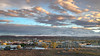


The above images may not be of the site on this page, but were taken nearby. They are loaded from Flickr so please click on them for image credits.
Click here to see more info for this site
Nearby sites
Click here to view sites on an interactive map of the areaKey: Red: member's photo, Blue: 3rd party photo, Yellow: other image, Green: no photo - please go there and take one, Grey: site destroyed
Download sites to:
KML (Google Earth)
GPX (GPS waypoints)
CSV (Garmin/Navman)
CSV (Excel)
To unlock full downloads you need to sign up as a Contributory Member. Otherwise downloads are limited to 50 sites.
Turn off the page maps and other distractions
Nearby sites listing. In the following links * = Image available
4.3km SW 235° Bloomington Petroglyph Park* Rock Art
11.2km SE 143° Little Black Mountain* Rock Art
13.0km NW 309° Land Hill Petroglyphs* Rock Art
35.2km SE 126° Antelope Cave Cave or Rock Shelter
89.9km E 90° Dupont Cave* Cave or Rock Shelter
109.5km SW 230° Mouse's Tank Canyon* Natural Stone / Erratic / Other Natural Feature
113.1km SW 230° Valley of Fire - Atlatl Rock* Rock Art
151.4km SW 232° Gypsum Cave Cave or Rock Shelter
170.6km SE 131° Bright Angel Trail* Rock Art
177.0km E 97° Glen Canyon - Descending Sheep Panel Petroglyph Site* Rock Art
184.1km ENE 65° North Creek Shelter Cave or Rock Shelter
185.7km SW 226° Sloan Petroglyph Site* Rock Art
193.0km SE 127° Tusayan Ruins* Ancient Village or Settlement
195.5km WSW 238° Lost Creek* Rock Art
199.5km NNE 33° Fremont Indian State Park* Museum
211.4km ENE 63° Anasazi Indian State Park* Ancient Village or Settlement
215.9km ESE 119° Tutuveni* Rock Art
223.4km NNW 348° Baker Archaeological Site* Ancient Village or Settlement
228.4km SSW 206° Grapevine Canyon* Rock Art
236.7km NNE 23° Devil's Kitchen Area Rock Art
244.9km SE 145° Keyhole Sink* Rock Art
245.7km NE 56° Fruita Petroglyphs* Rock Art
251.6km SE 131° Lomaki Pueblo Ancient Village or Settlement
251.6km SE 131° Box Canyon Pueblo Ancient Village or Settlement
252.4km SE 131° Citadel Pueblo Ancient Village or Settlement
View more nearby sites and additional images


 We would like to know more about this location. Please feel free to add a brief description and any relevant information in your own language.
 Wir möchten mehr über diese Stätte erfahren. Bitte zögern Sie nicht, eine kurze Beschreibung und relevante Informationen in Deutsch hinzuzufügen.
 Nous aimerions en savoir encore un peu sur les lieux. S'il vous plaît n'hesitez pas à ajouter une courte description et tous les renseignements pertinents dans votre propre langue.
 Quisieramos informarnos un poco más de las lugares. No dude en añadir una breve descripción y otros datos relevantes en su propio idioma.