 with our Megalithic Portal iPhone app")


<< Our Photo Pages >> Land Hill Petroglyphs - Rock Art in United States in The Southwest
Submitted by bat400 on Monday, 21 May 2012 Page Views: 7188
Rock ArtSite Name: Land Hill PetroglyphsCountry: United States
NOTE: This site is 21.878 km away from the location you searched for.
Region: The Southwest Type: Rock Art
Nearest Town: St. George, UT Nearest Village: Santa Clara, UT
Latitude: 37.148600N Longitude: 113.6892W
Condition:
| 5 | Perfect |
| 4 | Almost Perfect |
| 3 | Reasonable but with some damage |
| 2 | Ruined but still recognisable as an ancient site |
| 1 | Pretty much destroyed, possibly visible as crop marks |
| 0 | No data. |
| -1 | Completely destroyed |
| 5 | Superb |
| 4 | Good |
| 3 | Ordinary |
| 2 | Not Good |
| 1 | Awful |
| 0 | No data. |
| 5 | Can be driven to, probably with disabled access |
| 4 | Short walk on a footpath |
| 3 | Requiring a bit more of a walk |
| 2 | A long walk |
| 1 | In the middle of nowhere, a nightmare to find |
| 0 | No data. |
| 5 | co-ordinates taken by GPS or official recorded co-ordinates |
| 4 | co-ordinates scaled from a detailed map |
| 3 | co-ordinates scaled from a bad map |
| 2 | co-ordinates of the nearest village |
| 1 | co-ordinates of the nearest town |
| 0 | no data |
Internal Links:
External Links:
I have visited· I would like to visit
mfrincu couldn't find We passed twice on the road on our way to this site but missed the entrance. I guess a better sign should be installed.
")
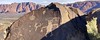
Land Hill is located within the Bureau of Land Management's Santa Clara Reserve. The area is known for petroglyphs.
Lnad Hill is served by two trailheads: Anasazi Valley and Tukupetsi. Trails lead visitors to evidence of prehistoric Ancestral Puebloan and Southern Paiute cultures. Art dates from Formative Period (ca. 700 B.C. to A.D. 1200,) Pueblo I-II (A.D. 700-1100), the Late Prehistoric and Protohistoric Periods (after approximately A.D.1200-1800) Note: The location given is approximate. See the BLM website: http://www.blm.gov/ut/st/en/fo/st__george/more/heritage_resources/public_use_sites/land_hill.html
Note: Fool's Names -- Defacing Utah Rock Art. See comment.
You may be viewing yesterday's version of this page. To see the most up to date information please register for a free account.
Do not use the above information on other web sites or publications without permission of the contributor.
Nearby Images from Flickr


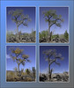
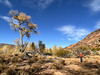
The above images may not be of the site on this page, but were taken nearby. They are loaded from Flickr so please click on them for image credits.
Click here to see more info for this site
Nearby sites
Click here to view sites on an interactive map of the areaKey: Red: member's photo, Blue: 3rd party photo, Yellow: other image, Green: no photo - please go there and take one, Grey: site destroyed
Download sites to:
KML (Google Earth)
GPX (GPS waypoints)
CSV (Garmin/Navman)
CSV (Excel)
To unlock full downloads you need to sign up as a Contributory Member. Otherwise downloads are limited to 50 sites.
Turn off the page maps and other distractions
Nearby sites listing. In the following links * = Image available
12.5km SSE 148° Bloomington Petroglyph Park* Rock Art
13.0km SE 129° Fort Pearce Wash Petroglyphs* Rock Art
24.0km SE 135° Little Black Mountain* Rock Art
48.1km SE 127° Antelope Cave Cave or Rock Shelter
100.3km E 95° Dupont Cave* Cave or Rock Shelter
107.8km SW 223° Mouse's Tank Canyon* Natural Stone / Erratic / Other Natural Feature
111.3km SW 224° Valley of Fire - Atlatl Rock* Rock Art
149.1km SW 227° Gypsum Cave Cave or Rock Shelter
183.5km SE 131° Bright Angel Trail* Rock Art
184.5km SW 222° Sloan Petroglyph Site* Rock Art
188.1km E 99° Glen Canyon - Descending Sheep Panel Petroglyph Site* Rock Art
190.0km ENE 68° North Creek Shelter Cave or Rock Shelter
191.7km SW 235° Lost Creek* Rock Art
198.5km NE 36° Fremont Indian State Park* Museum
206.0km SE 127° Tusayan Ruins* Ancient Village or Settlement
213.4km N 350° Baker Archaeological Site* Ancient Village or Settlement
217.0km ENE 66° Anasazi Indian State Park* Ancient Village or Settlement
228.7km ESE 119° Tutuveni* Rock Art
231.6km SSW 203° Grapevine Canyon* Rock Art
233.4km NNE 26° Devil's Kitchen Area Rock Art
249.8km ENE 59° Fruita Petroglyphs* Rock Art
257.4km SE 144° Keyhole Sink* Rock Art
264.6km SE 131° Lomaki Pueblo Ancient Village or Settlement
264.6km SE 131° Box Canyon Pueblo Ancient Village or Settlement
265.3km SE 131° Citadel Pueblo Ancient Village or Settlement
View more nearby sites and additional images


 We would like to know more about this location. Please feel free to add a brief description and any relevant information in your own language.
 Wir möchten mehr über diese Stätte erfahren. Bitte zögern Sie nicht, eine kurze Beschreibung und relevante Informationen in Deutsch hinzuzufügen.
 Nous aimerions en savoir encore un peu sur les lieux. S'il vous plaît n'hesitez pas à ajouter une courte description et tous les renseignements pertinents dans votre propre langue.
 Quisieramos informarnos un poco más de las lugares. No dude en añadir una breve descripción y otros datos relevantes en su propio idioma.