


<< Text Pages >> North Creek Shelter - Cave or Rock Shelter in United States in The Southwest
Submitted by bat400 on Thursday, 09 September 2010 Page Views: 7419
Natural PlacesSite Name: North Creek ShelterCountry: United States
NOTE: This site is 61.406 km away from the location you searched for.
Region: The Southwest Type: Cave or Rock Shelter
Nearest Town: Escalante, UT
Latitude: 37.771000N Longitude: 111.685W
Condition:
| 5 | Perfect |
| 4 | Almost Perfect |
| 3 | Reasonable but with some damage |
| 2 | Ruined but still recognisable as an ancient site |
| 1 | Pretty much destroyed, possibly visible as crop marks |
| 0 | No data. |
| -1 | Completely destroyed |
| 5 | Superb |
| 4 | Good |
| 3 | Ordinary |
| 2 | Not Good |
| 1 | Awful |
| 0 | No data. |
| 5 | Can be driven to, probably with disabled access |
| 4 | Short walk on a footpath |
| 3 | Requiring a bit more of a walk |
| 2 | A long walk |
| 1 | In the middle of nowhere, a nightmare to find |
| 0 | No data. |
| 5 | co-ordinates taken by GPS or official recorded co-ordinates |
| 4 | co-ordinates scaled from a detailed map |
| 3 | co-ordinates scaled from a bad map |
| 2 | co-ordinates of the nearest village |
| 1 | co-ordinates of the nearest town |
| 0 | no data |
Internal Links:
External Links:
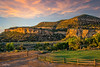
Rockshelter with rock art in Utah.Visible evidence of habitation include granaries in the cliff faces and petroglyphs and pictograms.
A Brigham Young University dig of the floor of the rock shelter has found artifacts dating back 10000 years, making the shelter one of the oldest habitation sites in Utah. Tools, beads, figurines, and food debris come from Paleoarchaic, Archaic, Fremont, Ancestral Puebloan, and historic cultures.
I'm uncertain whether the shelter itself is on public land (BLM) or private property. However, the site lies directly behind the Slot Canyon Inn, on North Creek, outside of Escalante. I'd recommend asking there for information and access. (The location given is for the inn.)
Note: Excavation of prehistoric home finished in Utah. 10000 years of habitation. See comment.
You may be viewing yesterday's version of this page. To see the most up to date information please register for a free account.
Do not use the above information on other web sites or publications without permission of the contributor.
Nearby Images from Flickr
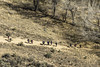
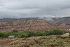
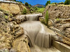
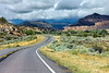
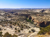
The above images may not be of the site on this page, but were taken nearby. They are loaded from Flickr so please click on them for image credits.
Click here to see more info for this site
Nearby sites
Click here to view sites on an interactive map of the areaKey: Red: member's photo, Blue: 3rd party photo, Yellow: other image, Green: no photo - please go there and take one, Grey: site destroyed
Download sites to:
KML (Google Earth)
GPX (GPS waypoints)
CSV (Garmin/Navman)
CSV (Excel)
To unlock full downloads you need to sign up as a Contributory Member. Otherwise downloads are limited to 50 sites.
Turn off the page maps and other distractions
Nearby sites listing. In the following links * = Image available
27.8km NE 56° Anasazi Indian State Park* Ancient Village or Settlement
69.4km NE 34° Fruita Petroglyphs* Rock Art
101.5km S 176° Glen Canyon - Descending Sheep Panel Petroglyph Site* Rock Art
106.2km NNW 328° Fremont Indian State Park* Museum
110.3km SW 225° Dupont Cave* Cave or Rock Shelter
132.9km NNE 18° Rochester Rock Art Panel* Rock Art
147.7km E 96° Hand Palm Paintings Rock Art
148.3km E 96° Natural Bridges National Monument Natural Stone / Erratic / Other Natural Feature
149.1km ENE 59° Great Gallery Horseshoe Canyon* Rock Art
150.1km ENE 59° Alcove Gallery Rock Art
151.0km ENE 59° Horseshoe Gallery Rock Art
151.1km ENE 59° High Gallery Rock Art
154.1km SE 137° Navajo Nat. Mon. - Keet Seel Ancient Village or Settlement
157.2km NNW 333° Devil's Kitchen Area Rock Art
158.1km SE 140° Navajo Nat. Mon. - Betatakin* Ancient Village or Settlement
158.5km ESE 122° Monument Valley - Sun's Eye Arch Petroglyphs* Rock Art
158.5km ESE 122° Monument Valley* Ancient Village or Settlement
158.5km ESE 122° Monument Valley - Water Birth Cliff Petroglyphs* Rock Art
158.5km ESE 122° Monument Valley - Ear of the Wind Handprint Pictographs* Rock Art
159.9km E 99° Grand Gulch Primitive Area* Ancient Village or Settlement
169.3km ESE 107° Valley of the Gods* Natural Stone / Erratic / Other Natural Feature
170.0km SW 235° Antelope Cave Cave or Rock Shelter
170.1km NE 40° Black Dragon Canyon* Rock Art
173.6km ENE 66° Mesa Arch* Natural Stone / Erratic / Other Natural Feature
174.3km ENE 78° Thirteen Faces Pictographs Rock Art
View more nearby sites and additional images


 We would like to know more about this location. Please feel free to add a brief description and any relevant information in your own language.
 Wir möchten mehr über diese Stätte erfahren. Bitte zögern Sie nicht, eine kurze Beschreibung und relevante Informationen in Deutsch hinzuzufügen.
 Nous aimerions en savoir encore un peu sur les lieux. S'il vous plaît n'hesitez pas à ajouter une courte description et tous les renseignements pertinents dans votre propre langue.
 Quisieramos informarnos un poco más de las lugares. No dude en añadir una breve descripción y otros datos relevantes en su propio idioma.