 with our Megalithic Portal iPhone app")


<< Our Photo Pages >> Bright Angel Trail - Rock Art in United States in The Southwest
Submitted by thecaptain on Tuesday, 02 June 2009 Page Views: 9382
Rock ArtSite Name: Bright Angel TrailCountry: United States Region: The Southwest Type: Rock Art
Nearest Town: Williams, Arizona Nearest Village: Grand Canyon village
Latitude: 36.059700N Longitude: 112.1441W
Condition:
| 5 | Perfect |
| 4 | Almost Perfect |
| 3 | Reasonable but with some damage |
| 2 | Ruined but still recognisable as an ancient site |
| 1 | Pretty much destroyed, possibly visible as crop marks |
| 0 | No data. |
| -1 | Completely destroyed |
| 5 | Superb |
| 4 | Good |
| 3 | Ordinary |
| 2 | Not Good |
| 1 | Awful |
| 0 | No data. |
| 5 | Can be driven to, probably with disabled access |
| 4 | Short walk on a footpath |
| 3 | Requiring a bit more of a walk |
| 2 | A long walk |
| 1 | In the middle of nowhere, a nightmare to find |
| 0 | No data. |
| 5 | co-ordinates taken by GPS or official recorded co-ordinates |
| 4 | co-ordinates scaled from a detailed map |
| 3 | co-ordinates scaled from a bad map |
| 2 | co-ordinates of the nearest village |
| 1 | co-ordinates of the nearest town |
| 0 | no data |
Internal Links:
External Links:
I have visited· I would like to visit
mfrincu visited on 22nd Jun 2014 - their rating: Cond: 3 Amb: 5 Access: 3 You need to know where to look for them. Just follow the trail into the canyon and pay attention to your left as you go through the 1st tunnel. You will see few red pictographs on the canyon walls. Take a good lens of at least 100-200mm.
TheCaptain have visited here
")
Just beyond the first tunnel on the trail down the side of the canyon can be seen some ancient petroglyphs, where there are animals, hand and footprints, and many enigmatic symbols.
Hiking down this trail to the bottom of the Grand Canyon, right down the giant cliff sided canyon on a narrow zig-zag path, is a highlight of any visit to this spectacular area. But beware, it is not only a mountain climb in reverse, with all the uphill to be done on the way back, but also the sun will now be high in the hot afternoon sky, making the ascent a very arduous trip.
You may be viewing yesterday's version of this page. To see the most up to date information please register for a free account.
Do not use the above information on other web sites or publications without permission of the contributor.
Nearby Images from Flickr
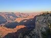
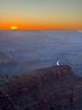
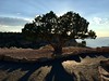
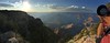
The above images may not be of the site on this page, but were taken nearby. They are loaded from Flickr so please click on them for image credits.
Click here to see more info for this site
Nearby sites
Click here to view sites on an interactive map of the areaKey: Red: member's photo, Blue: 3rd party photo, Yellow: other image, Green: no photo - please go there and take one, Grey: site destroyed
Download sites to:
KML (Google Earth)
GPX (GPS waypoints)
CSV (Garmin/Navman)
CSV (Excel)
To unlock full downloads you need to sign up as a Contributory Member. Otherwise downloads are limited to 50 sites.
Turn off the page maps and other distractions
Nearby sites listing. In the following links * = Image available
25.5km ESE 102° Tusayan Ruins* Ancient Village or Settlement
60.9km E 83° Tutuveni* Rock Art
81.0km SE 131° Lomaki Pueblo Ancient Village or Settlement
81.0km SE 131° Box Canyon Pueblo Ancient Village or Settlement
81.8km SE 132° Citadel Pueblo Ancient Village or Settlement
88.7km S 172° Keyhole Sink* Rock Art
91.8km SE 131° Wupatki Pueblo* Ancient Village or Settlement
94.1km SE 128° Wukoki Pueblo Ancient Village or Settlement
101.4km SSE 155° Museum of Northern Arizona* Museum
101.4km NNE 28° Glen Canyon - Descending Sheep Panel Petroglyph Site* Rock Art
104.6km SSE 150° Elden Pueblo* Ancient Village or Settlement
114.2km SSE 150° Walnut Canyon Nat. Mon.* Ancient Village or Settlement
117.9km NNW 342° Dupont Cave* Cave or Rock Shelter
129.1km S 170° Palatki* Rock Art
129.3km E 94° Taawaki Rock Art
135.6km NW 313° Antelope Cave Cave or Rock Shelter
141.4km SSE 168° Red Rock State Park* Ancient Village or Settlement
143.9km S 176° Tuzigoot Monument* Ancient Village or Settlement
159.6km NW 311° Little Black Mountain* Rock Art
160.0km ENE 64° Navajo Nat. Mon. - Betatakin* Ancient Village or Settlement
160.8km SSE 167° Montezuma Well* Ancient Village or Settlement
163.3km S 170° Montezuma Castle* Ancient Village or Settlement
166.8km ENE 62° Navajo Nat. Mon. - Keet Seel Ancient Village or Settlement
170.6km NW 312° Fort Pearce Wash Petroglyphs* Rock Art
171.7km NW 310° Bloomington Petroglyph Park* Rock Art
View more nearby sites and additional images


 We would like to know more about this location. Please feel free to add a brief description and any relevant information in your own language.
 Wir möchten mehr über diese Stätte erfahren. Bitte zögern Sie nicht, eine kurze Beschreibung und relevante Informationen in Deutsch hinzuzufügen.
 Nous aimerions en savoir encore un peu sur les lieux. S'il vous plaît n'hesitez pas à ajouter une courte description et tous les renseignements pertinents dans votre propre langue.
 Quisieramos informarnos un poco más de las lugares. No dude en añadir una breve descripción y otros datos relevantes en su propio idioma.