<< Other Photo Pages >> Mummy Cave - Cave or Rock Shelter in United States in The Northwest Mountains
Submitted by AKFisher on Wednesday, 13 September 2023 Page Views: 190
Natural PlacesSite Name: Mummy CaveCountry: United States
NOTE: This site is 54.752 km away from the location you searched for.
Region: The Northwest Mountains Type: Cave or Rock Shelter
Nearest Town: Cody, WY
Latitude: 44.460850N Longitude: 109.73596W
Condition:
| 5 | Perfect |
| 4 | Almost Perfect |
| 3 | Reasonable but with some damage |
| 2 | Ruined but still recognisable as an ancient site |
| 1 | Pretty much destroyed, possibly visible as crop marks |
| 0 | No data. |
| -1 | Completely destroyed |
| 5 | Superb |
| 4 | Good |
| 3 | Ordinary |
| 2 | Not Good |
| 1 | Awful |
| 0 | No data. |
| 5 | Can be driven to, probably with disabled access |
| 4 | Short walk on a footpath |
| 3 | Requiring a bit more of a walk |
| 2 | A long walk |
| 1 | In the middle of nowhere, a nightmare to find |
| 0 | No data. |
| 5 | co-ordinates taken by GPS or official recorded co-ordinates |
| 4 | co-ordinates scaled from a detailed map |
| 3 | co-ordinates scaled from a bad map |
| 2 | co-ordinates of the nearest village |
| 1 | co-ordinates of the nearest town |
| 0 | no data |
Internal Links:
External Links:
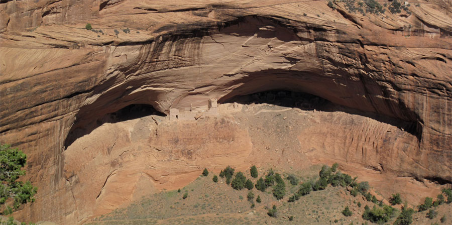
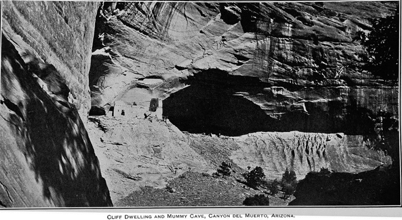
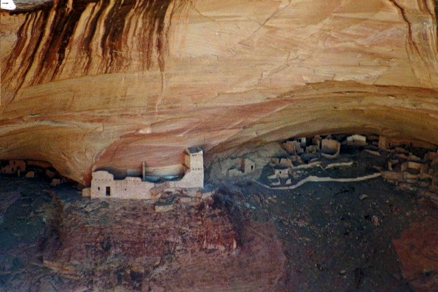
At its mouth, the cave is approximately 150 feet (46 m) wide, and it extends approximately 40 feet (12 m) into a volcanic cliff above the North Fork.[2]: 7, 12 It lies along the left bank of the river,[1] next to the mouth of a small stream and opposite from the mouth of Blackwater Creek.[2]: xii The largest known cave along the North Fork, it is believed to have been carved by the river's flow; the reason for its diversion away from the alcove is unknown.[2]: 8, 10
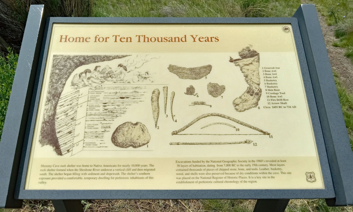
Mummy Cave was occupied between 7280 BC and AD 1580.[1] Discovered by Cody resident Gene Smith in 1957,[5] it was first studied in 1962 and excavated by the Buffalo Bill Historical Center. The site includes unusual amounts of perishable materials such as hide, feathers and wood, as well as the buried and mummified remains of an inhabitant, named by researchers "Mummy Joe," and dated to about AD 800.[1] The cave is notable for the depth of its cultural deposits, extending over 28 feet (8.5 m) in depth, and in particular for the continuity of those deposits. The deposits have been classified into 38 occupation levels that represent at least seasonal use of the site on an annual basis, extending from the Paleoindian period to the late Prehistoric period.[6]
Archeological investigation:
The investigation of Mummy Cave was led by Robert Edgar from 1963 to 1965. The alcove was marked out into a 5-foot (1.5 m) grid, with a permanent reference mark for elevation marked on the wall. Initial investigation focused on establishing stratigraphy. Once the layers of alluvium in the cave floor were established, the excavation proceeded layer by layer. The excavations terraced the cave floor into 4-to-6-foot (1.2 to 1.8 m) levels, following the established reference grid. Digging was done with hand trowels in the artifact-bearing layers while layers devoid of artifacts were excavated with shovels. Spoils were disposed of down the embankment.[2]: 31
The site had previously been disturbed by relic hunters, who had dug a 2.5 feet (0.76 m) deep pit in what turned out to be the most productive zone of the excavation. The relic hunters appear to have stopped when they encountered a rock cairn that covered what proved to be a human burial site.[2]: 31
By the end of 1963 a portion of the site had been excavated to a depth of 20 feet (6.1 m) and shored with timbers, while the upper three cultural zones (layers 36–38) were removed across the site. During the 1964 season layers 29–35 were removed and some zones were excavated much more deeply. In 1965 layers 24–28 were removed from the central area of the alcove. By this time it was clear that excavation would proceed for the full depth of the site, and that the disposal of a considerable quantity of excavated debris would need to be addressed. A bulldozer was brought in to remove sections of fill beyond the drip line of the shelter.[2]: 31–32 The 1966 season was directed by Wilfred M. Husted. Results of the Mummy Cave investigations were published in Science in 1968.
Results:
The excavation of Mummy Cave yielded a nearly continuous succession of artifacts, which span a period of over 9000 years. The artifacts were disposed in a manner that permitted dating in both relative terms through stratigraphy, as well as through radiocarbon dating to establish an absolute scale. This continuum has proved to be invaluable in relating and dating other excavations in the Rocky Mountain region. In particular, the stone projectile points found at Mummy Cave have been used to set the standard for classifying stone arrowheads and spear heads in the region.[2]: v The point typology has been extrapolated to define cultural and commercial relationships between peoples throughout the American West.[2]: 113–114 Stratigraphy and carbon dating indicate that Mummy Cave was first occupied near the end of the Pinedale glaciation. Later occupancy spanned the Altithermal, followed by a cooler climate from about 1000 BC.[2]: 29
Further reading and information:
Wikipedia
NPS History
Directions: From Cody, WY via US-14 W/US-16 W/US-20 W, 36.1 mi.
You may be viewing yesterday's version of this page. To see the most up to date information please register for a free account.


Do not use the above information on other web sites or publications without permission of the contributor.
Click here to see more info for this site
Nearby sites
Click here to view sites on an interactive map of the areaKey: Red: member's photo, Blue: 3rd party photo, Yellow: other image, Green: no photo - please go there and take one, Grey: site destroyed
Download sites to:
KML (Google Earth)
GPX (GPS waypoints)
CSV (Garmin/Navman)
CSV (Excel)
To unlock full downloads you need to sign up as a Contributory Member. Otherwise downloads are limited to 50 sites.
Turn off the page maps and other distractions
Nearby sites listing. In the following links * = Image available
50.0km W 268° Yellowstone Lake* Ancient Village or Settlement
88.2km WNW 297° Obsidian Cliff* Ancient Mine, Quarry or other Industry
114.5km ENE 58° Petroglyph Canyon (Cowley)* Rock Art
115.2km S 176° High Rise Village Ancient Village or Settlement
116.9km SE 129° Legend Rock* Rock Art
117.5km NNE 33° Valley of the Shields* Rock Art
149.2km ENE 74° Bighorn Medicine Wheel* Stone Circle
175.0km NE 35° Pictograph Caves* Rock Art
175.3km E 95° Medicine Lodge State Archeological Site* Rock Art
241.1km SE 134° Castle Gardens* Rock Art
288.4km NW 324° Megaliths Of Helena* Natural Stone / Erratic / Other Natural Feature
288.5km S 172° White Mountain Wyoming* Rock Art
354.8km ESE 119° Glenrock Buffalo Jump* Natural Stone / Erratic / Other Natural Feature
363.0km NNW 338° First Peoples Buffalo Jump* Natural Stone / Erratic / Other Natural Feature
396.5km WSW 250° Shoshone Ice Caves* Cave or Rock Shelter
399.5km E 86° Devil's Tower National Monument* Natural Stone / Erratic / Other Natural Feature
401.2km E 90° Arch Creek Petroglyphs* Rock Art
405.7km WSW 244° Wilson Butte Cave Cave or Rock Shelter
406.2km WSW 249° Idaho's Mammoth Cave* Cave or Rock Shelter
414.1km SW 214° Great Salt Lake Cave* Cave or Rock Shelter
439.7km S 172° Dinosaur National Monument* Rock Art
442.5km E 87° Vore Buffalo Jump* Natural Stone / Erratic / Other Natural Feature
470.9km ESE 117° Hell Gap* Ancient Village or Settlement
479.9km SSW 210° Red Warrior Pictograph* Rock Art
489.8km SSW 203° Eagle Mountain Petroglyphs* Rock Art
View more nearby sites and additional images




 We would like to know more about this location. Please feel free to add a brief description and any relevant information in your own language.
 Wir möchten mehr über diese Stätte erfahren. Bitte zögern Sie nicht, eine kurze Beschreibung und relevante Informationen in Deutsch hinzuzufügen.
 Nous aimerions en savoir encore un peu sur les lieux. S'il vous plaît n'hesitez pas à ajouter une courte description et tous les renseignements pertinents dans votre propre langue.
 Quisieramos informarnos un poco más de las lugares. No dude en añadir una breve descripción y otros datos relevantes en su propio idioma.