


<< Other Photo Pages >> Boca Negra Canyon - Rock Art in United States in The South
Submitted by Andy B on Sunday, 30 July 2023 Page Views: 99
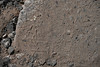
Rock ArtSite Name: Boca Negra CanyonCountry: United States
NOTE: This site is 13.193 km away from the location you searched for.
Region: The South Type: Rock Art
Latitude: 35.161410N Longitude: 106.7206W
Condition:
| 5 | Perfect |
| 4 | Almost Perfect |
| 3 | Reasonable but with some damage |
| 2 | Ruined but still recognisable as an ancient site |
| 1 | Pretty much destroyed, possibly visible as crop marks |
| 0 | No data. |
| -1 | Completely destroyed |
| 5 | Superb |
| 4 | Good |
| 3 | Ordinary |
| 2 | Not Good |
| 1 | Awful |
| 0 | No data. |
| 5 | Can be driven to, probably with disabled access |
| 4 | Short walk on a footpath |
| 3 | Requiring a bit more of a walk |
| 2 | A long walk |
| 1 | In the middle of nowhere, a nightmare to find |
| 0 | No data. |
| 5 | co-ordinates taken by GPS or official recorded co-ordinates |
| 4 | co-ordinates scaled from a detailed map |
| 3 | co-ordinates scaled from a bad map |
| 2 | co-ordinates of the nearest village |
| 1 | co-ordinates of the nearest town |
| 0 | no data |
Internal Links:
External Links:
")
You may be viewing yesterday's version of this page. To see the most up to date information please register for a free account.
")
")
")
")
Do not use the above information on other web sites or publications without permission of the contributor.
Nearby Images from Flickr
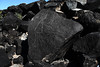
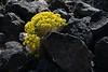
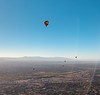
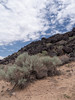
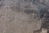
The above images may not be of the site on this page, but were taken nearby. They are loaded from Flickr so please click on them for image credits.
Click here to see more info for this site
Nearby sites
Click here to view sites on an interactive map of the areaKey: Red: member's photo, Blue: 3rd party photo, Yellow: other image, Green: no photo - please go there and take one, Grey: site destroyed
Download sites to:
KML (Google Earth)
GPX (GPS waypoints)
CSV (Garmin/Navman)
CSV (Excel)
To unlock full downloads you need to sign up as a Contributory Member. Otherwise downloads are limited to 50 sites.
Turn off the page maps and other distractions
Nearby sites listing. In the following links * = Image available
4.7km SW 233° Petroglyph Nat. Mon.* Rock Art
4.7km SW 233° Petroglyph National Monument Rock Art
12.1km SE 134° Maxwell Museum of Anthropology* Museum
48.7km SSW 211° Los Lunas Decalogue Stone* Marker Stone
67.8km N 1° Jemez Gallina Culture* Ancient Village or Settlement
79.9km NNE 31° Bandelier National Monument* Ancient Village or Settlement
80.0km NNE 30° Bandelier National Mounument - Tyuonyi* Ancient Village or Settlement
80.1km NNE 30° Bandelier National Monument - Long House* Ancient Village or Settlement
80.1km NNE 29° Bandelier National Monument - Alcove House* Ancient Village or Settlement
83.7km WSW 250° Acoma Pueblo Ancient Village or Settlement
100.9km NNE 26° Puye Cliff Dwellings* Cave or Rock Shelter
121.0km WNW 285° Blue J Ancient Village or Settlement
124.5km WNW 284° Casamero* Ancient Village or Settlement
125.1km NW 317° Pueblo Pintado* Ancient Village or Settlement
138.6km WNW 295° Kin Ya'a* Ancient Village or Settlement
141.6km NW 313° Chaco Culture NHP - Wijiji Ancient Village or Settlement
143.2km NW 314° Chaco Culture NHP* Ancient Village or Settlement
143.7km NW 312° Chaco Culture NHP- Fajada Butte* Rock Art
145.0km NW 312° Chaco Culture NHP - Una Vida Petroglyph site* Rock Art
145.0km NW 312° Chaco Culture NHP - Una Vida* Ancient Village or Settlement
147.4km NW 312° Chaco Culture NHP - Hungo Pavi* Ancient Village or Settlement
148.2km NW 311° Chaco Culture NHP - Tsin Kletzin* Ancient Village or Settlement
149.2km W 265° Atsinna Pueblo* Ancient Village or Settlement
149.8km NW 312° Chaco Culture NHP - Casa Rinconada* Ancient Temple
149.8km NW 312° Chaco Culture NHP - Chetro Ketl* Ancient Village or Settlement
View more nearby sites and additional images


 We would like to know more about this location. Please feel free to add a brief description and any relevant information in your own language.
 Wir möchten mehr über diese Stätte erfahren. Bitte zögern Sie nicht, eine kurze Beschreibung und relevante Informationen in Deutsch hinzuzufügen.
 Nous aimerions en savoir encore un peu sur les lieux. S'il vous plaît n'hesitez pas à ajouter une courte description et tous les renseignements pertinents dans votre propre langue.
 Quisieramos informarnos un poco más de las lugares. No dude en añadir una breve descripción y otros datos relevantes en su propio idioma.