


<< Our Photo Pages >> Baile an Mhuilinn rock art - Rock Art in Ireland (Republic of) in Co. Kerry
Submitted by GaelicLaird on Tuesday, 14 September 2021 Page Views: 650
Rock ArtSite Name: Baile an Mhuilinn rock art Alternative Name: Milltown Rock ArtCountry: Ireland (Republic of)
NOTE: This site is 1.561 km away from the location you searched for.
County: Co. Kerry Type: Rock Art
Nearest Town: Dingle
Latitude: 52.139738N Longitude: 10.294396W
Condition:
| 5 | Perfect |
| 4 | Almost Perfect |
| 3 | Reasonable but with some damage |
| 2 | Ruined but still recognisable as an ancient site |
| 1 | Pretty much destroyed, possibly visible as crop marks |
| 0 | No data. |
| -1 | Completely destroyed |
| 5 | Superb |
| 4 | Good |
| 3 | Ordinary |
| 2 | Not Good |
| 1 | Awful |
| 0 | No data. |
| 5 | Can be driven to, probably with disabled access |
| 4 | Short walk on a footpath |
| 3 | Requiring a bit more of a walk |
| 2 | A long walk |
| 1 | In the middle of nowhere, a nightmare to find |
| 0 | No data. |
| 5 | co-ordinates taken by GPS or official recorded co-ordinates |
| 4 | co-ordinates scaled from a detailed map |
| 3 | co-ordinates scaled from a bad map |
| 2 | co-ordinates of the nearest village |
| 1 | co-ordinates of the nearest town |
| 0 | no data |
Internal Links:
External Links:
")
Rock art officially recorded as monument KE043-214----
The 2nd stone measures 4.2m x 1.25m x .6m thick. On its sloping E face the decoration, with the exception of a single cup-and-circle, is confined to the broad N end. At least 18 isolated cup-marks are distributed randomly about the decorated area, while 8 cup-and-circles occur along the upper portion of the stone. One of the circles spirals slightly, and most are provided with radial lines which follow the downward slope of the face. Beneath these is a complex grouping of cup-marks and straight and curved lines, some of the lines joining up to enclose cup-marks. Three further cup-marks occur at the N edge of the WSW face. Ó Nualláin (1978b, 68) suggests that both these stones may have fallen from an upright position, and Finlay (1973, 9-10) points out that the decoration is likely to have been added subsequent to this as the linear grooves follow the downward slope of the E face. The inclusion of this site in a list of cist-graves by Simpson and Thawley appears to arise from some confusion with another site (Shee 1972, 233).
The above description is derived from J. Cuppage, ‘Corca Dhuibhne. Dingle Peninsula archaeological survey. Ballyferriter. Oidhreacht Chorca Dhuibhne’ (1986), no. 191.
This monument is subject to a preservation order made under the National Monuments Acts 1930 to 2014 (PO no. 54/1937).
In improved rough pasture (26m OD), on a very gentle ENE-facing slope, c. 20m to N of Dingle-Ventry regional route (R559). Good view of Dingle Harbour to SE.
Reasonably good condition, although obscured by white and grey lichens; Stone appears damaged on underside at N end. Smooth and unfractured, prostrate sandstone (dims. 4.10m N-S; 1.75m E-W; max. T 1.20m) with an irregular decorated surface (dims. 3.00m N-S; 0.90m E-W) having an E-facing aspect.
The motifs occupy the northern half of the stone with the exception of an isolated cup-and-ring motif (overall diam. 18cm; ring Wth 3.5-4cm; D 3mm; cup diam. 7.5cm; D 1cm) toward the S end. The main decorated area bears at least twenty-five cup-marks (average diam. 5-7cm; D 4-8mm), two of which are incorporated into a more complex decorative element of intersecting linear and curvilinears grooves in the centre of the stone. Seven cup-and-one-ring motifs are located along the upper portion of the stone, one of which has a penannular ring open to W. Three of these have radial grooves (long-axis E-W) which extend downslope, to E and the ring around another, takes the form of a spiral. Two of the cup-and-ring motifs are conjoined by a curvilinear groove. The best preserved cup-and-ring motif (overall diam. 18cm; ring Wth 2cm; D 3mm; cup diam. 9.5cm; D 4mm) is on upper portion of decorated surface.
According to Cuppage (1986, 57, 64-65), Ó Nualláin (1978b, 68) suggests that both these stones may have fallen from an upright position, and Finlay (1973, 9-10) points out that the decoration is likely to have been added subsequent to this as the linear grooves follow the downward slope of the E face. A second prostrate stone (dims. 3.25m N-S; 1.4m E-W; max. T 0.5m) adjacent to W, bears no markings. A single standing stone (KE043-215----) is c. 20m to SW and a pair of standing stones (KE043-213----) are c. 50m to N.
The above description compiled by Alison McQueen and Vera Rahilly.
A 3D model of the stone can be accessed at the following website:
https://skfb.ly/YRAC
You may be viewing yesterday's version of this page. To see the most up to date information please register for a free account.
")
")
Do not use the above information on other web sites or publications without permission of the contributor.
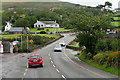
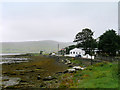
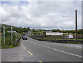
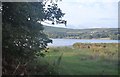
Nearby Images from Geograph Britain and Ireland:
©2019(licence)
©2019(licence)
©2016(licence)
©2018(licence)
©2006(licence)
The above images may not be of the site on this page, they are loaded from Geograph.
Please Submit an Image of this site or go out and take one for us!
Click here to see more info for this site
Nearby sites
Click here to view sites on an interactive map of the areaKey: Red: member's photo, Blue: 3rd party photo, Yellow: other image, Green: no photo - please go there and take one, Grey: site destroyed
Download sites to:
KML (Google Earth)
GPX (GPS waypoints)
CSV (Garmin/Navman)
CSV (Excel)
To unlock full downloads you need to sign up as a Contributory Member. Otherwise downloads are limited to 50 sites.
Turn off the page maps and other distractions
Nearby sites listing. In the following links * = Image available
35m SSW 211° Gallán na Cille Brice standing stone* Standing Stone (Menhir)
51m NNW 346° Milltown N* Standing Stones (Q42960113)
107m SW 220° Milltown S Standing Stones (Q429010)
1.7km SSW 209° Colaiste Ide Ogham Stones* Museum (V4211599651)
2.2km NNW 341° Kilfountain Cross Slab* Early Christian Sculptured Stone (Q423032)
2.5km NNW 347° Kilfountan Standing Stone* Standing Stone (Menhir) (Q425035)
3.3km N 351° Knockavrogeen E Standing Stones (Q42580434)
3.7km ESE 110° Ballintaggart Nine Stones* Early Christian Sculptured Stone (V464997)
4.4km W 276° Kilcolman Cross-Inscribed Ogham Stone* Early Christian Sculptured Stone (Q386017)
4.9km WNW 299° Leataoibh Meánach standing stone* Standing Stone (Menhir)
5.0km W 267° Giant's Table* Wedge Tomb (Q3801)
5.4km NW 314° Gallarus Oratory* Ancient Temple (Q392049)
5.4km NW 325° Cathair Deargáin cashel* Stone Fort or Dun
5.8km NNW 331° Kilmalkedar Ogham Stone* Standing Stone (Menhir) (Q403062)
5.8km NNW 330° Cill Maoilchéadair sundial* Early Christian Sculptured Stone
5.8km NNW 330° Kilmalkedar Early Christian Sculptured Stone* Early Christian Sculptured Stone (Q40230622)
6.1km ENE 73° Ballyrishteen Standing Stones (Q489027)
6.3km NNW 342° Corr Aille Spiral* Rock Art
6.8km ESE 102° Kinard East* Carving (V496994)
7.2km WNW 298° Reask* Early Christian Sculptured Stone (Q367046)
7.7km NW 304° Baile an Reannaigh ogham stone* Ancient Village or Settlement
7.7km WNW 293° Ballineanig-Castlequarter Standing Stones (Q359043)
8.2km WNW 287° Altóir na Gréine* Wedge Tomb
8.3km E 98° Áth an Charbaill rock art* Rock Art
8.6km WSW 244° Fahan Standing Stones (V351975)
View more nearby sites and additional images


 We would like to know more about this location. Please feel free to add a brief description and any relevant information in your own language.
 Wir möchten mehr über diese Stätte erfahren. Bitte zögern Sie nicht, eine kurze Beschreibung und relevante Informationen in Deutsch hinzuzufügen.
 Nous aimerions en savoir encore un peu sur les lieux. S'il vous plaît n'hesitez pas à ajouter une courte description et tous les renseignements pertinents dans votre propre langue.
 Quisieramos informarnos un poco más de las lugares. No dude en añadir una breve descripción y otros datos relevantes en su propio idioma.