 with our Megalithic Portal iPhone app")


<< Our Photo Pages >> Caherdaniel Fort (1) - Stone Fort or Dun in Ireland (Republic of) in Co. Kerry
Submitted by Klingon on Sunday, 13 October 2002 Page Views: 14581
Multi-periodSite Name: Caherdaniel Fort (1)Country: Ireland (Republic of) County: Co. Kerry Type: Stone Fort or Dun
Nearest Town: Waterville Nearest Village: Caherdaniel
Map Ref: V5434559619
Discovery Map Number: D83
Latitude: 51.770491N Longitude: 10.110827W
Condition:
| 5 | Perfect |
| 4 | Almost Perfect |
| 3 | Reasonable but with some damage |
| 2 | Ruined but still recognisable as an ancient site |
| 1 | Pretty much destroyed, possibly visible as crop marks |
| 0 | No data. |
| -1 | Completely destroyed |
| 5 | Superb |
| 4 | Good |
| 3 | Ordinary |
| 2 | Not Good |
| 1 | Awful |
| 0 | No data. |
| 5 | Can be driven to, probably with disabled access |
| 4 | Short walk on a footpath |
| 3 | Requiring a bit more of a walk |
| 2 | A long walk |
| 1 | In the middle of nowhere, a nightmare to find |
| 0 | No data. |
| 5 | co-ordinates taken by GPS or official recorded co-ordinates |
| 4 | co-ordinates scaled from a detailed map |
| 3 | co-ordinates scaled from a bad map |
| 2 | co-ordinates of the nearest village |
| 1 | co-ordinates of the nearest town |
| 0 | no data |
Internal Links:
External Links:
I have visited· I would like to visit
Klingon visited on 25th Mar 2005 - their rating: Cond: 3 Amb: 5 Access: 4
SteveC have visited here
 (PID:13099)")
Have you visited this site? Please contribute a description or any thoughts by adding a comment.
You may be viewing yesterday's version of this page. To see the most up to date information please register for a free account.
 (PID:13100)")
Do not use the above information on other web sites or publications without permission of the contributor.
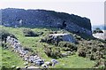
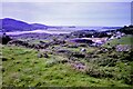
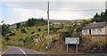
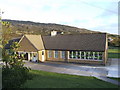
Nearby Images from Geograph Britain and Ireland:
©2009(licence)
©2023(licence)
©2018(licence)
©2007(licence)
©2018(licence)
The above images may not be of the site on this page, they are loaded from Geograph.
Please Submit an Image of this site or go out and take one for us!
Click here to see more info for this site
Nearby sites
Click here to view sites on an interactive map of the areaKey: Red: member's photo, Blue: 3rd party photo, Yellow: other image, Green: no photo - please go there and take one, Grey: site destroyed
Download sites to:
KML (Google Earth)
GPX (GPS waypoints)
CSV (Garmin/Navman)
CSV (Excel)
To unlock full downloads you need to sign up as a Contributory Member. Otherwise downloads are limited to 50 sites.
![]()
Turn off the page maps and other distractions
Nearby sites listing. In the following links * = Image available
95m W 273° Caherdaniel Fort (2)* Stone Fort or Dun (V5425059627)
1.0km SW 227° The Derrynane Stone* Standing Stone (Menhir) (V5356258932)
1.7km NE 47° Coomnahorna* Standing Stones
3.6km W 277° Coomatloukane* Wedge Tomb (V5074660179)
4.1km WNW 295° Loher Stone Fort* Hillfort
5.9km NNW 326° Eightercua* Stone Row / Alignment (V51206465)
6.1km E 85° White Strand Modern Stone Circle and Dolmen* Modern Stone Circle etc (V6046959977)
7.6km ENE 60° Staigue* Stone Fort or Dun (V6103463272)
8.8km N 357° Dromkeare Stone Row / Alignment
9.1km NW 323° Spuncane Stone Circle (V490670)
9.5km ENE 70° Derreenauliff Stone Row / Alignment
9.5km SE 127° Kilcatherine wedge tomb* Wedge Tomb
9.8km N 359° Dromod* Stone Circle (V545694)
10.0km ESE 123° Kilcatherine standing stone (west)* Standing Stone (Menhir)
10.1km ESE 122° Kilcatherine standing stone (east)* Standing Stone (Menhir)
10.1km N 8° Cahersavane* Standing Stones (V5605769610)
10.8km N 3° Dromod Stone Row* Stone Row / Alignment
11.3km N 359° Doory row Stone Row / Alignment
11.3km N 360° Doory standing stone Standing Stone (Menhir)
11.5km ESE 122° Gortgarriff stone cross* Ancient Cross
11.7km ESE 123° Cailleach Beara* Natural Stone / Erratic / Other Natural Feature (V6453)
12.0km N 10° Derrineden W Stone Row / Alignment
12.0km ESE 116° Faranfada Stone Circle (V650540)
12.4km NNE 12° Derrineden E Stone Row / Alignment
12.7km ESE 124° Na hAoraí stone pair* Standing Stones
View more nearby sites and additional images


 We would like to know more about this location. Please feel free to add a brief description and any relevant information in your own language.
 Wir möchten mehr über diese Stätte erfahren. Bitte zögern Sie nicht, eine kurze Beschreibung und relevante Informationen in Deutsch hinzuzufügen.
 Nous aimerions en savoir encore un peu sur les lieux. S'il vous plaît n'hesitez pas à ajouter une courte description et tous les renseignements pertinents dans votre propre langue.
 Quisieramos informarnos un poco más de las lugares. No dude en añadir una breve descripción y otros datos relevantes en su propio idioma.