

<< Our Photo Pages >> Boreray - Stone Circle in Scotland in Isle of Harris
Submitted by Andy B on Sunday, 26 June 2011 Page Views: 17361
Neolithic and Bronze AgeSite Name: BorerayCountry: Scotland County: Isle of Harris Type: Stone Circle
Map Ref: NA15060499
Latitude: 57.867744N Longitude: 8.495988W
Condition:
| 5 | Perfect |
| 4 | Almost Perfect |
| 3 | Reasonable but with some damage |
| 2 | Ruined but still recognisable as an ancient site |
| 1 | Pretty much destroyed, possibly visible as crop marks |
| 0 | No data. |
| -1 | Completely destroyed |
| 5 | Superb |
| 4 | Good |
| 3 | Ordinary |
| 2 | Not Good |
| 1 | Awful |
| 0 | No data. |
| 5 | Can be driven to, probably with disabled access |
| 4 | Short walk on a footpath |
| 3 | Requiring a bit more of a walk |
| 2 | A long walk |
| 1 | In the middle of nowhere, a nightmare to find |
| 0 | No data. |
| 5 | co-ordinates taken by GPS or official recorded co-ordinates |
| 4 | co-ordinates scaled from a detailed map |
| 3 | co-ordinates scaled from a bad map |
| 2 | co-ordinates of the nearest village |
| 1 | co-ordinates of the nearest town |
| 0 | no data |
Internal Links:
External Links:
I have visited· I would like to visit
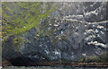
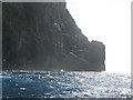
lichen saw from a distance on 25th Aug 2016 - their rating: Amb: 5 Access: 1
Andy B have visited here
")
CANMORE Entry: Type of Site: Stone Circle
NMRS Number: NA10SE 2
Map reference: NA 1525 0505
Archaeology Notes
NA10SE 2 c. 1525 0505.
(Area: NA 1506 0499) K Macaulay 1764; J Sands 1875.
Note: Prehistoric finds from five-year survey project on remote St Kilda's Boreray isle
You may be viewing yesterday's version of this page. To see the most up to date information please register for a free account.
Do not use the above information on other web sites or publications without permission of the contributor.
Nearby Images from Geograph Britain and Ireland:
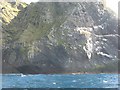
©2009(licence)
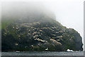
©2013(licence)
©2011(licence)
©2015(licence)
©2009(licence)
The above images may not be of the site on this page, they are loaded from Geograph.
Please Submit an Image of this site or go out and take one for us!
Click here to see more info for this site
Nearby sites
Key: Red: member's photo, Blue: 3rd party photo, Yellow: other image, Green: no photo - please go there and take one, Grey: site destroyed
Download sites to:
KML (Google Earth)
GPX (GPS waypoints)
CSV (Garmin/Navman)
CSV (Excel)
To unlock full downloads you need to sign up as a Contributory Member. Otherwise downloads are limited to 50 sites.
Turn off the page maps and other distractions
Nearby sites listing. In the following links * = Image available
7.5km SW 217° House Of The Fairies* Souterrain (Fogou, Earth House) (NF1001799410)
7.9km SW 227° The Amazon's House (Hirta) Ancient Village or Settlement (NA08780010)
7.9km SW 228° Tobar nam Buadh (St Kilda) Holy Well or Sacred Spring (NA0864400247)
8.3km SW 223° Gleann Mor* Standing Stones (NF08869943)
65.0km ESE 112° Dun Scolpaig* Stone Fort or Dun (NF7310375028)
65.2km ESE 115° Dun Grogary Stone Fort or Dun (NF71257141)
68.0km ESE 109° Bac Mic Connain Stone Fort or Dun (NF76947619)
68.1km ESE 110° Bac Mhic Connain Ancient Village or Settlement (NF76737537)
68.2km ESE 110° Vallay (N Uist) Rock Art (NF77137600)
68.3km ESE 110° Geirisclett* Chambered Cairn (NF76847520)
68.4km ESE 114° Cleithreabhal* Chambered Cairn (NF749713)
68.4km ESE 111° Airigh Mhic Ruairidh* Stone Fort or Dun (NF76597440)
68.5km ESE 114° South Clettraval* Standing Stone (Menhir) (NF75017118)
68.7km ESE 114° Clettraval South* Burial Chamber or Dolmen (NF75167101)
69.0km ESE 111° Cnoc A'Comhdhalach Ancient Village or Settlement (NF77087415)
69.0km ESE 111° Garry Iochdrach Ancient Village or Settlement (NF77237427)
69.2km ESE 112° Buaile Risary Wheelhouse Ancient Village or Settlement (NF76677291)
69.2km ESE 112° Buaile Risary Cup Marked Stone Rock Art (NF76697293)
69.4km ESE 111° Eilean Maleit Ancient Village or Settlement (NF77487388)
69.5km ESE 109° Rudh' An Duin Stone Fort or Dun (NF7859376180)
69.8km ESE 109° Leac nan Cailleacha Dubha Standing Stones (NF79087650)
70.7km ESE 114° Toroghas* Standing Stones (NF77007029)
71.2km ESE 109° Sollas, Machair Leathann Ancient Village or Settlement (NF80117533)
71.9km ESE 109° Dun Skellor Broch or Nuraghe (NF80757507)
72.1km ESE 106° Udal (Grenitote)* Ancient Village or Settlement (NF82387822)
View more nearby sites and additional images


 We would like to know more about this location. Please feel free to add a brief description and any relevant information in your own language.
 Wir möchten mehr über diese Stätte erfahren. Bitte zögern Sie nicht, eine kurze Beschreibung und relevante Informationen in Deutsch hinzuzufügen.
 Nous aimerions en savoir encore un peu sur les lieux. S'il vous plaît n'hesitez pas à ajouter une courte description et tous les renseignements pertinents dans votre propre langue.
 Quisieramos informarnos un poco más de las lugares. No dude en añadir una breve descripción y otros datos relevantes en su propio idioma.