


<< Text Pages >> Gorritiko Langa Túmulo - Round Barrow(s) in Spain in Navarra
Submitted by holger_rix on Tuesday, 10 November 2015 Page Views: 498
Neolithic and Bronze AgeSite Name: Gorritiko Langa TúmuloCountry: Spain
NOTE: This site is 1.951 km away from the location you searched for.
Region: Navarra Type: Round Barrow(s)
Latitude: 43.046092N Longitude: 1.963897W
Condition:
| 5 | Perfect |
| 4 | Almost Perfect |
| 3 | Reasonable but with some damage |
| 2 | Ruined but still recognisable as an ancient site |
| 1 | Pretty much destroyed, possibly visible as crop marks |
| 0 | No data. |
| -1 | Completely destroyed |
| 5 | Superb |
| 4 | Good |
| 3 | Ordinary |
| 2 | Not Good |
| 1 | Awful |
| 0 | No data. |
| 5 | Can be driven to, probably with disabled access |
| 4 | Short walk on a footpath |
| 3 | Requiring a bit more of a walk |
| 2 | A long walk |
| 1 | In the middle of nowhere, a nightmare to find |
| 0 | No data. |
| 5 | co-ordinates taken by GPS or official recorded co-ordinates |
| 4 | co-ordinates scaled from a detailed map |
| 3 | co-ordinates scaled from a bad map |
| 2 | co-ordinates of the nearest village |
| 1 | co-ordinates of the nearest town |
| 0 | no data |
Be the first person to rate this site - see the 'Contribute!' box in the right hand menu.
Internal Links:
External Links:
Round Barrow(s) in Navarra
You may be viewing yesterday's version of this page. To see the most up to date information please register for a free account.
Do not use the above information on other web sites or publications without permission of the contributor.
Nearby Images from Flickr
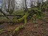
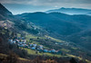
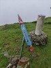


The above images may not be of the site on this page, but were taken nearby. They are loaded from Flickr so please click on them for image credits.
Click here to see more info for this site
Nearby sites
Click here to view sites on an interactive map of the areaKey: Red: member's photo, Blue: 3rd party photo, Yellow: other image, Green: no photo - please go there and take one, Grey: site destroyed
Download sites to:
KML (Google Earth)
GPX (GPS waypoints)
CSV (Garmin/Navman)
CSV (Excel)
To unlock full downloads you need to sign up as a Contributory Member. Otherwise downloads are limited to 50 sites.
Turn off the page maps and other distractions
Nearby sites listing. In the following links * = Image available
65m N 6° Aizetxulo Fondo Cabaña 1+2 Ancient Village or Settlement
1.9km N 359° Mugarri Haundi Dolmen Burial Chamber or Dolmen
2.0km E 97° Goldanburu Dolmen* Burial Chamber or Dolmen
2.2km ESE 107° Oiarrar Goikoa Campo Tumular Round Cairn
2.2km ESE 105° Oiarrar Bekoa Campo Tumular Barrow Cemetery
2.3km ESE 106° Oiarrar Goikoa Túmulo Round Barrow(s)
2.3km E 85° Sokillete Túmulo Round Barrow(s)
2.3km ESE 110° Oiarrar Behekoa Túmulo* Round Barrow(s)
2.3km E 85° Sokillete Dolmen Burial Chamber or Dolmen
2.8km ESE 102° Laloita Dolmen Burial Chamber or Dolmen
3.2km ESE 102° Santa Cruz Dolmen Burial Chamber or Dolmen
3.4km ENE 73° Arrola Dolmen Burial Chamber or Dolmen
4.4km E 93° Iontenea Fondo Cabaña 1-4 Ancient Village or Settlement
4.6km ESE 120° Atume Túmulo Round Barrow(s)
4.6km ESE 120° Atume Campo Túmular 1-7 Barrow Cemetery
4.6km E 91° Atxitxia Dolmen* Burial Chamber or Dolmen
4.7km ESE 120° Atume Fondo Cabaña 1-7 Ancient Village or Settlement
4.7km SW 223° Autzin Campos Tumulares Barrow Cemetery
4.7km E 93° Tronkoneko Borda Túmulo Round Barrow(s)
4.9km SW 223° Auntzin Fondo Cabaña 1-5 Ancient Village or Settlement
4.9km SW 223° Auntzin Bizkarra Fondo Cabaña 1-3 Ancient Village or Settlement
5.0km SW 224° Santa Cruz Ekialde Fondo Cabaña Ancient Village or Settlement
5.0km SW 223° Santa Cruz Fondo Cabaña 1-8 Ancient Village or Settlement
5.1km E 99° Musulun Dolmen Burial Chamber or Dolmen
5.2km SW 224° Telleridenea Fondo Cabaña 1-3 Ancient Village or Settlement
View more nearby sites and additional images


 We would like to know more about this location. Please feel free to add a brief description and any relevant information in your own language.
 Wir möchten mehr über diese Stätte erfahren. Bitte zögern Sie nicht, eine kurze Beschreibung und relevante Informationen in Deutsch hinzuzufügen.
 Nous aimerions en savoir encore un peu sur les lieux. S'il vous plaît n'hesitez pas à ajouter une courte description et tous les renseignements pertinents dans votre propre langue.
 Quisieramos informarnos un poco más de las lugares. No dude en añadir una breve descripción y otros datos relevantes en su propio idioma.