<< Our Photo Pages >> Berrybrae - Stone Circle in Scotland in Aberdeenshire
Submitted by Drew Parsons on Monday, 15 July 2002 Page Views: 16874
Neolithic and Bronze AgeSite Name: BerrybraeCountry: Scotland
NOTE: This site is 2.08 km away from the location you searched for.
County: Aberdeenshire Type: Stone Circle
Nearest Town: Fraserburgh Nearest Village: St. Combs
Map Ref: NK02765716 Landranger Map Number: 30
Latitude: 57.604438N Longitude: 1.955476W
Condition:
| 5 | Perfect |
| 4 | Almost Perfect |
| 3 | Reasonable but with some damage |
| 2 | Ruined but still recognisable as an ancient site |
| 1 | Pretty much destroyed, possibly visible as crop marks |
| 0 | No data. |
| -1 | Completely destroyed |
| 5 | Superb |
| 4 | Good |
| 3 | Ordinary |
| 2 | Not Good |
| 1 | Awful |
| 0 | No data. |
| 5 | Can be driven to, probably with disabled access |
| 4 | Short walk on a footpath |
| 3 | Requiring a bit more of a walk |
| 2 | A long walk |
| 1 | In the middle of nowhere, a nightmare to find |
| 0 | No data. |
| 5 | co-ordinates taken by GPS or official recorded co-ordinates |
| 4 | co-ordinates scaled from a detailed map |
| 3 | co-ordinates scaled from a bad map |
| 2 | co-ordinates of the nearest village |
| 1 | co-ordinates of the nearest town |
| 0 | no data |
Internal Links:
External Links:
Edit visit report or Add another visit
DrewParsons tyrianterror HaggisAction have visited here
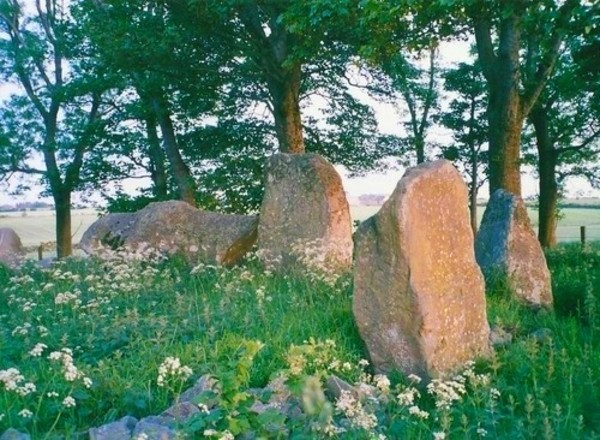
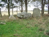
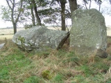
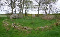
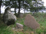
The Aberdeenshire website on recumbent stone circles (see references below) states that the original setting comprised a 12.8 metre by 10.8 metre oval of low stones with 9 standing stones and a 3.3 metre long and 1.4 metre wide recumbent stone around its perimeter.
There was a ring cairn in its centre from which three cremation burials were identified. Burl (who excavated the site between 1975 and 1978 - see references below) says that it was partially destroyed by intrusive beaker peoples around 1900 to 1550 BC BC from which era a beaker burial was found. The stones were toppled and some smashed to create an enclosed cremation cemetery.
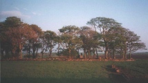
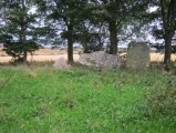
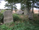
There are now 5 remaining stones including the recumbent stone with its bank reconstructed after the 1975-8 excavations. The site is located in a small wooded area 60 metres from the lane which runs between the A90 and the A952 about 3 kilometres south of the junction of those two A roads.
References: Burl A, The Stone Circles of Britain Ireland and Brittany, Yale Univerisity Press, Newhaven, 2000
Canmore: http://canmore.rcahms.gov.uk/en/site/21099/details/berrybrae/
Aberdeenshire County Website: http://www.aberdeenshire.gov.uk/smrpub/shire/detail.aspx?refno=NK05NW0001
You may be viewing yesterday's version of this page. To see the most up to date information please register for a free account.






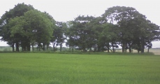
These are just the first 25 photos of Berrybrae. If you log in with a free user account you will be able to see our entire collection.
Do not use the above information on other web sites or publications without permission of the contributor.
Click here to see more info for this site
Nearby sites
Key: Red: member's photo, Blue: 3rd party photo, Yellow: other image, Green: no photo - please go there and take one, Grey: site destroyed
Download sites to:
KML (Google Earth)
GPX (GPS waypoints)
CSV (Garmin/Navman)
CSV (Excel)
To unlock full downloads you need to sign up as a Contributory Member. Otherwise downloads are limited to 50 sites.
Turn off the page maps and other distractions
Nearby sites listing. In the following links * = Image available
1.5km ESE 111° Greengate* Standing Stone (Menhir) (NK04205662)
1.6km E 88° Netherton* Stone Circle (NK04335722)
2.7km NW 320° Cortie Brae* Stone Circle (NK01015924)
7.1km NW 314° Memsie Burial Cairn* Cairn (NJ97666205)
7.3km SW 220° Gaval Standing Stone* Standing Stone (Menhir) (NJ9805651504)
8.0km SW 215° Fetterangus* Class I Pictish Symbol Stone (NJ98135056)
9.4km WSW 254° Strichen House* Stone Circle (NJ93675449)
9.6km WSW 237° White Cow Wood* Chambered Cairn (NJ947519)
10.0km SW 222° Loudon Wood* Stone Circle (NJ96104974)
10.5km SW 229° Auchmachar* Stone Circle (NJ948503)
10.6km SW 230° Auchmachar Long Cairn* Cairn (NJ9461850314)
10.6km SW 230° Knapperty Hill* Chambered Cairn (NJ946503)
10.7km WNW 283° Picts House* Misc. Earthwork (NJ92365963)
10.7km SW 226° Auchmachar Clump Ancient Village or Settlement (NJ950498)
10.8km SSW 213° Old Deer* Class I Pictish Symbol Stone (NJ96854810)
11.4km WNW 301° Tyrie Class I Pictish Symbol Stone (NJ93006310)
12.2km SW 214° Aikey Brae* Stone Circle (NJ95884709)
13.5km NW 308° Gallows Hill (The Hanging Stone) Standing Stone (Menhir) (NJ9211465539)
13.9km SSW 202° East Crichie Stone Circle (NJ9751344269)
14.6km SSW 208° Upper Crichie Stone Circle (NJ9580344301)
14.6km W 278° Law Cairn* Cairn (NJ88205911)
15.0km SE 136° Arbuthnot Museum, Peterhead Museum (NK1318846334)
15.3km WNW 300° Dundarg Castle* Hillfort (NJ895648)
15.7km SSE 163° Cairn Catto* Cairn (NK0743542124)
15.9km WNW 298° St Drostan's Well* Holy Well or Sacred Spring (NJ887646)
View more nearby sites and additional images




 We would like to know more about this location. Please feel free to add a brief description and any relevant information in your own language.
 Wir möchten mehr über diese Stätte erfahren. Bitte zögern Sie nicht, eine kurze Beschreibung und relevante Informationen in Deutsch hinzuzufügen.
 Nous aimerions en savoir encore un peu sur les lieux. S'il vous plaît n'hesitez pas à ajouter une courte description et tous les renseignements pertinents dans votre propre langue.
 Quisieramos informarnos un poco más de las lugares. No dude en añadir una breve descripción y otros datos relevantes en su propio idioma.