


<< Text Pages >> Lyd Well (Kemble) - Holy Well or Sacred Spring in England in Gloucestershire
Submitted by Anne T on Thursday, 31 January 2019 Page Views: 1684
Springs and Holy WellsSite Name: Lyd Well (Kemble) Alternative Name: Roman Well (Kemble)Country: England
NOTE: This site is 5.232 km away from the location you searched for.
County: Gloucestershire Type: Holy Well or Sacred Spring
Nearest Town: Cirencester Nearest Village: Kemble
Map Ref: ST98969847
Latitude: 51.684988N Longitude: 2.016442W
Condition:
| 5 | Perfect |
| 4 | Almost Perfect |
| 3 | Reasonable but with some damage |
| 2 | Ruined but still recognisable as an ancient site |
| 1 | Pretty much destroyed, possibly visible as crop marks |
| 0 | No data. |
| -1 | Completely destroyed |
| 5 | Superb |
| 4 | Good |
| 3 | Ordinary |
| 2 | Not Good |
| 1 | Awful |
| 0 | No data. |
| 5 | Can be driven to, probably with disabled access |
| 4 | Short walk on a footpath |
| 3 | Requiring a bit more of a walk |
| 2 | A long walk |
| 1 | In the middle of nowhere, a nightmare to find |
| 0 | No data. |
| 5 | co-ordinates taken by GPS or official recorded co-ordinates |
| 4 | co-ordinates scaled from a detailed map |
| 3 | co-ordinates scaled from a bad map |
| 2 | co-ordinates of the nearest village |
| 1 | co-ordinates of the nearest town |
| 0 | no data |
Be the first person to rate this site - see the 'Contribute!' box in the right hand menu.
Internal Links:
External Links:
Holy Well or Sacred Spring in Gloucestershire
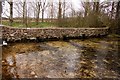
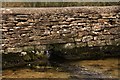
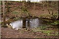
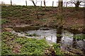
The Journal of Antiquities features an entry for Lyd Well, Kemble, Gloucestershire. The Journal adds: "In the dry, summer months it is difficult to find, but in a long wet spell of weather it is in full flow. This is now considered by historians to be the source of the river Thames, rather than at Thames Head one mile to the north-west where the water has given up the ghost and where all there is to be seen today is a small circle of stones on the ground and a hidden stone gulley close by".
The Journal tells us the spring emerges from a large circular hole covered with an iron grate and flows into an even larger stone-lined pool which often overflows. Their entry also includes a number of reference sources for more information.
Note: Have you visited this site? Do you have any photographs, information or comments to add?
You may be viewing yesterday's version of this page. To see the most up to date information please register for a free account.
Do not use the above information on other web sites or publications without permission of the contributor.
Nearby Images from Geograph Britain and Ireland:
©2013(licence)
©2013(licence)
©2013(licence)
©2013(licence)
©2016(licence)
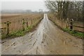
The above images may not be of the site on this page, they are loaded from Geograph.
Please Submit an Image of this site or go out and take one for us!
Click here to see more info for this site
Nearby sites
Key: Red: member's photo, Blue: 3rd party photo, Yellow: other image, Green: no photo - please go there and take one, Grey: site destroyed
Download sites to:
KML (Google Earth)
GPX (GPS waypoints)
CSV (Garmin/Navman)
CSV (Excel)
To unlock full downloads you need to sign up as a Contributory Member. Otherwise downloads are limited to 50 sites.
Turn off the page maps and other distractions
Nearby sites listing. In the following links * = Image available
668m NW 321° King Athelstans Mounting Stone* Marker Stone (ST98549899)
1.6km NNW 327° Trewsbury Camp* Hillfort (ST98109980)
3.6km WSW 252° Haresdown Barrow* Round Barrow(s) (ST95489737)
4.3km NE 45° Querns Barrow* Chambered Tomb (SP01980150)
4.8km NE 41° Corinium Museum* Museum (SP0212602059)
5.3km NW 315° Cassey Well* Holy Well or Sacred Spring (SO952022)
5.5km N 8° Wellhill Copse Barrow* Round Barrow(s) (SO99740387)
5.8km NE 46° Tar Barrow* Round Barrow(s) (SP03110252)
5.8km WSW 258° Windmill Tump* Long Barrow (ST93259731)
6.1km W 262° Hasleden Barrow* Round Barrow(s) (ST92949760)
7.5km NNW 335° Pinbury Hillfort Hillfort (SO958053)
8.1km NNW 339° College Plantation 1* Chambered Tomb (SO960060)
8.1km NNW 338° College Plantation 2* Chambered Tomb (SO959060)
8.3km NW 311° The Golden Coffin (Far Oakridge)* Round Barrow(s) (SO92620388)
8.4km NNE 20° Bagendon* Hillfort (SP018064)
8.4km NW 309° Litteridge Cross* Ancient Cross (SO92350373)
8.5km NNW 343° Hoar Stone at Duntisbourne* Chambered Tomb (SO965066)
8.5km WSW 251° Warren Tump (Gloucestershire)* Round Barrow(s) (ST90889577)
8.7km NW 322° Westwood (Gloucestershire)* Chambered Tomb (SO936053)
8.8km NW 316° The Trench* Misc. Earthwork (SO92900482)
8.9km WNW 301° Ashmead Well* Holy Well or Sacred Spring (SO91270301)
9.3km NNW 340° Jack Barrow Chambered Cairn (SO957072)
9.4km W 266° Barrow Tumps* Long Barrow (ST89519783)
9.5km NNE 18° North Cerney 1* Chambered Tomb (SP01840752)
9.8km WNW 302° Avenis Barrow* Long Barrow (SO907037)
View more nearby sites and additional images


 We would like to know more about this location. Please feel free to add a brief description and any relevant information in your own language.
 Wir möchten mehr über diese Stätte erfahren. Bitte zögern Sie nicht, eine kurze Beschreibung und relevante Informationen in Deutsch hinzuzufügen.
 Nous aimerions en savoir encore un peu sur les lieux. S'il vous plaît n'hesitez pas à ajouter une courte description et tous les renseignements pertinents dans votre propre langue.
 Quisieramos informarnos un poco más de las lugares. No dude en añadir una breve descripción y otros datos relevantes en su propio idioma.