


<< Text Pages >> Barnard Castle Allotment 1 & Langleydale Common 10 - Rock Art in England in County Durham
Submitted by Anne T on Wednesday, 23 May 2018 Page Views: 859
Rock ArtSite Name: Barnard Castle Allotment 1 & Langleydale Common 10 Alternative Name: ERA-2015; ERA-2016Country: England
NOTE: This site is 0.684 km away from the location you searched for.
County: County Durham Type: Rock Art
Nearest Town: Middleton-in-Teesdale / Barnard Castle Nearest Village: Eggleston
Map Ref: NZ0237923805
Latitude: 54.609403N Longitude: 1.964684W
Condition:
| 5 | Perfect |
| 4 | Almost Perfect |
| 3 | Reasonable but with some damage |
| 2 | Ruined but still recognisable as an ancient site |
| 1 | Pretty much destroyed, possibly visible as crop marks |
| 0 | No data. |
| -1 | Completely destroyed |
| 5 | Superb |
| 4 | Good |
| 3 | Ordinary |
| 2 | Not Good |
| 1 | Awful |
| 0 | No data. |
| 5 | Can be driven to, probably with disabled access |
| 4 | Short walk on a footpath |
| 3 | Requiring a bit more of a walk |
| 2 | A long walk |
| 1 | In the middle of nowhere, a nightmare to find |
| 0 | No data. |
| 5 | co-ordinates taken by GPS or official recorded co-ordinates |
| 4 | co-ordinates scaled from a detailed map |
| 3 | co-ordinates scaled from a bad map |
| 2 | co-ordinates of the nearest village |
| 1 | co-ordinates of the nearest town |
| 0 | no data |
Be the first person to rate this site - see the 'Contribute!' box in the right hand menu.
Internal Links:
External Links:
Rock Art in County Durham
England's Rock Art has two entries for rock art panels at the same location:
Barnard Castle Allotment 1: This rock art panel is recorded by NADRAP as being on a large boulder near a stream; the boulder is irregular in shape with some sharp sides. The motif is a single cup, but NADRAP notes this may be natural, being near a leading edge. Part of the rock on the south eastern side has been removed.
For more information see England's Rock Art entry for ERA-2015 Barnard Castle Allotment 1, which includes NADRAP's notes and two sketches of the rock and its motif.
Langleydale Common 10: This rock art panel is described by NADRAP as being on an upright stone with one possible cup. NADRAP adds they only partially recorded this panel.
For more information see England's Rock Art entry for ERA-2016 Langleydale Common 10, which includes NADRAP's notes, photographs and photogrammetry.
It is not recorded if these rock art panels are on Open Access or private land; land usage given is 'heathland/moorland'.
Note: Have you seen these rock art panels? Do you have any photographs or information to add?
You may be viewing yesterday's version of this page. To see the most up to date information please register for a free account.
Do not use the above information on other web sites or publications without permission of the contributor.
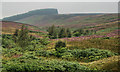
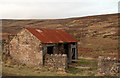
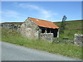
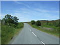
Nearby Images from Geograph Britain and Ireland:
©2011(licence)
©2011(licence)
©2018(licence)
©2018(licence)
©2011(licence)
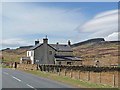
The above images may not be of the site on this page, they are loaded from Geograph.
Please Submit an Image of this site or go out and take one for us!
Click here to see more info for this site
Nearby sites
Key: Red: member's photo, Blue: 3rd party photo, Yellow: other image, Green: no photo - please go there and take one, Grey: site destroyed
Download sites to:
KML (Google Earth)
GPX (GPS waypoints)
CSV (Garmin/Navman)
CSV (Excel)
To unlock full downloads you need to sign up as a Contributory Member. Otherwise downloads are limited to 50 sites.
Turn off the page maps and other distractions
Nearby sites listing. In the following links * = Image available
883m ENE 64° Langleydale Common 9 Rock Art (NZ0317624190)
989m WSW 238° Brackenheads 3* Rock Art (NZ0153523286)
998m WSW 241° Brackenheads 4 Rock Art (NZ0150423321)
1.0km WSW 240° Brackenheads 1* Rock Art (NZ0150823298)
1.0km WSW 240° Brackenheads 2* Rock Art (NZ0150523298)
1.0km WSW 240° Brackenheads 6* Rock Art (NZ0150123299)
1.0km WSW 240° Brackenheads 5 Rock Art (NZ0150023290)
1.1km WSW 238° Brackenheads N02 Rock Art (NZ0144923234)
1.1km WSW 238° Brackenheads N03* Rock Art (NZ0145423225)
1.1km WSW 240° Brackenheads N01* Rock Art (NZ0142323244)
1.1km WSW 254° Stobgreen Plantation - The Grayson Stone* Rock Art (NZ0128723489)
1.1km WSW 243° Brackenheads 8* Rock Art (NZ0136123281)
1.2km WSW 242° Brackenheads 7* Rock Art (NZ0134023255)
1.3km W 260° Stobgreen Plantation N01 Rock Art (NZ0107323567)
1.4km ENE 67° Langleydale Common 8 Rock Art (NZ0363324341)
1.5km ENE 70° Langleydale Common 5 Rock Art (NZ0379024318)
1.5km WSW 249° Stobgreen Plantation 3 Rock Art (NZ0093623252)
1.7km W 277° Stobgreen Plantation 2* Rock Art (NZ0072824000)
1.7km W 276° Stobgreen Plantation 1* Rock Art (NZ0071423974)
1.9km ENE 59° Langleydale Common 4 Rock Art (NZ0402324800)
2.1km ENE 65° Langleydale Common 3 Rock Art (NZ0427224670)
2.2km NE 56° Woolly Hills 1 & 2 Rock Art (NZ0417425028)
2.3km ENE 69° Langleydale Common 6, 7 & 11 Ring Cairn (NZ0451024640)
2.3km ENE 69° Langleydale Common 2 Rock Art (NZ0451824642)
2.5km E 80° Langleydale Common 1 Rock Art (NZ0487824254)
View more nearby sites and additional images


 We would like to know more about this location. Please feel free to add a brief description and any relevant information in your own language.
 Wir möchten mehr über diese Stätte erfahren. Bitte zögern Sie nicht, eine kurze Beschreibung und relevante Informationen in Deutsch hinzuzufügen.
 Nous aimerions en savoir encore un peu sur les lieux. S'il vous plaît n'hesitez pas à ajouter une courte description et tous les renseignements pertinents dans votre propre langue.
 Quisieramos informarnos un poco más de las lugares. No dude en añadir una breve descripción y otros datos relevantes en su propio idioma.