


<< Our Photo Pages >> Menhir de la Bergerie des Etennevaux - Standing Stone (Menhir) in France in Normandie:Manche (50)
Submitted by TheCaptain on Sunday, 19 December 2004 Page Views: 5750
Neolithic and Bronze AgeSite Name: Menhir de la Bergerie des Etennevaux Alternative Name: La Grosse PierreCountry: France Département: Normandie:Manche (50) Type: Standing Stone (Menhir)
Nearest Town: Cherbourg Nearest Village: St-Germain-des-Vaux
Latitude: 49.720983N Longitude: 1.927502W
Condition:
| 5 | Perfect |
| 4 | Almost Perfect |
| 3 | Reasonable but with some damage |
| 2 | Ruined but still recognisable as an ancient site |
| 1 | Pretty much destroyed, possibly visible as crop marks |
| 0 | No data. |
| -1 | Completely destroyed |
| 5 | Superb |
| 4 | Good |
| 3 | Ordinary |
| 2 | Not Good |
| 1 | Awful |
| 0 | No data. |
| 5 | Can be driven to, probably with disabled access |
| 4 | Short walk on a footpath |
| 3 | Requiring a bit more of a walk |
| 2 | A long walk |
| 1 | In the middle of nowhere, a nightmare to find |
| 0 | No data. |
| 5 | co-ordinates taken by GPS or official recorded co-ordinates |
| 4 | co-ordinates scaled from a detailed map |
| 3 | co-ordinates scaled from a bad map |
| 2 | co-ordinates of the nearest village |
| 1 | co-ordinates of the nearest town |
| 0 | no data |
Internal Links:
External Links:
I have visited· I would like to visit
johnstone visited on 1st Jul 2009 - their rating: Cond: 3 Amb: 3 Access: 4
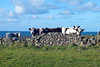
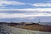
TheCaptain saw from a distance on 26th Apr 2005 Menhir about 2 metres tall northwest of the village of St Germain-des-Vaux on Cap de la Hague right at the northwestern tip of the Cherbourg peninsular. I couldn’t get right up to this menhir and could only see it from two fields distance and judged the height from the size of the cows in the field with it.
")
See also: T4T35
You may be viewing yesterday's version of this page. To see the most up to date information please register for a free account.
")
")
")
Do not use the above information on other web sites or publications without permission of the contributor.
Nearby Images from Flickr

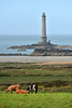
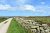
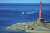
The above images may not be of the site on this page, but were taken nearby. They are loaded from Flickr so please click on them for image credits.
Click here to see more info for this site
Nearby sites
Click here to view sites on an interactive map of the areaKey: Red: member's photo, Blue: 3rd party photo, Yellow: other image, Green: no photo - please go there and take one, Grey: site destroyed
Download sites to:
KML (Google Earth)
GPX (GPS waypoints)
CSV (Garmin/Navman)
CSV (Excel)
To unlock full downloads you need to sign up as a Contributory Member. Otherwise downloads are limited to 50 sites.
Turn off the page maps and other distractions
Nearby sites listing. In the following links * = Image available
686m SSE 155° Dolmen du Jogard* Burial Chamber or Dolmen
1.1km SSE 151° Pierre à Feu Standing Stone (Menhir)
4.4km ESE 120° Saint-Martin d'Ormonville Tumuli Chambered Tomb
4.7km SSE 155° Tumuli Landes de Jobourg* Barrow Cemetery
4.7km ESE 103° Tumulus des Sablons Artificial Mound
5.3km S 187° Tumulus du Nez de Jobourg* Round Barrow(s)
5.3km ESE 110° Digulleville Tumuli Barrow Cemetery
8.1km SE 134° Hague-Dick* Misc. Earthwork
9.1km SE 135° Beaumont-Hague Tumuli Barrow Cemetery
9.5km SSE 146° Pierres Pouquelées* Passage Grave
10.2km SE 137° Tumulus Landes des Cottes* Round Barrow(s)
10.5km SE 132° Tumulus de La Fosse Yvon* Round Barrow(s)
11.9km SE 130° Tumulus des Delles* Round Barrow(s)
12.6km SE 139° Menhir dit Epinette de Vauville Standing Stone (Menhir)
13.5km SE 137° Tumulus Bois des Hougues* Barrow Cemetery
14.4km SE 129° Sainte-Croix-Hague Tumuli Chambered Tomb
16.2km SE 145° Cromlech de Vasteville Stone Circle
17.3km W 271° Les Pourciaux Dolmen Passage Grave
17.3km W 272° MP3 Stones* Passage Grave
17.4km W 271° Les Pourciaux Dolmen* Burial Chamber or Dolmen
18.0km W 270° Les Huguettes* Ancient Village or Settlement
18.8km W 269° Les Rochers (Alderney)* Passage Grave
18.8km W 269° Les Rochers Tobruk Stones* Passage Grave
20.1km W 268° Alderney Museum Museum
20.2km SE 139° Pierres Tournantes (Néretz) Standing Stones
View more nearby sites and additional images


 We would like to know more about this location. Please feel free to add a brief description and any relevant information in your own language.
 Wir möchten mehr über diese Stätte erfahren. Bitte zögern Sie nicht, eine kurze Beschreibung und relevante Informationen in Deutsch hinzuzufügen.
 Nous aimerions en savoir encore un peu sur les lieux. S'il vous plaît n'hesitez pas à ajouter une courte description et tous les renseignements pertinents dans votre propre langue.
 Quisieramos informarnos un poco más de las lugares. No dude en añadir una breve descripción y otros datos relevantes en su propio idioma.