 with our Megalithic Portal iPhone app")


<< Our Photo Pages >> The Sleepy Sheep, Deepdale - Natural Stone / Erratic / Other Natural Feature in England in County Durham
Submitted by durhamnature on Friday, 29 June 2012 Page Views: 3667
Natural PlacesSite Name: The Sleepy Sheep, DeepdaleCountry: England
NOTE: This site is 0.854 km away from the location you searched for.
County: County Durham Type: Natural Stone / Erratic / Other Natural Feature
Nearest Town: Barnard Castle
Map Ref: NZ043168
Latitude: 54.546438N Longitude: 1.935042W
Condition:
| 5 | Perfect |
| 4 | Almost Perfect |
| 3 | Reasonable but with some damage |
| 2 | Ruined but still recognisable as an ancient site |
| 1 | Pretty much destroyed, possibly visible as crop marks |
| 0 | No data. |
| -1 | Completely destroyed |
| 5 | Superb |
| 4 | Good |
| 3 | Ordinary |
| 2 | Not Good |
| 1 | Awful |
| 0 | No data. |
| 5 | Can be driven to, probably with disabled access |
| 4 | Short walk on a footpath |
| 3 | Requiring a bit more of a walk |
| 2 | A long walk |
| 1 | In the middle of nowhere, a nightmare to find |
| 0 | No data. |
| 5 | co-ordinates taken by GPS or official recorded co-ordinates |
| 4 | co-ordinates scaled from a detailed map |
| 3 | co-ordinates scaled from a bad map |
| 2 | co-ordinates of the nearest village |
| 1 | co-ordinates of the nearest town |
| 0 | no data |
Internal Links:
External Links:
I have visited· I would like to visit
Anne T visited on 2nd Jun 2015 - their rating: Cond: 4 Amb: 4 Access: 4 The Sleepy Sheep Stone, Natural Erratic near Barnard Castle: Having decided to go to see Egglestone Abbey, I did a quick trawl on the Portal to see what else was nearby around Barnard Castle. The Red Well and this stone looked intriguing so I printed off the pages, and off we set. [Thanks to Durham Nature for this entry – I’ve since looked up his web site and will dip into this again.]
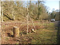
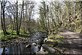
On the way back from Egglestone Abbey, instead of turning right along The Sills to go over the road bridge over the Tees into Barnard Castle by the castle, we went straight on along Lartington Lane. Whilst it’s a relatively minor road, it is wide but busy along its first part, with Hensall Way peeling off and leading up to HM Young Offenders Institute Deerbolt. Not sure which side of the river the stone was on, we parked on a wider section of the road near Deepdale Cottage, just along from the junction with Henshall Way. We walked back along the narrow pavement to Deepdale footbridge over the river to its northern banks, but drew a blank. From the image from the Portal, the stone was most likely to be on the southern side of the river, so we trekked back over the footbridge (distressingly the wooden sheets across the bridge were all rotten and cracking, and plastic reinforcement had been laid across some parts).
Finding the entrance to the park on the southern banks of the Tees between two cottages, we opened (and closed) the gate and followed the metalled road along the grassy meadow. In a couple of hundred yards I said to Andrew, “either that’s a sheep that’s keeping very still, or it’s the stone.” It was the stone.
The shape of this natural erratic is indeed like a sleeping sheep. Made definitely of red Shap granite, it was so cute! We wondered how on earth it had got there. The Durham Nature web site tells us that there are a number of these erratic in the area, pushed over the Pennines by a glacier during the last ice age. I definitely want to go and find the others at Deepdale and The Mortham Stones.
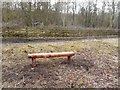
The location is also very pretty, sleeping between the small road and the river with lush, green grass blowing in the breeze and sheep with their photogenic lambs standing watching what we were doing.
The winds were definitely getting stronger by this time (pity my friends walking from John O’Groats to Lands End who are up around Shap today!) so set off to find The Red Well, then onto Staindrop to find the Anglo Saxon Stone Fragment on the way back.
")
A glacial erratic of pink Shap granite, in a sheep pasture on the banks of the River Tees, close to a footpath.
You may be viewing yesterday's version of this page. To see the most up to date information please register for a free account.
")
")
")
Do not use the above information on other web sites or publications without permission of the contributor.
Nearby Images from Geograph Britain and Ireland:
![NZ0416 : A circular walk from Barnard Castle [79] by Michael Dibb](https://s1.geograph.org.uk/geophotos/07/27/35/7273545_21b0f108_120x120.jpg)
©2022(licence)
©2020(licence)
©2019(licence)
©2021(licence)
![NZ0416 : A circular walk from Barnard Castle [7] by Michael Dibb](https://s1.geograph.org.uk/geophotos/07/26/67/7266761_a982e202_120x120.jpg)
©2022(licence)
The above images may not be of the site on this page, they are loaded from Geograph.
Please Submit an Image of this site or go out and take one for us!
Click here to see more info for this site
Nearby sites
Key: Red: member's photo, Blue: 3rd party photo, Yellow: other image, Green: no photo - please go there and take one, Grey: site destroyed
Download sites to:
KML (Google Earth)
GPX (GPS waypoints)
CSV (Garmin/Navman)
CSV (Excel)
To unlock full downloads you need to sign up as a Contributory Member. Otherwise downloads are limited to 50 sites.
Turn off the page maps and other distractions
Nearby sites listing. In the following links * = Image available
1.3km WSW 247° The Great Stone, Deepdale* Natural Stone / Erratic / Other Natural Feature (NZ031163)
1.3km ESE 112° The Bowes Museum* Museum (NZ05551630)
1.8km NE 45° Red Well, Barnard Castle* Holy Well or Sacred Spring (NZ05561805)
2.2km N 355° Marwood Rock Art (NZ04091899)
2.4km SE 132° Thorsgill Stone* Rock Art (NZ0608115200)
2.4km N 350° Knott Hill (Marwood) Rock Art (NZ0390019161)
2.5km SE 133° Egglestone, Folly House Rock Art (NZ0614015070)
3.3km W 265° Lartington, The Rigg 11 Rock Art (NZ0095716509)
3.4km W 265° Lartington, The Rigg 10 Rock Art (NZ0093516511)
3.4km W 265° Lartington, The Rigg 12 Rock Art (NZ0092416510)
3.4km W 265° Lartington, The Rigg 16, 17 & 18 Rock Art (NZ0086016500)
3.5km W 265° Lartington, The Rigg 9 Rock Art (NZ0082216495)
3.6km W 263° Lartington, The Rigg 13* Rock Art (NZ0076016376)
3.6km W 265° Lartington, The Rigg 8* Rock Art (NZ0073016479)
3.6km W 265° Lartington, The Rigg 7* Rock Art (NZ0071816482)
3.6km W 265° Lartington, The Rigg 14* Rock Art (NZ0070716482)
3.6km W 265° Lartington, The Rigg 6* Rock Art (NZ0070716481)
3.6km W 265° Lartington, The Rigg 5* Rock Art (NZ0070116489)
3.7km W 265° Lartington, The Rigg 3* Rock Art (NZ0055616471)
3.8km W 265° Lartington, The Rigg 4* Rock Art (NZ0055116469)
3.8km W 265° Lartington, The Rigg 2* Rock Art (NZ0054916470)
3.8km W 265° Lartington, The Rigg 1.* Rock Art (NZ00511645)
3.9km N 353° Hawkesley Hill 2 Rock Art (NZ0382020672)
3.9km N 353° Hawkesley Hill 1 Rock Art (NZ0382120675)
4.1km W 266° Lartington, The Rigg 15 Rock Art (NZ0016716488)
View more nearby sites and additional images


 We would like to know more about this location. Please feel free to add a brief description and any relevant information in your own language.
 Wir möchten mehr über diese Stätte erfahren. Bitte zögern Sie nicht, eine kurze Beschreibung und relevante Informationen in Deutsch hinzuzufügen.
 Nous aimerions en savoir encore un peu sur les lieux. S'il vous plaît n'hesitez pas à ajouter une courte description et tous les renseignements pertinents dans votre propre langue.
 Quisieramos informarnos un poco más de las lugares. No dude en añadir una breve descripción y otros datos relevantes en su propio idioma.