<< Our Photo Pages >> Newtown Mill - Standing Stone (Menhir) in England in Northumberland
Submitted by stu on Sunday, 14 December 2003 Page Views: 6870
Neolithic and Bronze AgeSite Name: Newtown Mill Alternative Name: ERA-776; SAM 29302; SMR/HER N3484Country: England County: Northumberland Type: Standing Stone (Menhir)
Nearest Town: Wooler Nearest Village: East Lilburn / Newtown
Map Ref: NU04322421 Landranger Map Number: 75
Latitude: 55.511636N Longitude: 1.933152W
Condition:
| 5 | Perfect |
| 4 | Almost Perfect |
| 3 | Reasonable but with some damage |
| 2 | Ruined but still recognisable as an ancient site |
| 1 | Pretty much destroyed, possibly visible as crop marks |
| 0 | No data. |
| -1 | Completely destroyed |
| 5 | Superb |
| 4 | Good |
| 3 | Ordinary |
| 2 | Not Good |
| 1 | Awful |
| 0 | No data. |
| 5 | Can be driven to, probably with disabled access |
| 4 | Short walk on a footpath |
| 3 | Requiring a bit more of a walk |
| 2 | A long walk |
| 1 | In the middle of nowhere, a nightmare to find |
| 0 | No data. |
| 5 | co-ordinates taken by GPS or official recorded co-ordinates |
| 4 | co-ordinates scaled from a detailed map |
| 3 | co-ordinates scaled from a bad map |
| 2 | co-ordinates of the nearest village |
| 1 | co-ordinates of the nearest town |
| 0 | no data |
Internal Links:
External Links:
I have visited· I would like to visit
bishop_pam visited on 19th Aug 2017 - their rating: Cond: 3 Amb: 2 Access: 5 Sadly there is now a sturdy wooden fence surrounding this stone, so that it can't be viewed as part of the landscape
Anne T visited on 17th Aug 2014 - their rating: Cond: 4 Amb: 4 Access: 5 Driving southwards from Fowberry Park rock art site, through the small hamlet of Newtown, this standing stone appeared on the map to be very near the road, so we drove past hoping to see it. And there it was – about 50 yards inside the field to our left hand side, easily accessible by a metal gate. There were no footpaths to the stone, but having been disappointed at not seeing the Wade Stone South on 15th August, I was somewhat reckless, and entered the field to take some photographs, sincerely hoping the farmer wouldn’t object and I would explain if I saw him/her.
Astonishingly, the Devil’s Causeway (Roman road) runs almost immediately to the eastern side of this stone, although there was no sign of this road whatsoever (we’ve usually seen some signs of old Roman roads in the form of traces of the ditches at each side, but in this instance, all evidence seemed to have disappeared. We looked for further signs of this road at the modern road junction leading up to Newtown, but there were no traces here, either).
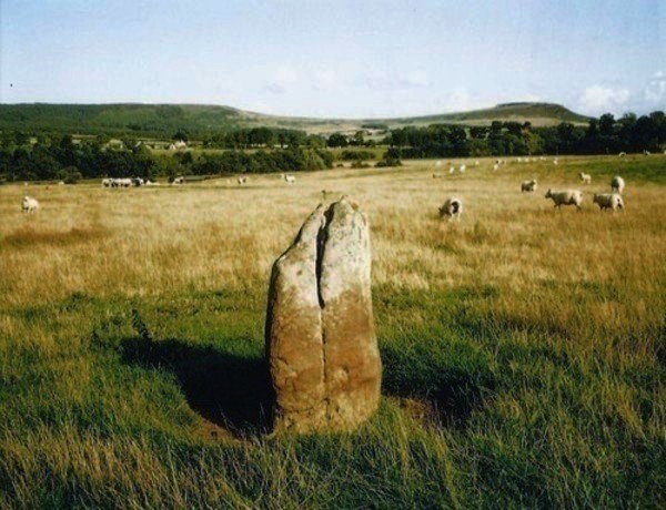
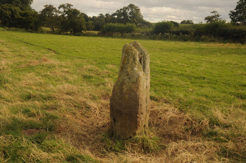
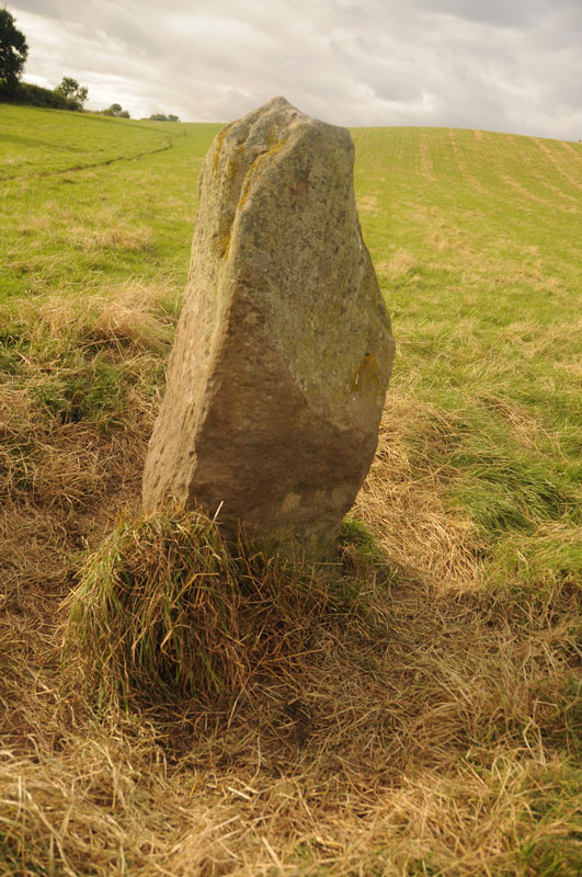
The rounded form of 80m high Ewe Hill seemed to loom above this standing stone, although the stone sits in the valley, well sheltered from the wind, and appears to be in its original position. We thought we spotted some cup marks on the stone, but these could be the results of weathering, as the stone has deep vertical fluting (like many of the standing stones in the area).
The road next to the standing stone is single track, with few passing places, although it is possible to park on the grass verge next to the gate next to the standing stone.
Once I'd taken photographs, we turned the car around and headed back up the hill towards Newtown, to locate the Hurl Stone.
Average ratings for this site from all visit loggers: Condition: 3.5 Ambience: 3 Access: 5
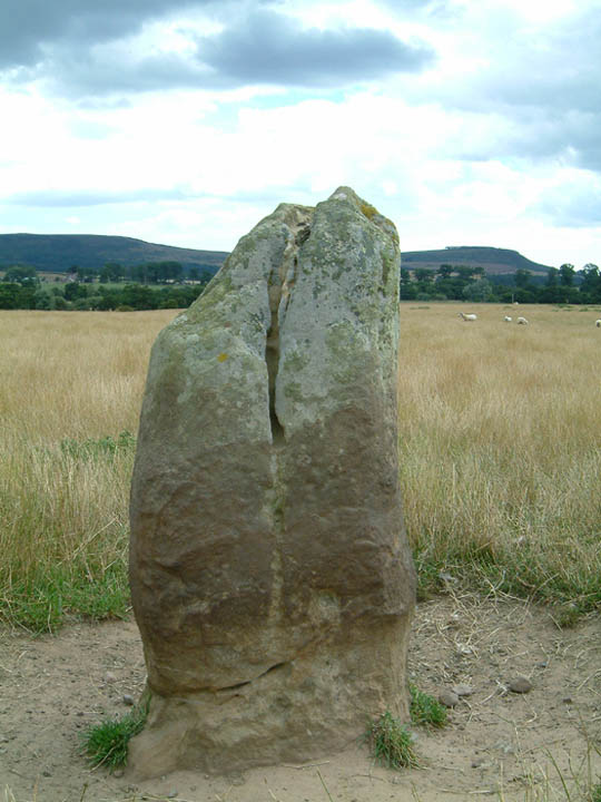
This is located on the east side of the road as you pass through Newtown Mill. A gate into field so access is easy.
For more information see Pastscape Monument No. 5869, which says: "A prehistoric standing stone situated at the foot of the southern slopes of Ewe Hill. There are two possible cup marks linked by a shallow groove on the south side and a single cup mark on the north side ... Stone 1.4m high, and roughly rectangular in cross-section, 0.6m x 0.5m. It appears to have stood upon the site for a considerable length of time as there is considerable weathering with vertical fluting from the top on all sides."
Also see England's Rock Art entry for Standing Stone Newtown Mill, which includes an extract from NADRAP's notes: "A series of cup-like depressions are almost certainly from rifle or other gunshot impacts, evidenced by their countersunk nature, external fracturing of the surface, radially and also their flat bottoms. A pillbox is 320 metres north east. One cup is very unevenly formed in the circular bowl. Reddish colour indicates possible iron constituent. Two smaller cups on north face at a low level are again more likely to natural than artificial." The ERA entry also includes photographs, a sketch of the rock and its motifs, plus photogrammetry.
You may be viewing yesterday's version of this page. To see the most up to date information please register for a free account.



Do not use the above information on other web sites or publications without permission of the contributor.
Click here to see more info for this site
Nearby sites
Key: Red: member's photo, Blue: 3rd party photo, Yellow: other image, Green: no photo - please go there and take one, Grey: site destroyed
Download sites to:
KML (Google Earth)
GPX (GPS waypoints)
CSV (Garmin/Navman)
CSV (Excel)
To unlock full downloads you need to sign up as a Contributory Member. Otherwise downloads are limited to 50 sites.
Turn off the page maps and other distractions
Nearby sites listing. In the following links * = Image available
621m NW 324° Hurl Stone* Standing Stone (Menhir) (NU03952471)
1.4km WNW 282° Lilburn Portable* Rock Art (NU0290024500)
1.8km SW 227° Lilburn South Stead Farm Rock Art (NU0323)
1.8km E 87° Hepburn Bell* Hillfort (NU06122431)
2.4km NW 323° Fowberry Moor Farm (Wooler) Rock Art (NU029261)
2.4km NW 323° Fowberry Enclosure 3* Rock Art (NU0289226113)
2.4km NE 49° Hepburn Moor b & c Rock Art (NU0616925795)
2.5km NE 45° Chillingham/Hepburn Moor d Rock Art (NU0608025990)
2.6km NW 324° Fowberry Enclosure 2* Rock Art (NU0277126301)
2.6km NW 324° Fowberry Enclosure 1* Rock Art (NU0276726307)
2.7km E 87° Hepburn Moor a Rock Art (NU0704724336)
3.0km NW 319° The Way to Wooler 2* Rock Art (NU0235926432)
3.0km NW 324° Fowberry Moor Settlement* Ancient Village or Settlement (NU0258026611)
3.0km NW 315° Lilburn Cist* Cist (NU022263)
3.0km E 92° Hepburn Woods cist* Cist (NU073241)
3.0km NW 324° Fowberry Moor Cairn Excavation Panels Rock Art (NU0256026620)
3.0km NW 319° The Way to Wooler 1* Rock Art (NU0234026452)
3.1km E 81° Hepburn Crags Camp Promontory Fort / Cliff Castle (NU07432470)
3.2km SE 130° Holy Trinity (Old Bewick)* Ancient Cross (NU0679022152)
3.3km WNW 294° Clover Bank (Lilburn Hill Farm) Rock Art (NU01312556)
3.3km WNW 295° Lilburn Rock Art* Rock Art (NU013256)
3.3km SSW 209° Roseden Standing Stone Standing Stone (Menhir) (NU0272221269)
3.4km E 86° Hepburn Moor Unenclosed 2 Rock Art (NU0769724453)
3.4km E 86° Hepburn Moor Unenclosed 1 Rock Art (NU0771324429)
3.5km NE 45° Chillingham enclosures* Misc. Earthwork (NU06812668)
View more nearby sites and additional images





 We would like to know more about this location. Please feel free to add a brief description and any relevant information in your own language.
 Wir möchten mehr über diese Stätte erfahren. Bitte zögern Sie nicht, eine kurze Beschreibung und relevante Informationen in Deutsch hinzuzufügen.
 Nous aimerions en savoir encore un peu sur les lieux. S'il vous plaît n'hesitez pas à ajouter une courte description et tous les renseignements pertinents dans votre propre langue.
 Quisieramos informarnos un poco más de las lugares. No dude en añadir una breve descripción y otros datos relevantes en su propio idioma.