


<< Text Pages >> Fontburn N01 - Rock Art in England in Northumberland
Submitted by Anne T on Friday, 27 April 2018 Page Views: 725
Rock ArtSite Name: Fontburn N01 Alternative Name: ERA-1360Country: England
NOTE: This site is 0.356 km away from the location you searched for.
County: Northumberland Type: Rock Art
Nearest Town: Rothbury Nearest Village: Coldrife
Map Ref: NZ0489793466
Latitude: 55.235377N Longitude: 1.924541W
Condition:
| 5 | Perfect |
| 4 | Almost Perfect |
| 3 | Reasonable but with some damage |
| 2 | Ruined but still recognisable as an ancient site |
| 1 | Pretty much destroyed, possibly visible as crop marks |
| 0 | No data. |
| -1 | Completely destroyed |
| 5 | Superb |
| 4 | Good |
| 3 | Ordinary |
| 2 | Not Good |
| 1 | Awful |
| 0 | No data. |
| 5 | Can be driven to, probably with disabled access |
| 4 | Short walk on a footpath |
| 3 | Requiring a bit more of a walk |
| 2 | A long walk |
| 1 | In the middle of nowhere, a nightmare to find |
| 0 | No data. |
| 5 | co-ordinates taken by GPS or official recorded co-ordinates |
| 4 | co-ordinates scaled from a detailed map |
| 3 | co-ordinates scaled from a bad map |
| 2 | co-ordinates of the nearest village |
| 1 | co-ordinates of the nearest town |
| 0 | no data |
Be the first person to rate this site - see the 'Contribute!' box in the right hand menu.
Internal Links:
External Links:
Rock Art in Northumberland
This rock art panel is recorded by NADRAP as being on a slight slope of a natural, small watercourse with other loosely collected stones, close to the valley side. Motifs include three distinct cups in a line. Adjacent is another large cup and photogrammetry shows cup-like depressions elsewhere on the rock.
For more information see England's Rock Art entry for ERA-1360 Fontburn N01, which includes NADRAP's notes, photographs, a panoramic photograph, a sketch of the rock and its motifs, plus photogrammetry, a VRML model and a QTVR model.
This rock art panel is located on Open Access land.
Note: Have you seen this rock art panel? Do you have any photographs or information to add?
You may be viewing yesterday's version of this page. To see the most up to date information please register for a free account.
Do not use the above information on other web sites or publications without permission of the contributor.
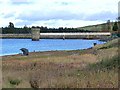
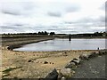
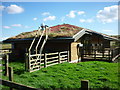
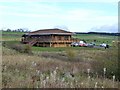
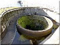
Nearby Images from Geograph Britain and Ireland:
©2010(licence)
©2022(licence)
©2014(licence)
©2010(licence)
©2010(licence)
The above images may not be of the site on this page, they are loaded from Geograph.
Please Submit an Image of this site or go out and take one for us!
Click here to see more info for this site
Nearby sites
Key: Red: member's photo, Blue: 3rd party photo, Yellow: other image, Green: no photo - please go there and take one, Grey: site destroyed
Download sites to:
KML (Google Earth)
GPX (GPS waypoints)
CSV (Garmin/Navman)
CSV (Excel)
To unlock full downloads you need to sign up as a Contributory Member. Otherwise downloads are limited to 50 sites.
Turn off the page maps and other distractions
Nearby sites listing. In the following links * = Image available
976m WSW 253° Fontburn N02* Rock Art (NZ0395993186)
1.2km SE 130° Ewesley Enclosure* Misc. Earthwork (NZ0583092681)
1.6km WNW 287° Fontburn e Rock Art (NZ0336593941)
1.6km W 267° Fontburn B* Rock Art (NZ0328093376)
1.6km W 276° Fontburn c(ii) Rock Art (NZ0325693650)
1.6km W 276° Fontburn Four-Poster* Stone Circle (NZ0325493646)
1.7km W 268° Fontburn N03 Rock Art (NZ0317793419)
1.8km W 272° Fontburn D* Rock Art (NZ0310993518)
2.2km W 276° Hollinghill Enclosure* Misc. Earthwork (NZ02709368)
2.6km W 274° West Shank Enclosure* Misc. Earthwork (NZ02269364)
2.7km W 277° Fontburn a(i)* Rock Art (NZ0223593788)
2.7km W 277° Fontburn a(ii)* Rock Art (NZ0222793792)
2.7km W 277° Fontburn a(iii)* Rock Art (NZ0215893775)
2.8km W 276° Fontburn (iv) Rock Art (NZ0213493772)
2.8km W 279° Fallowlees Burn Stone Rock Art (NZ0208093920)
3.0km W 274° Fallowlees Settlement* Ancient Village or Settlement (NZ01919367)
3.0km W 273° Fontburn a(v) Rock Art (NZ0189093629)
3.0km W 273° Fontburn a(vi)* Rock Art (NZ0185393643)
3.0km W 273° Fontburn a(viii)* Rock Art (NZ0185393645)
3.0km W 273° Fontburn a(vii)* Rock Art (NZ0185393645)
3.3km NNE 32° Blueburn Farm (Rothbury) Rock Art (NZ0666096270)
5.0km S 188° Rothley Crags* Hillfort (NZ04228850)
5.1km N 356° Spy Law Beacon Cairn* Cairn (NZ04529859)
5.1km ESE 120° Netherwitton A* Round Cairn (NZ0938090925)
5.2km N 358° Thompson's Rock* Holed Stone (NZ0475098632)
View more nearby sites and additional images


 We would like to know more about this location. Please feel free to add a brief description and any relevant information in your own language.
 Wir möchten mehr über diese Stätte erfahren. Bitte zögern Sie nicht, eine kurze Beschreibung und relevante Informationen in Deutsch hinzuzufügen.
 Nous aimerions en savoir encore un peu sur les lieux. S'il vous plaît n'hesitez pas à ajouter une courte description et tous les renseignements pertinents dans votre propre langue.
 Quisieramos informarnos un poco más de las lugares. No dude en añadir una breve descripción y otros datos relevantes en su propio idioma.