


<< Image Pages >> Kyloe Cist - Cist in England in Northumberland
Submitted by durhamnature on Monday, 01 October 2012 Page Views: 1844
Neolithic and Bronze AgeSite Name: Kyloe CistCountry: England
NOTE: This site is 0.918 km away from the location you searched for.
County: Northumberland Type: Cist
Nearest Town: Berwick Nearest Village: Kyloe
Map Ref: NU042404
Latitude: 55.657109N Longitude: 1.934812W
Condition:
| 5 | Perfect |
| 4 | Almost Perfect |
| 3 | Reasonable but with some damage |
| 2 | Ruined but still recognisable as an ancient site |
| 1 | Pretty much destroyed, possibly visible as crop marks |
| 0 | No data. |
| -1 | Completely destroyed |
| 5 | Superb |
| 4 | Good |
| 3 | Ordinary |
| 2 | Not Good |
| 1 | Awful |
| 0 | No data. |
| 5 | Can be driven to, probably with disabled access |
| 4 | Short walk on a footpath |
| 3 | Requiring a bit more of a walk |
| 2 | A long walk |
| 1 | In the middle of nowhere, a nightmare to find |
| 0 | No data. |
| 5 | co-ordinates taken by GPS or official recorded co-ordinates |
| 4 | co-ordinates scaled from a detailed map |
| 3 | co-ordinates scaled from a bad map |
| 2 | co-ordinates of the nearest village |
| 1 | co-ordinates of the nearest town |
| 0 | no data |
Be the first person to rate this site - see the 'Contribute!' box in the right hand menu.
Internal Links:
External Links:
")
Site number N 4034
Cist uncovered in Kyloe whinstone quarry in the 1920s. A pot and 60 elements of a jet necklace were found.
You may be viewing yesterday's version of this page. To see the most up to date information please register for a free account.
Do not use the above information on other web sites or publications without permission of the contributor.
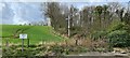
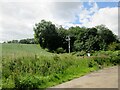
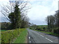
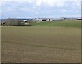
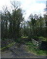
Nearby Images from Geograph Britain and Ireland:
©2021(licence)
©2020(licence)
©2015(licence)
©2016(licence)
©2015(licence)
The above images may not be of the site on this page, they are loaded from Geograph.
Please Submit an Image of this site or go out and take one for us!
Click here to see more info for this site
Nearby sites
Key: Red: member's photo, Blue: 3rd party photo, Yellow: other image, Green: no photo - please go there and take one, Grey: site destroyed
Download sites to:
KML (Google Earth)
GPX (GPS waypoints)
CSV (Garmin/Navman)
CSV (Excel)
To unlock full downloads you need to sign up as a Contributory Member. Otherwise downloads are limited to 50 sites.
Turn off the page maps and other distractions
Nearby sites listing. In the following links * = Image available
2.8km WSW 257° Hetton North Farm Rock Art (NU0150839760)
2.8km WSW 255° Lowick Lowsteads Rock Art (NU0150039700)
5.7km SSW 211° Hare Law Crags 6* Rock Art (NU0126735534)
5.7km SSW 211° Hare Law Crags 5* Rock Art (NU0127835526)
5.7km SSW 211° Hare Law Crags 4* Rock Art (NU0128435521)
5.7km SSW 211° Hare Law Crags 3* Rock Art (NU0128835518)
5.7km SSW 211° Hare Law Crags 2.1* Rock Art (NU0129235514)
5.7km SSW 211° Hare Law Crags 2.2* Rock Art (NU0129135513)
5.7km SSW 212° Hare Law Crags 7* Rock Art (NU0121235532)
5.7km SSW 210° Hare Law Crags 1.3* Rock Art (NU0137135431)
5.7km SSW 210° Hare Law Crags 1.4* Rock Art (NU0136935427)
5.7km SSW 210° Hare Law Crags 1.2 Rock Art (NU0136735427)
5.7km SSW 210° Hare Law Crags 1.1 Rock Art (NU0136435422)
6.7km N 350° Goswick Sands Rock Art* Rock Art (NU0347)
6.9km WSW 238° Roughting Linn Rock Art* Rock Art (NT9838936732)
6.9km W 274° Watch Law Farm Rock Art (NT9733040850)
6.9km WSW 238° Roughting Linn Hillfort* Promontory Fort / Cliff Castle (NT9829836781)
7.3km WSW 242° Goatscrag Rock Shelter* Cave or Rock Shelter (NT9771237019)
7.3km WSW 243° Goatscrag a Rock Art (NT9766437040)
7.6km S 190° Fox Covert Camp* Hillfort (NU02943294)
7.6km SSW 201° Doddington Sheepfold A & D* Rock Art (NU0144233352)
7.6km WNW 284° Lickar Moor Rock Art (NT9680042300)
7.6km WSW 245° Broomridge 1* Rock Art (NT9729837110)
7.7km S 177° Hazelrigg 4 Rock Art (NU0460032680)
7.7km S 177° Hazelrigg 1 Rock Art (NU0460332680)
View more nearby sites and additional images


 We would like to know more about this location. Please feel free to add a brief description and any relevant information in your own language.
 Wir möchten mehr über diese Stätte erfahren. Bitte zögern Sie nicht, eine kurze Beschreibung und relevante Informationen in Deutsch hinzuzufügen.
 Nous aimerions en savoir encore un peu sur les lieux. S'il vous plaît n'hesitez pas à ajouter une courte description et tous les renseignements pertinents dans votre propre langue.
 Quisieramos informarnos un poco más de las lugares. No dude en añadir una breve descripción y otros datos relevantes en su propio idioma.