


<< Other Photo Pages >> Goff Well - Holy Well or Sacred Spring in England in Yorkshire (West)
Submitted by Rombald on Friday, 10 February 2006 Page Views: 5539
Springs and Holy WellsSite Name: Goff WellCountry: England
NOTE: This site is 1.005 km away from the location you searched for.
County: Yorkshire (West) Type: Holy Well or Sacred Spring
Nearest Town: Keighley Nearest Village: Hainworth
Map Ref: SE0615038822
Latitude: 53.845605N Longitude: 1.908009W
Condition:
| 5 | Perfect |
| 4 | Almost Perfect |
| 3 | Reasonable but with some damage |
| 2 | Ruined but still recognisable as an ancient site |
| 1 | Pretty much destroyed, possibly visible as crop marks |
| 0 | No data. |
| -1 | Completely destroyed |
| 5 | Superb |
| 4 | Good |
| 3 | Ordinary |
| 2 | Not Good |
| 1 | Awful |
| 0 | No data. |
| 5 | Can be driven to, probably with disabled access |
| 4 | Short walk on a footpath |
| 3 | Requiring a bit more of a walk |
| 2 | A long walk |
| 1 | In the middle of nowhere, a nightmare to find |
| 0 | No data. |
| 5 | co-ordinates taken by GPS or official recorded co-ordinates |
| 4 | co-ordinates scaled from a detailed map |
| 3 | co-ordinates scaled from a bad map |
| 2 | co-ordinates of the nearest village |
| 1 | co-ordinates of the nearest town |
| 0 | no data |
Be the first person to rate this site - see the 'Contribute!' box in the right hand menu.
Internal Links:
External Links:
Holy Well or Sacred Spring in Yorkshire (West)
In 1858, William Keighley claimed Goff Well as one of Keighley’s three former holy wells, together with Jennet’s Well and True Well, and maintained that it had been sanctified by a mediaeval hermit who supposedly lived at Hermit Hole (a row of houses above Ingrow; “Keighley, Past and Present”, Arthur Hall, Virtue and Co., London). He also argued that “Goff” derives from the Danish word for red, so the hermit must have had red hair! (actually, the surname is from the Welsh for red). Clearly, Keighley’s authority is insufficient to support Goff Well having been a holy well, but the well is in a small field that has no obvious use other than to allow public access at the time of enclosure in the late 18th or early 19th century [the parliamentary enclosure of Hainworth and Lees was in 1862 (Barbara English, “Yorkshire Enclosure Awards”, University of Hull Press, Hull, 1985, p. 62), but this part of the manor was already enclosed, because the fields are shown on the 1852 OS map. However, the fields are fairly regular, and the walls look modern, so I cannot imagine the enclosure having been before the late 18th century], suggesting that it was seen as somehow special.
The Northern Antiquarian (TNA) also features a page for this healing well - see their entry for Goff Well, Keighley, West Yorkshire. TNA give directions for finding this well, together with a photograph, a brief archaeology & history and local folklore.
Note: Have you visited this site? Do you have any photographs or information to add?
You may be viewing yesterday's version of this page. To see the most up to date information please register for a free account.
Do not use the above information on other web sites or publications without permission of the contributor.
Andy B has found this location on Google Street View:
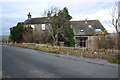
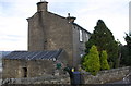
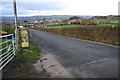
Nearby Images from Geograph Britain and Ireland:
©2020(licence)
©2020(licence)
©2020(licence)
©2020(licence)
©2018(licence)
The above images may not be of the site on this page, they are loaded from Geograph.
Please Submit an Image of this site or go out and take one for us!
Click here to see more info for this site
Nearby sites
Key: Red: member's photo, Blue: 3rd party photo, Yellow: other image, Green: no photo - please go there and take one, Grey: site destroyed
Download sites to:
KML (Google Earth)
GPX (GPS waypoints)
CSV (Garmin/Navman)
CSV (Excel)
To unlock full downloads you need to sign up as a Contributory Member. Otherwise downloads are limited to 50 sites.
Turn off the page maps and other distractions
Nearby sites listing. In the following links * = Image available
941m SE 136° Catstones Ring* Misc. Earthwork (SE0680638145)
1.2km SE 134° Harden Moor Stone Row (Bingley) Stone Row / Alignment (SE0738)
1.4km E 96° Harden Moor Ring Cairn* Ring Cairn (SE0749638675)
1.4km E 95° Harden Moor Cairnfield* Cairn (SE0757838699)
1.9km NW 315° Exley Head Cross* Ancient Cross (SE0481840146)
2.2km N 357° Market Cross (Keighley) Ancient Cross (SE0604241002)
2.5km N 8° Railway Station Cist (Keighley) Cist (SE06474127)
2.7km SSW 202° Castle Stead Ring* Misc. Earthwork (SE05143627)
3.3km NNW 336° Whin Knoll Well (Keighley) Holy Well or Sacred Spring (SE04794179)
3.3km ENE 70° Druid's Altar (Bingley) Natural Stone / Erratic / Other Natural Feature (SE09243994)
3.3km N 352° Cliffe Castle Museum* Rock Art (SE057421)
3.3km NNW 333° Jennet's Well/Spring* Holy Well or Sacred Spring (SE04614180)
3.4km ENE 72° Druid's Well (Bingley)* Holy Well or Sacred Spring (SE094399)
3.5km S 171° Castle Stead Misc. Earthwork (SE067354)
3.7km NW 307° Laycock Cross (Keighley)* Early Christian Sculptured Stone (SE032410)
3.7km WNW 292° True Well (Oakworth) Holy Well or Sacred Spring (SE02724017)
3.7km NNE 28° East Riddlesden Cross (Keighley) Ancient Cross (SE07904208)
3.8km ESE 104° Cottingley Woods* Rock Art (SE09803789)
4.0km E 86° Elm Crag Well (Bingley) Holy Well or Sacred Spring (SE102391)
4.1km SSW 205° Armshaw Lowe Artificial Mound (SE04423513)
4.1km ENE 60° Lund Well (Bingley) Holy Well or Sacred Spring (SE09734091)
4.2km N 4° Elam Grange 01* Rock Art (SE0641543023)
4.3km NE 42° Carr Lane* Rock Art (SE0900042000)
4.4km E 81° Eadberht's Cross Ancient Cross (SE105395)
4.4km NE 35° How Beck 01* Rock Art (SE0865542435)
View more nearby sites and additional images


 We would like to know more about this location. Please feel free to add a brief description and any relevant information in your own language.
 Wir möchten mehr über diese Stätte erfahren. Bitte zögern Sie nicht, eine kurze Beschreibung und relevante Informationen in Deutsch hinzuzufügen.
 Nous aimerions en savoir encore un peu sur les lieux. S'il vous plaît n'hesitez pas à ajouter une courte description et tous les renseignements pertinents dans votre propre langue.
 Quisieramos informarnos un poco más de las lugares. No dude en añadir una breve descripción y otros datos relevantes en su propio idioma.