


<< Text Pages >> La Pierre Couvretiere (St-Suliac) - Burial Chamber or Dolmen in France in Bretagne:Ille-et-Vilaine (35)
Submitted by thecaptain on Monday, 27 July 2009 Page Views: 3432
Neolithic and Bronze AgeSite Name: La Pierre Couvretiere (St-Suliac)Country: France
NOTE: This site is 14.553 km away from the location you searched for.
Département: Bretagne:Ille-et-Vilaine (35) Type: Burial Chamber or Dolmen
Nearest Town: St Malo Nearest Village: Saint-Suliac
Latitude: 48.572000N Longitude: 1.954W
Condition:
| 5 | Perfect |
| 4 | Almost Perfect |
| 3 | Reasonable but with some damage |
| 2 | Ruined but still recognisable as an ancient site |
| 1 | Pretty much destroyed, possibly visible as crop marks |
| 0 | No data. |
| -1 | Completely destroyed |
| 5 | Superb |
| 4 | Good |
| 3 | Ordinary |
| 2 | Not Good |
| 1 | Awful |
| 0 | No data. |
| 5 | Can be driven to, probably with disabled access |
| 4 | Short walk on a footpath |
| 3 | Requiring a bit more of a walk |
| 2 | A long walk |
| 1 | In the middle of nowhere, a nightmare to find |
| 0 | No data. |
| 5 | co-ordinates taken by GPS or official recorded co-ordinates |
| 4 | co-ordinates scaled from a detailed map |
| 3 | co-ordinates scaled from a bad map |
| 2 | co-ordinates of the nearest village |
| 1 | co-ordinates of the nearest town |
| 0 | no data |
Internal Links:
External Links:
Close to Chablé, La Pierre Couvretiere dolmen has now been destroyed. A slab of 1.5 metre length once rested against two slabs 0.5 metres in height, and about 1.5 metres away, two other slabs emerged from the ground.
You may be viewing yesterday's version of this page. To see the most up to date information please register for a free account.
Do not use the above information on other web sites or publications without permission of the contributor.
Nearby Images from Flickr
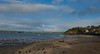
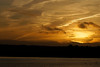
The above images may not be of the site on this page, but were taken nearby. They are loaded from Flickr so please click on them for image credits.
Click here to see more info for this site
Nearby sites
Click here to view sites on an interactive map of the areaKey: Red: member's photo, Blue: 3rd party photo, Yellow: other image, Green: no photo - please go there and take one, Grey: site destroyed
Download sites to:
KML (Google Earth)
GPX (GPS waypoints)
CSV (Garmin/Navman)
CSV (Excel)
To unlock full downloads you need to sign up as a Contributory Member. Otherwise downloads are limited to 50 sites.
Turn off the page maps and other distractions
Nearby sites listing. In the following links * = Image available
724m S 180° Dent de Gargantua* Standing Stone (Menhir)
1.9km SSW 210° Le Lit de Gargantua Burial Chamber or Dolmen
2.0km W 271° Saint-Suliac Abri Cave or Rock Shelter
2.1km SSW 207° Enceinte dite l'Huitière* Ancient Village or Settlement
2.4km SW 222° Gravier de Gargantua (St-Suliac) Standing Stone (Menhir)
7.7km SW 229° Beleven allée couverte* Passage Grave
8.1km S 170° Dolmen du Bois de la Tougeais Burial Chamber or Dolmen
8.1km S 170° Allée Couverte du Bois de la Tougeais Passage Grave
8.1km S 170° Menhir du Bois de la Tougeais Standing Stone (Menhir)
8.5km WSW 241° La Roche-Bise Standing Stone (Menhir)
8.7km SSE 161° Four-És-Feins* Passage Grave
9.0km WSW 238° Champ des Roches* Multiple Stone Rows / Avenue
9.6km WSW 240° Pierre de Minoz* Standing Stone (Menhir)
9.8km SSW 209° Thiemblais menhir* Standing Stone (Menhir)
10.2km S 185° La Ganterie* Passage Grave
11.2km SSE 150° La Maison des Feins* Passage Grave
12.5km SE 124° Menhir dit la Pierre du Domaine* Standing Stone (Menhir)
13.4km WNW 299° Allée Couverte de Roche-Plate* Passage Grave
13.7km E 90° Mont-Dol* Ancient Temple
14.2km W 278° la Pierre Levée (La Mattrie)* Standing Stone (Menhir)
14.6km WNW 296° Les Roches-Hues* Stone Row / Alignment
14.9km WNW 298° menhir Garde Guerin* Standing Stone (Menhir)
14.9km WNW 299° dolmen de la Garde Guerin* Burial Chamber or Dolmen
16.1km W 265° Menhir dit la Pierre du Diable (Ploubalay) Standing Stone (Menhir)
16.3km ESE 104° Champ Dolent Menhir* Standing Stone (Menhir)
View more nearby sites and additional images


 We would like to know more about this location. Please feel free to add a brief description and any relevant information in your own language.
 Wir möchten mehr über diese Stätte erfahren. Bitte zögern Sie nicht, eine kurze Beschreibung und relevante Informationen in Deutsch hinzuzufügen.
 Nous aimerions en savoir encore un peu sur les lieux. S'il vous plaît n'hesitez pas à ajouter une courte description et tous les renseignements pertinents dans votre propre langue.
 Quisieramos informarnos un poco más de las lugares. No dude en añadir una breve descripción y otros datos relevantes en su propio idioma.