


<< Our Photo Pages >> Holy Trinity (Wensley) - Ancient Cross in England in Yorkshire (North)
Submitted by TimPrevett on Wednesday, 23 May 2007 Page Views: 4753
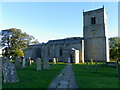
Early Medieval (Dark Age)Site Name: Holy Trinity (Wensley)Country: England
NOTE: This site is 2.904 km away from the location you searched for.
County: Yorkshire (North) Type: Ancient Cross
Nearest Village: Wensley
Map Ref: SE09228954
Latitude: 54.301388N Longitude: 1.859824W
Condition:
| 5 | Perfect |
| 4 | Almost Perfect |
| 3 | Reasonable but with some damage |
| 2 | Ruined but still recognisable as an ancient site |
| 1 | Pretty much destroyed, possibly visible as crop marks |
| 0 | No data. |
| -1 | Completely destroyed |
| 5 | Superb |
| 4 | Good |
| 3 | Ordinary |
| 2 | Not Good |
| 1 | Awful |
| 0 | No data. |
| 5 | Can be driven to, probably with disabled access |
| 4 | Short walk on a footpath |
| 3 | Requiring a bit more of a walk |
| 2 | A long walk |
| 1 | In the middle of nowhere, a nightmare to find |
| 0 | No data. |
| 5 | co-ordinates taken by GPS or official recorded co-ordinates |
| 4 | co-ordinates scaled from a detailed map |
| 3 | co-ordinates scaled from a bad map |
| 2 | co-ordinates of the nearest village |
| 1 | co-ordinates of the nearest town |
| 0 | no data |
Be the first person to rate this site - see the 'Contribute!' box in the right hand menu.
Internal Links:
External Links:
 (PID:80971)")
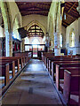
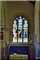
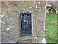
A wonderful amount of ancient Christian stones to view here. NMR records "Stored in the church are two early 8th century slabs inscribed 'Donfrid' and 'Eadberehct'; several mid-late 8th century slab fragments; an early 10th century shaft fragment and 11th century cross shaft. A cross shaft and wheel-cross head are built into the South porch."
You may be viewing yesterday's version of this page. To see the most up to date information please register for a free account.
 (PID:80972)")
Do not use the above information on other web sites or publications without permission of the contributor.
Nearby Images from Geograph Britain and Ireland:
©2010(licence)
©2020(licence)
©2021(licence)
©2021(licence)
©2013(licence)
The above images may not be of the site on this page, they are loaded from Geograph.
Please Submit an Image of this site or go out and take one for us!
Click here to see more info for this site
Nearby sites
Key: Red: member's photo, Blue: 3rd party photo, Yellow: other image, Green: no photo - please go there and take one, Grey: site destroyed
Download sites to:
KML (Google Earth)
GPX (GPS waypoints)
CSV (Garmin/Navman)
CSV (Excel)
To unlock full downloads you need to sign up as a Contributory Member. Otherwise downloads are limited to 50 sites.
Turn off the page maps and other distractions
Nearby sites listing. In the following links * = Image available
3.2km E 87° Fairy Well (Harmby)* Holy Well or Sacred Spring (SE12448969)
3.6km ESE 117° St Alkelda's Holy Well* Holy Well or Sacred Spring (SE124879)
3.8km ESE 116° St Mary and St Alkelda* Ancient Cross (SE1262887878)
7.0km WSW 240° Burton Moor* Ancient Village or Settlement (SE03118604)
8.0km ESE 106° Richard Wood South (Thornton Steward) Rock Art (SE1694087301)
8.3km SSE 149° Agra Moor Standing Stone* Standing Stone (Menhir) (SE1349982440)
8.5km W 272° St Matthew's Well (Carperby)* Holy Well or Sacred Spring (SE0065689756)
8.6km W 271° Carperby Cross* Ancient Cross (SE0063189729)
8.6km ENE 61° St Oswald (East Hauxwell)* Ancient Cross (SE168937)
9.3km SSE 147° West Agra* Rock Art (SE14248175)
9.3km SSE 148° West Agra Carving 2b Rock Art (SE1412681669)
9.3km SSE 149° West Agra Carving 1 Rock Art (SE1406981627)
9.3km SSE 148° West Agra 3a and 3b* Rock Art (SE1423681675)
9.7km SE 144° Gollinglith Foot (West Agra) Standing Stone (Menhir) (SE149817)
9.9km NW 325° Harkerside Moor circle* Stone Circle (SE035976)
10.2km W 273° Carperby Stone Circle* Stone Circle (SD99009013)
11.0km NW 322° Maiden Castle Barrow (Yorkshire North) Round Barrow(s) (SE02349814)
11.1km NW 321° Maiden Castle (N Yorks)* Ancient Village or Settlement (SE02189808)
11.2km N 352° Forty Acres 03 (Stelling) Rock Art (NZ07580058)
11.2km WSW 259° Castle Dykes* Henge (SD9823187289)
11.3km NNW 347° Whitton Burn(Rock Art) Rock Art (NZ066005)
11.5km SE 138° Healey Stone Circles (Masham) Stone Circle (SE170810)
12.7km W 261° Dove Stones (Thornton Rust Moor) Rock Art (SD9663487493)
13.4km SE 128° Fearby Cross (Masham) Ancient Cross (SE1984081273)
13.6km SE 143° Swinton Druid's Temple* Modern Stone Circle etc (SE1746478713)
View more nearby sites and additional images


 We would like to know more about this location. Please feel free to add a brief description and any relevant information in your own language.
 Wir möchten mehr über diese Stätte erfahren. Bitte zögern Sie nicht, eine kurze Beschreibung und relevante Informationen in Deutsch hinzuzufügen.
 Nous aimerions en savoir encore un peu sur les lieux. S'il vous plaît n'hesitez pas à ajouter une courte description et tous les renseignements pertinents dans votre propre langue.
 Quisieramos informarnos un poco más de las lugares. No dude en añadir una breve descripción y otros datos relevantes en su propio idioma.