

<< Our Photo Pages >> Frankinshaw - Cairn in England in Yorkshire (North)
Submitted by rich32 on Sunday, 15 January 2006 Page Views: 4915
Neolithic and Bronze AgeSite Name: Frankinshaw Alternative Name: Frankinshaw CairnCountry: England
NOTE: This site is 0.953 km away from the location you searched for.
County: Yorkshire (North) Type: Cairn
Nearest Village: Newsham
Map Ref: NZ06170672
Latitude: 54.455832N Longitude: 1.906342W
Condition:
| 5 | Perfect |
| 4 | Almost Perfect |
| 3 | Reasonable but with some damage |
| 2 | Ruined but still recognisable as an ancient site |
| 1 | Pretty much destroyed, possibly visible as crop marks |
| 0 | No data. |
| -1 | Completely destroyed |
| 5 | Superb |
| 4 | Good |
| 3 | Ordinary |
| 2 | Not Good |
| 1 | Awful |
| 0 | No data. |
| 5 | Can be driven to, probably with disabled access |
| 4 | Short walk on a footpath |
| 3 | Requiring a bit more of a walk |
| 2 | A long walk |
| 1 | In the middle of nowhere, a nightmare to find |
| 0 | No data. |
| 5 | co-ordinates taken by GPS or official recorded co-ordinates |
| 4 | co-ordinates scaled from a detailed map |
| 3 | co-ordinates scaled from a bad map |
| 2 | co-ordinates of the nearest village |
| 1 | co-ordinates of the nearest town |
| 0 | no data |
Internal Links:
External Links:
")
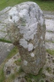
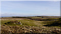
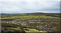
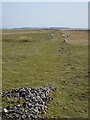
This cairn sits about 150meters north of Frankinshaw How & just off the track way which leads towards the Grouse Butts. Its not marked on the OS map, so you’ll have to keep an eye for the distinctive mound.
The cairn has diameter of about 8-9m and has 3 known cup marked stones which protrude through the turf covering.
You may be viewing yesterday's version of this page. To see the most up to date information please register for a free account.
Do not use the above information on other web sites or publications without permission of the contributor.
Nearby Images from Geograph Britain and Ireland:
©2011(licence)
©2006(licence)
©2010(licence)
©2020(licence)
©2010(licence)
The above images may not be of the site on this page, they are loaded from Geograph.
Please Submit an Image of this site or go out and take one for us!
Click here to see more info for this site
Nearby sites
Key: Red: member's photo, Blue: 3rd party photo, Yellow: other image, Green: no photo - please go there and take one, Grey: site destroyed
Download sites to:
KML (Google Earth)
GPX (GPS waypoints)
CSV (Garmin/Navman)
CSV (Excel)
To unlock full downloads you need to sign up as a Contributory Member. Otherwise downloads are limited to 50 sites.
Turn off the page maps and other distractions
Nearby sites listing. In the following links * = Image available
809m NNW 327° How Tallon Cairn* Cairn (NZ05730740)
812m NNW 328° Barningham Moor 61 Rock Art (NZ0573907410)
962m NNW 342° Barningham Moor 62* Rock Art (NZ0587807638)
976m NNW 335° Barningham Moor 137 Rock Art (NZ0575907606)
1.0km NNW 335° Barningham Moor 90* Rock Art (NZ0574707633)
1.0km NNW 335° Barningham Moor 63 Rock Art (NZ0574207650)
1.0km NNW 335° Barningham Moor 91 Rock Art (NZ0573507654)
1.1km NNW 334° Barningham Moor 64 Rock Art (NZ0570807667)
1.1km NNW 333° Barningham Moor 65 Rock Art (NZ0566907682)
1.1km NNW 330° Barningham Moor 69 Rock Art (NZ0561307693)
1.1km NNW 335° Barningham Moor 66 Rock Art (NZ0569507750)
1.1km NNW 334° Barningham Moor 67 Rock Art (NZ0567007747)
1.1km NNW 329° Barningham Moor 92 Rock Art (NZ0558407702)
1.1km NNW 329° Barningham Moor 123 Rock Art (NZ0557807702)
1.1km NNW 328° Barningham Moor 71 Rock Art (NZ0555807691)
1.1km NNW 328° Barningham Moor 70 Rock Art (NZ0556507697)
1.2km NNW 326° Barningham Moor 74 Rock Art (NZ0552607687)
1.2km NNW 327° Barningham Moor 29 Rock Art (NZ0552707688)
1.2km NNW 333° Barningham Moor 68 Rock Art (NZ0563207750)
1.2km NW 326° Barningham Moor 95 Rock Art (NZ0551607685)
1.2km NNW 327° Barningham Moor 126 Rock Art (NZ0552707696)
1.2km NNW 328° Barningham Moor 94 Rock Art (NZ0554807710)
1.2km NNW 328° Barningham Moor 93 Rock Art (NZ0555007713)
1.2km NW 325° Barningham Moor 118 Rock Art (NZ0549207690)
1.2km NNW 328° Barningham Moor 72 Rock Art (NZ0553107720)
View more nearby sites and additional images


 We would like to know more about this location. Please feel free to add a brief description and any relevant information in your own language.
 Wir möchten mehr über diese Stätte erfahren. Bitte zögern Sie nicht, eine kurze Beschreibung und relevante Informationen in Deutsch hinzuzufügen.
 Nous aimerions en savoir encore un peu sur les lieux. S'il vous plaît n'hesitez pas à ajouter une courte description et tous les renseignements pertinents dans votre propre langue.
 Quisieramos informarnos un poco más de las lugares. No dude en añadir una breve descripción y otros datos relevantes en su propio idioma.