


<< Text Pages >> Mount Zion (Illingworth) - Cist in England in Yorkshire (West)
Submitted by Anne T on Tuesday, 05 December 2017 Page Views: 1260
Neolithic and Bronze AgeSite Name: Mount Zion (Illingworth)Country: England
NOTE: This site is 1.371 km away from the location you searched for.
County: Yorkshire (West) Type: Cist
Nearest Town: Halifax Nearest Village: Illingworth
Map Ref: SE068297
Latitude: 53.763609N Longitude: 1.898328W
Condition:
| 5 | Perfect |
| 4 | Almost Perfect |
| 3 | Reasonable but with some damage |
| 2 | Ruined but still recognisable as an ancient site |
| 1 | Pretty much destroyed, possibly visible as crop marks |
| 0 | No data. |
| -1 | Completely destroyed |
| 5 | Superb |
| 4 | Good |
| 3 | Ordinary |
| 2 | Not Good |
| 1 | Awful |
| 0 | No data. |
| 5 | Can be driven to, probably with disabled access |
| 4 | Short walk on a footpath |
| 3 | Requiring a bit more of a walk |
| 2 | A long walk |
| 1 | In the middle of nowhere, a nightmare to find |
| 0 | No data. |
| 5 | co-ordinates taken by GPS or official recorded co-ordinates |
| 4 | co-ordinates scaled from a detailed map |
| 3 | co-ordinates scaled from a bad map |
| 2 | co-ordinates of the nearest village |
| 1 | co-ordinates of the nearest town |
| 0 | no data |
Internal Links:
External Links:
Cist in Yorkshire (West)
The Northern Antiquarian (TNA) features a page for this now destroyed cist - see their entry for Mount Zion, Illingworth, Halifax, West Yorkshire. TNA describe how the cists was found accidentally by a grave digger in February 1877; they include an early photograph of the prehistoric urn and say: "The remains of the urn were eventually presented to the care of the Bankfield Museum by the Halifax antiquary, F.A. Leyland. We have no notes of any further discoveries in or around the graveyard in question."
The cist and finds are also recorded as Pastscape Monument No. 47650, which dates this to the Bronze Age and adds: "Collared urn discovered in February 1877 in the grounds of Mount Zion Chapel, 2 feet below the surface. A slab of stone was found and beneath it a square cist formed of 4 upright stones containing the urn, inverted and surrounded by gravel. The vessel is 19 inches high, 13 inches diameter at mouth and 4 inches at base; its `neck is ornamented with dots', and it contained the broken, cremated bones of an adult female. Bankfield Museum, Halifax."
Note: Does anyone have any historical information or images to add? Has anyone seen the urn that was found?
You may be viewing yesterday's version of this page. To see the most up to date information please register for a free account.
Do not use the above information on other web sites or publications without permission of the contributor.
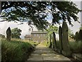
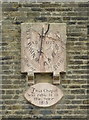
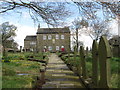
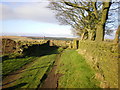
Nearby Images from Geograph Britain and Ireland:
©2015(licence)
©2010(licence)
©2014(licence)
©2008(licence)
©2008(licence)
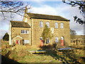
The above images may not be of the site on this page, they are loaded from Geograph.
Please Submit an Image of this site or go out and take one for us!
Click here to see more info for this site
Nearby sites
Key: Red: member's photo, Blue: 3rd party photo, Yellow: other image, Green: no photo - please go there and take one, Grey: site destroyed
Download sites to:
KML (Google Earth)
GPX (GPS waypoints)
CSV (Garmin/Navman)
CSV (Excel)
To unlock full downloads you need to sign up as a Contributory Member. Otherwise downloads are limited to 50 sites.
Turn off the page maps and other distractions
Nearby sites listing. In the following links * = Image available
1.3km W 281° The Carrs (Ovenden) Ancient Village or Settlement (SE0554729937)
2.0km NNW 334° The Giants Tooth Modern Stone Circle etc (SE059315)
2.1km NNW 331° The Boggarts Grave Holy Well or Sacred Spring (SE058315)
2.4km WSW 245° Robin Hood's Penny Stone (Wainstalls) Standing Stone (Menhir) (SE04632870)
2.4km NNW 328° The Nab Round Cairn (SE0549831755)
3.0km WSW 244° The White Stones Natural Stone / Erratic / Other Natural Feature (SE041284)
3.2km W 264° Sleepy Lowe Cairn (SE03612936)
3.2km SSW 210° Tower Hill Enclosure Misc. Earthwork (SE05192689)
3.4km W 278° Rocking Stone (Warley Moor) Natural Stone / Erratic / Other Natural Feature (SE0339930199)
3.9km SSW 200° Tower Hill (Warley) Cairn (SE05472604)
4.3km WNW 285° Dean Head Stony Edge* Rock Art (SE0267730808)
4.6km S 189° Warley Edge (Halifax)* Rock Art (SE061252)
4.6km SSE 154° Stannary (Halifax) Stone Circle (SE088256)
4.6km WSW 238° Midgley Moor Ring Cairn (SE0284227259)
4.9km WSW 238° Crow Hill Cairn Circle* Stone Circle (SE026271)
5.1km WSW 255° Miller's Grave* Cairn (SE0191328369)
5.2km WSW 240° Foster Clough* Misc. Earthwork (SE02352708)
5.2km WSW 247° Churn Milk Joan (Midgley Moor)* Standing Stone (Menhir) (SE0197327691)
5.3km W 274° Shore End Top Standing Stone (Menhir) (SE01533002)
5.3km WSW 257° Greenwood Stone (Midgley Moor)* Marker Stone (SE0165228514)
5.7km N 359° Castle Stead Misc. Earthwork (SE067354)
5.9km WSW 247° Wicken Hill* Misc. Earthwork (SE0133527390)
5.9km NNW 336° Armshaw Lowe Artificial Mound (SE04423513)
5.9km W 277° High Brown Knoll* Rock Art (SE0089930463)
6.2km WNW 283° White Hill (Yorkshire West) Rock Art (SE0077031129)
View more nearby sites and additional images


 We would like to know more about this location. Please feel free to add a brief description and any relevant information in your own language.
 Wir möchten mehr über diese Stätte erfahren. Bitte zögern Sie nicht, eine kurze Beschreibung und relevante Informationen in Deutsch hinzuzufügen.
 Nous aimerions en savoir encore un peu sur les lieux. S'il vous plaît n'hesitez pas à ajouter une courte description et tous les renseignements pertinents dans votre propre langue.
 Quisieramos informarnos un poco más de las lugares. No dude en añadir una breve descripción y otros datos relevantes en su propio idioma.