 with our Megalithic Portal iPhone app")


<< Text Pages >> Forty Acres 03 (Stelling) - Rock Art in England in Yorkshire (North)
Submitted by Anne T on Tuesday, 24 October 2017 Page Views: 860
Rock ArtSite Name: Forty Acres 03 (Stelling)Country: England
NOTE: This site is 2.389 km away from the location you searched for.
County: Yorkshire (North) Type: Rock Art
Nearest Town: Richmond Nearest Village: Skelton
Map Ref: NZ07580058
Latitude: 54.400633N Longitude: 1.884748W
Condition:
| 5 | Perfect |
| 4 | Almost Perfect |
| 3 | Reasonable but with some damage |
| 2 | Ruined but still recognisable as an ancient site |
| 1 | Pretty much destroyed, possibly visible as crop marks |
| 0 | No data. |
| -1 | Completely destroyed |
| 5 | Superb |
| 4 | Good |
| 3 | Ordinary |
| 2 | Not Good |
| 1 | Awful |
| 0 | No data. |
| 5 | Can be driven to, probably with disabled access |
| 4 | Short walk on a footpath |
| 3 | Requiring a bit more of a walk |
| 2 | A long walk |
| 1 | In the middle of nowhere, a nightmare to find |
| 0 | No data. |
| 5 | co-ordinates taken by GPS or official recorded co-ordinates |
| 4 | co-ordinates scaled from a detailed map |
| 3 | co-ordinates scaled from a bad map |
| 2 | co-ordinates of the nearest village |
| 1 | co-ordinates of the nearest town |
| 0 | no data |
Be the first person to rate this site - see the 'Contribute!' box in the right hand menu.
Internal Links:
External Links:
Rock Art in Yorkshire (North)
This previously unrecorded cup and ring stone features on The Northern Antiquarian (TNA) - see their entry for Forty Acres 03, Stelling, Marske, North Yorkshire,which gives directions for finding this stone together with photographs and a brief archaeology & history.
TNA adds "Found a few hundred yards northwest of the once giant cairn of Cock Howe, this design is characterized mainly by the two large deep channels deliberately cut into the stone that run from the middle of the upper surface down to ground level. One of them emerges from a single cup-marking, at an angle; whilst the other comes from the edge of a natural crack in the rock. The channels are wide and flattened. Other faint lines can be discerned too, which may have originally been carved.
Other prehistoric rock art in the area is detailed in Brown, Paul & Barbara, Prehistoric Rock Art in the Northern Dales, Tempus: Stroud 2008.
Note: Have you visited this site? Do you have any photographs or information to add?
You may be viewing yesterday's version of this page. To see the most up to date information please register for a free account.
Do not use the above information on other web sites or publications without permission of the contributor.
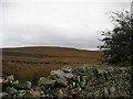
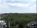
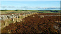
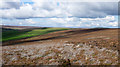
Nearby Images from Geograph Britain and Ireland:
©2007(licence)
©2013(licence)
©2020(licence)
©2017(licence)
©2019(licence)
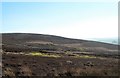
The above images may not be of the site on this page, they are loaded from Geograph.
Please Submit an Image of this site or go out and take one for us!
Click here to see more info for this site
Nearby sites
Key: Red: member's photo, Blue: 3rd party photo, Yellow: other image, Green: no photo - please go there and take one, Grey: site destroyed
Download sites to:
KML (Google Earth)
GPX (GPS waypoints)
CSV (Garmin/Navman)
CSV (Excel)
To unlock full downloads you need to sign up as a Contributory Member. Otherwise downloads are limited to 50 sites.
Turn off the page maps and other distractions
Nearby sites listing. In the following links * = Image available
980m W 265° Whitton Burn(Rock Art) Rock Art (NZ066005)
5.0km SW 234° Harkerside Moor circle* Stone Circle (SE035976)
5.8km WSW 245° Maiden Castle Barrow (Yorkshire North) Round Barrow(s) (SE02349814)
5.9km WSW 245° Maiden Castle (N Yorks)* Ancient Village or Settlement (SE02189808)
6.3km NNW 347° Frankinshaw* Cairn (NZ06170672)
6.4km NNE 31° Feldom Ranges 20d* Rock Art (NZ1086106083)
6.5km NE 43° Gayles Moor Slab Rock Art (NZ1200005300)
6.5km NE 35° Feldom Ranges 14a* Rock Art (NZ1127405907)
6.5km NNE 33° Feldom Ranges 13d* Rock Art (NZ1117706029)
6.6km NE 36° Feldom Ranges 15c* Rock Art (NZ1146905905)
6.6km NE 36° Feldom Ranges 15e* Rock Art (NZ1146105932)
6.6km NE 36° Feldom Ranges 15d* Rock Art (NZ1147105928)
6.6km NE 38° Feldom Ranges 5a* Rock Art (NZ1164405835)
6.8km NE 44° Feldom Ranges 17b* Rock Art (NZ1229205448)
6.8km NE 35° Feldom Ranges 12a* Rock Art (NZ1146406138)
6.8km NE 36° Feldom Ranges 6a* Rock Art (NZ1155506105)
6.8km NE 37° Feldom Ranges 6c* Rock Art (NZ1166906063)
6.9km NE 35° Feldom Ranges 8a* Rock Art (NZ1155606266)
7.1km NNW 345° How Tallon Cairn* Cairn (NZ05730740)
7.1km NNW 345° Barningham Moor 61 Rock Art (NZ0573907410)
7.2km NNW 341° Barningham Moor 60* Rock Art (NZ0520607422)
7.3km NNW 346° Barningham Moor 137 Rock Art (NZ0575907606)
7.3km NNW 347° Barningham Moor 62* Rock Art (NZ0587807638)
7.3km NNW 346° Barningham Moor 90* Rock Art (NZ0574707633)
7.3km NNW 346° Barningham Moor 63 Rock Art (NZ0574207650)
View more nearby sites and additional images


 We would like to know more about this location. Please feel free to add a brief description and any relevant information in your own language.
 Wir möchten mehr über diese Stätte erfahren. Bitte zögern Sie nicht, eine kurze Beschreibung und relevante Informationen in Deutsch hinzuzufügen.
 Nous aimerions en savoir encore un peu sur les lieux. S'il vous plaît n'hesitez pas à ajouter une courte description et tous les renseignements pertinents dans votre propre langue.
 Quisieramos informarnos un poco más de las lugares. No dude en añadir una breve descripción y otros datos relevantes en su propio idioma.