


<< Text Pages >> Saint-Martin d'Ormonville Tumuli - Chambered Tomb in France in Normandie:Manche (50)
Submitted by TheCaptain on Sunday, 19 December 2004 Page Views: 4096
Neolithic and Bronze AgeSite Name: Saint-Martin d'Ormonville TumuliCountry: France
NOTE: This site is 0.61 km away from the location you searched for.
Département: Normandie:Manche (50) Type: Chambered Tomb
Nearest Town: Cherbourg Nearest Village: Saint-Martin d'Ormon
Latitude: 49.701000N Longitude: 1.875W
Condition:
| 5 | Perfect |
| 4 | Almost Perfect |
| 3 | Reasonable but with some damage |
| 2 | Ruined but still recognisable as an ancient site |
| 1 | Pretty much destroyed, possibly visible as crop marks |
| 0 | No data. |
| -1 | Completely destroyed |
| 5 | Superb |
| 4 | Good |
| 3 | Ordinary |
| 2 | Not Good |
| 1 | Awful |
| 0 | No data. |
| 5 | Can be driven to, probably with disabled access |
| 4 | Short walk on a footpath |
| 3 | Requiring a bit more of a walk |
| 2 | A long walk |
| 1 | In the middle of nowhere, a nightmare to find |
| 0 | No data. |
| 5 | co-ordinates taken by GPS or official recorded co-ordinates |
| 4 | co-ordinates scaled from a detailed map |
| 3 | co-ordinates scaled from a bad map |
| 2 | co-ordinates of the nearest village |
| 1 | co-ordinates of the nearest town |
| 0 | no data |
Be the first person to rate this site - see the 'Contribute!' box in the right hand menu.
Internal Links:
External Links:
Tumulus in Manche
IMPORTANT NOTE: Position of site unknown, co-ordinates given for nearest village
You may be viewing yesterday's version of this page. To see the most up to date information please register for a free account.
Do not use the above information on other web sites or publications without permission of the contributor.
Nearby Images from Flickr
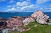
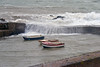
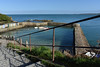
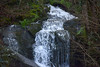
The above images may not be of the site on this page, but were taken nearby. They are loaded from Flickr so please click on them for image credits.
Click here to see more info for this site
Nearby sites
Click here to view sites on an interactive map of the areaKey: Red: member's photo, Blue: 3rd party photo, Yellow: other image, Green: no photo - please go there and take one, Grey: site destroyed
Download sites to:
KML (Google Earth)
GPX (GPS waypoints)
CSV (Garmin/Navman)
CSV (Excel)
To unlock full downloads you need to sign up as a Contributory Member. Otherwise downloads are limited to 50 sites.
Turn off the page maps and other distractions
Nearby sites listing. In the following links * = Image available
1.3km ENE 72° Digulleville Tumuli Barrow Cemetery
1.4km NE 36° Tumulus des Sablons Artificial Mound
2.7km SW 222° Tumuli Landes de Jobourg* Barrow Cemetery
3.5km WNW 292° Pierre à Feu Standing Stone (Menhir)
3.8km WNW 295° Dolmen du Jogard* Burial Chamber or Dolmen
3.9km SSE 149° Hague-Dick* Misc. Earthwork
4.4km WNW 301° Menhir de la Bergerie des Etennevaux* Standing Stone (Menhir)
5.0km SSE 147° Beaumont-Hague Tumuli Barrow Cemetery
5.4km SW 236° Tumulus du Nez de Jobourg* Round Barrow(s)
5.9km SSE 165° Pierres Pouquelées* Passage Grave
6.1km SSE 149° Tumulus Landes des Cottes* Round Barrow(s)
6.3km SE 139° Tumulus de La Fosse Yvon* Round Barrow(s)
7.6km SE 135° Tumulus des Delles* Round Barrow(s)
8.5km SSE 149° Menhir dit Epinette de Vauville Standing Stone (Menhir)
9.4km SE 144° Tumulus Bois des Hougues* Barrow Cemetery
10.1km SE 133° Sainte-Croix-Hague Tumuli Chambered Tomb
12.4km SSE 154° Cromlech de Vasteville Stone Circle
16.1km SE 144° Pierres Tournantes (Néretz) Standing Stones
18.1km ESE 110° Musée d'Histoire Naturelle Museum
18.4km S 182° Corb Dolmen Burial Chamber or Dolmen
19.0km S 178° Flamanville menhirs Standing Stones
19.3km S 182° Camp du Castel* Promontory Fort / Cliff Castle
19.6km S 179° Pierre-aux-Serpents Standing Stone (Menhir)
19.7km SE 125° Roche a Trois Pieds* Burial Chamber or Dolmen
19.9km S 182° Pierre au Rey* Burial Chamber or Dolmen
View more nearby sites and additional images


 We would like to know more about this location. Please feel free to add a brief description and any relevant information in your own language.
 Wir möchten mehr über diese Stätte erfahren. Bitte zögern Sie nicht, eine kurze Beschreibung und relevante Informationen in Deutsch hinzuzufügen.
 Nous aimerions en savoir encore un peu sur les lieux. S'il vous plaît n'hesitez pas à ajouter une courte description et tous les renseignements pertinents dans votre propre langue.
 Quisieramos informarnos un poco más de las lugares. No dude en añadir una breve descripción y otros datos relevantes en su propio idioma.