


<< Our Photo Pages >> Lions Hill Enclosure - Misc. Earthwork in England in Dorset
Submitted by Gedv1 on Thursday, 10 March 2011 Page Views: 6371
Multi-periodSite Name: Lions Hill EnclosureCountry: England
NOTE: This site is 0.316 km away from the location you searched for.
County: Dorset Type: Misc. Earthwork
Nearest Town: Ringwood Nearest Village: Ashley Heath
Map Ref: SU103039
Latitude: 50.834542N Longitude: 1.855105W
Condition:
| 5 | Perfect |
| 4 | Almost Perfect |
| 3 | Reasonable but with some damage |
| 2 | Ruined but still recognisable as an ancient site |
| 1 | Pretty much destroyed, possibly visible as crop marks |
| 0 | No data. |
| -1 | Completely destroyed |
| 5 | Superb |
| 4 | Good |
| 3 | Ordinary |
| 2 | Not Good |
| 1 | Awful |
| 0 | No data. |
| 5 | Can be driven to, probably with disabled access |
| 4 | Short walk on a footpath |
| 3 | Requiring a bit more of a walk |
| 2 | A long walk |
| 1 | In the middle of nowhere, a nightmare to find |
| 0 | No data. |
| 5 | co-ordinates taken by GPS or official recorded co-ordinates |
| 4 | co-ordinates scaled from a detailed map |
| 3 | co-ordinates scaled from a bad map |
| 2 | co-ordinates of the nearest village |
| 1 | co-ordinates of the nearest town |
| 0 | no data |
Internal Links:
External Links:
")
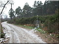
Lions Hill enclosure is a ring-work bank and ditch surmounting Lions Hill, a local nature reserve beside the public Castleman Trailway, midway between Ashley Heath Halt ( Horton Road crossing ) and the Moors Valley river, the approach from the Ashley Heath side being most logical. The central area is roughly 2 acres. The ditch is relatively narrow and shallow, and the bank is eroded and low. It is worn away in a number of places most especially to the south and west, but the north and east are fairly well defined, but all could be considered as being quite negligible
Its origin is quite obsure. At a public meeting convened by the parish council in 1994 to discuss and verify public access to Lions Hill over the fencing campaign of the then owner, local historian Mr A.... spoke to confirm that it was his belief that the origins of the earthworks were not prehistoric being insubstantial enough to defend a community. However, Mr C S....... spoke to say that it was his belief that the remains were evident of an early medieval animal stockade, and that it was inconceivable nonetheless, that the hill top was not used by prehistoric man, it being the highest point locally, suitably round in shape, rising from the scrub lowland to the east and south and the Moors Valley river flood plain to the west. Indeed, this point straddles the margin of sandy pebble bank hills of Ringwood Forest and arable flood plain. He further suggested that in any event, such a stockade would probably have been fortified, typically with a bank, ditch and pallisade. He then invited us to imagine that if the raised bank of the disused railway line ( a Dr Beeching cut ) were removed Lions hill would rise a single island high above a surrounding pathless morass. A prehistoric site waiting to be verified.
Another party offered that the ring-work was a fire break to protect the trees growing within, as it is known that Lions Hill used to be a hill top plantation of Lodgepole Pines, which were grown as sailing ship masts. This type of pine, tall, thin and very straight growing is extremely combustible and would have required firebreak protection at ground level from heath fire, although typically it is razed more frequently by crown fire.
It is now being considered by another local party, of the possibily of a lost Roman road passing very closely to the base of the hill. Can the two be related? Road and fortlette? To the eye, the evidence is weak to support this, although the Romans were very active hereabouts.
The jury is still out on this, but it is clear that within the interior there has been substantial digging, presumably for gravel.
Photo to follow.
You may be viewing yesterday's version of this page. To see the most up to date information please register for a free account.
Do not use the above information on other web sites or publications without permission of the contributor.
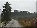
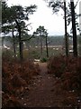
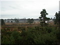
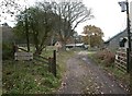
Nearby Images from Geograph Britain and Ireland:
©2010(licence)
©2010(licence)
©2010(licence)
©2010(licence)
©2010(licence)
The above images may not be of the site on this page, they are loaded from Geograph.
Please Submit an Image of this site or go out and take one for us!
Click here to see more info for this site
Nearby sites
Key: Red: member's photo, Blue: 3rd party photo, Yellow: other image, Green: no photo - please go there and take one, Grey: site destroyed
Download sites to:
KML (Google Earth)
GPX (GPS waypoints)
CSV (Garmin/Navman)
CSV (Excel)
To unlock full downloads you need to sign up as a Contributory Member. Otherwise downloads are limited to 50 sites.
Turn off the page maps and other distractions
Nearby sites listing. In the following links * = Image available
2.9km NNE 16° Ashley Heath North* Round Barrow(s) (SU111067)
3.1km SE 129° Barnsfield Heath (North)* Round Barrow(s) (SU127020)
3.1km NE 54° Ashley Heath* Round Barrow(s) (SU128057)
3.2km ENE 62° Watchmoor Wood* Round Barrow(s) (SU131054)
3.3km NE 50° Bakers Hanging* Round Barrow(s) (SU128060)
3.3km SSW 194° Trickett's Cross Barrow* Round Barrow(s) (SU095007)
4.0km N 9° Ebblake Barrow* Round Barrow(s) (SU109079)
4.3km NW 320° Horton Common Earthworks* Misc. Earthwork (SU075072)
4.7km NW 320° Redman's Hill Barrow* Round Barrow(s) (SU073075)
4.9km WNW 282° Holt Heath* Round Barrow(s) (SU055049)
5.0km SSE 157° Hurn Forest Barrow* Round Barrow(s) (SZ123993)
5.3km NW 311° David's Cross* Round Barrow(s) (SU063074)
5.4km SSW 199° Ralph's Barrow* Round Barrow(s) (SZ086988)
5.8km SSW 205° Parley Barrow* Round Barrow(s) (SZ07909865)
5.8km SW 218° Ferndown Town Common* Round Barrow(s) (SZ067993)
5.9km NNW 348° Stephen's Castle Tumulus* Round Barrow(s) (SU091097)
6.1km N 6° Plumley Wood* Barrow Cemetery (SU109100)
6.2km WNW 303° Roman Barrow, Knob's Crook* Round Barrow(s) (SU051073)
6.2km N 352° Verwood Stone* Standing Stone (Menhir) (SU09371005)
6.2km SSW 210° Dudsbury Hill Tumuli* Round Barrow(s) (SZ072985)
6.3km NW 323° Woodlands Common Barrow* Round Barrow(s) (SU065089)
6.5km N 351° Boveridge Heath* Round Barrow(s) (SU093103)
6.5km WSW 237° Bowl round barrow just outside Stapehill community centre Dorset Barrow Cemetery (SU0482700373)
6.5km SSW 203° Dudsbury Camp* Hillfort (SZ077979)
6.8km N 9° Sleep Valley Barrow* Round Barrow(s) (SU113106)
View more nearby sites and additional images


 We would like to know more about this location. Please feel free to add a brief description and any relevant information in your own language.
 Wir möchten mehr über diese Stätte erfahren. Bitte zögern Sie nicht, eine kurze Beschreibung und relevante Informationen in Deutsch hinzuzufügen.
 Nous aimerions en savoir encore un peu sur les lieux. S'il vous plaît n'hesitez pas à ajouter une courte description et tous les renseignements pertinents dans votre propre langue.
 Quisieramos informarnos un poco más de las lugares. No dude en añadir una breve descripción y otros datos relevantes en su propio idioma.