

<< Our Photo Pages >> Hurn Forest Barrow - Round Barrow(s) in England in Dorset
Submitted by Gedv1 on Friday, 04 March 2011 Page Views: 5103
Neolithic and Bronze AgeSite Name: Hurn Forest Barrow Alternative Name: Barnsfield HeathCountry: England
NOTE: This site is 1.077 km away from the location you searched for.
County: Dorset Type: Round Barrow(s)
Nearest Town: Bournemouth Nearest Village: Hurn
Map Ref: SZ123993
Latitude: 50.793138N Longitude: 1.826857W
Condition:
| 5 | Perfect |
| 4 | Almost Perfect |
| 3 | Reasonable but with some damage |
| 2 | Ruined but still recognisable as an ancient site |
| 1 | Pretty much destroyed, possibly visible as crop marks |
| 0 | No data. |
| -1 | Completely destroyed |
| 5 | Superb |
| 4 | Good |
| 3 | Ordinary |
| 2 | Not Good |
| 1 | Awful |
| 0 | No data. |
| 5 | Can be driven to, probably with disabled access |
| 4 | Short walk on a footpath |
| 3 | Requiring a bit more of a walk |
| 2 | A long walk |
| 1 | In the middle of nowhere, a nightmare to find |
| 0 | No data. |
| 5 | co-ordinates taken by GPS or official recorded co-ordinates |
| 4 | co-ordinates scaled from a detailed map |
| 3 | co-ordinates scaled from a bad map |
| 2 | co-ordinates of the nearest village |
| 1 | co-ordinates of the nearest town |
| 0 | no data |
Internal Links:
External Links:
")
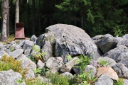
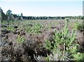
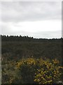
A low barrow, deeply scarred by previous Foresty Commission plantings. Now pot holed with rabbit holes, and with evidence of unspecified digging ( Victorian treasure hunters? ) it barely raises itself above the surrounding heathland. It is however, delineated by monument marking posts on each corner.
You may be viewing yesterday's version of this page. To see the most up to date information please register for a free account.
Do not use the above information on other web sites or publications without permission of the contributor.
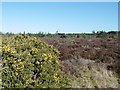
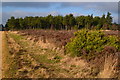
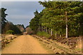
Nearby Images from Geograph Britain and Ireland:
©2015(licence)
©2019(licence)
©2019(licence)
©2015(licence)
©2011(licence)
The above images may not be of the site on this page, they are loaded from Geograph.
Please Submit an Image of this site or go out and take one for us!
Click here to see more info for this site
Nearby sites
Key: Red: member's photo, Blue: 3rd party photo, Yellow: other image, Green: no photo - please go there and take one, Grey: site destroyed
Download sites to:
KML (Google Earth)
GPX (GPS waypoints)
CSV (Garmin/Navman)
CSV (Excel)
To unlock full downloads you need to sign up as a Contributory Member. Otherwise downloads are limited to 50 sites.
Turn off the page maps and other distractions
Nearby sites listing. In the following links * = Image available
2.3km SSE 157° Sopley Common Tumulus* Round Barrow(s) (SZ132972)
2.6km SSE 160° Ramsdown Plantation / Sopley Common* Round Barrow(s) (SZ132969)
2.7km N 9° Barnsfield Heath (North)* Round Barrow(s) (SU127020)
3.1km WNW 297° Trickett's Cross Barrow* Round Barrow(s) (SU095007)
3.7km W 262° Ralph's Barrow* Round Barrow(s) (SZ086988)
4.2km SE 126° St Michael's Well (Sopley)* Holy Well or Sacred Spring (SZ1573596865)
4.3km SSE 152° St Catherine's Hill (Christchurch)* Barrow Cemetery (SZ143955)
4.4km W 262° Parley Barrow* Round Barrow(s) (SZ07909865)
4.8km S 189° Holdenhurst Long Barrow* Long Barrow (SZ116946)
4.8km WSW 253° Dudsbury Camp* Hillfort (SZ077979)
5.0km NNW 337° Lions Hill Enclosure* Misc. Earthwork (SU103039)
5.1km W 261° Dudsbury Hill Tumuli* Round Barrow(s) (SZ072985)
5.6km W 270° Ferndown Town Common* Round Barrow(s) (SZ067993)
6.2km N 8° Watchmoor Wood* Round Barrow(s) (SU131054)
6.4km N 5° Ashley Heath* Round Barrow(s) (SU128057)
6.6km WSW 239° Two Barrow Heath Barrow Cemetery (SZ0663495924)
6.7km N 4° Bakers Hanging* Round Barrow(s) (SU128060)
6.8km ENE 76° Lugden Barrow* Round Barrow(s) (SU18920091)
7.4km E 87° All Saints Well* Holy Well or Sacred Spring (SZ197997)
7.5km N 351° Ashley Heath North* Round Barrow(s) (SU111067)
7.5km W 278° Bowl round barrow just outside Stapehill community centre Dorset Barrow Cemetery (SU0482700373)
7.6km SSE 152° The Red House Museum* Museum (SZ1588292577)
7.7km NE 53° Knaves Ash barrow* Round Barrow(s) (SU18430396)
7.9km ENE 56° Strodgemoor Barrow* Round Barrow(s) (SU18910371)
8.0km SSW 213° Robin Hood's Barrow (Bournemouth) Round Barrow(s) (SZ07939256)
View more nearby sites and additional images


 We would like to know more about this location. Please feel free to add a brief description and any relevant information in your own language.
 Wir möchten mehr über diese Stätte erfahren. Bitte zögern Sie nicht, eine kurze Beschreibung und relevante Informationen in Deutsch hinzuzufügen.
 Nous aimerions en savoir encore un peu sur les lieux. S'il vous plaît n'hesitez pas à ajouter une courte description et tous les renseignements pertinents dans votre propre langue.
 Quisieramos informarnos un poco más de las lugares. No dude en añadir una breve descripción y otros datos relevantes en su propio idioma.