


<< Text Pages >> Eadberht's Cross - Ancient Cross in England in Yorkshire (West)
Submitted by Sunny100 on Monday, 30 August 2010 Page Views: 4295
Early Medieval (Dark Age)Site Name: Eadberht''s Cross Alternative Name: The Bingley Cross, All Saints Runic StoneCountry: England
NOTE: This site is 0.158 km away from the location you searched for.
County: Yorkshire (West) Type: Ancient Cross
Nearest Town: Bingley
Map Ref: SE105395
Latitude: 53.851630N Longitude: 1.841871W
Condition:
| 5 | Perfect |
| 4 | Almost Perfect |
| 3 | Reasonable but with some damage |
| 2 | Ruined but still recognisable as an ancient site |
| 1 | Pretty much destroyed, possibly visible as crop marks |
| 0 | No data. |
| -1 | Completely destroyed |
| 5 | Superb |
| 4 | Good |
| 3 | Ordinary |
| 2 | Not Good |
| 1 | Awful |
| 0 | No data. |
| 5 | Can be driven to, probably with disabled access |
| 4 | Short walk on a footpath |
| 3 | Requiring a bit more of a walk |
| 2 | A long walk |
| 1 | In the middle of nowhere, a nightmare to find |
| 0 | No data. |
| 5 | co-ordinates taken by GPS or official recorded co-ordinates |
| 4 | co-ordinates scaled from a detailed map |
| 3 | co-ordinates scaled from a bad map |
| 2 | co-ordinates of the nearest village |
| 1 | co-ordinates of the nearest town |
| 0 | no data |
Internal Links:
External Links:
Ancient Cross in Yorkshire (West)
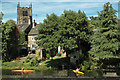
All Saints church, Bingley, stands on the site of a Roman fort and later a Saxon site. The base or pedestal of an Anglo-Saxon cross, dating from the 8th century, stands within. It is also described as a runic stone bearing three lines of runes. - now faint and undeciferable
The stone is thought to commemorate King Eadberht of Northumbria who died in 768 CE. He reigned as king from c738-758 CE. Some historians considered it to have been part of a Saxon font.
You may be viewing yesterday's version of this page. To see the most up to date information please register for a free account.
Do not use the above information on other web sites or publications without permission of the contributor.
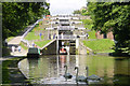
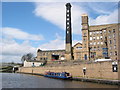
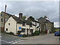
Nearby Images from Geograph Britain and Ireland:
©2005(licence)
©2005(licence)
©2007(licence)
©2010(licence)
©2012(licence)
The above images may not be of the site on this page, they are loaded from Geograph.
Please Submit an Image of this site or go out and take one for us!
Click here to see more info for this site
Nearby sites
Key: Red: member's photo, Blue: 3rd party photo, Yellow: other image, Green: no photo - please go there and take one, Grey: site destroyed
Download sites to:
KML (Google Earth)
GPX (GPS waypoints)
CSV (Garmin/Navman)
CSV (Excel)
To unlock full downloads you need to sign up as a Contributory Member. Otherwise downloads are limited to 50 sites.
Turn off the page maps and other distractions
Nearby sites listing. In the following links * = Image available
499m SW 217° Elm Crag Well (Bingley) Holy Well or Sacred Spring (SE102391)
1.2km WNW 290° Druid's Well (Bingley)* Holy Well or Sacred Spring (SE094399)
1.2km NNE 13° Green Hill Wood 01* Rock Art (SE1077140638)
1.3km WNW 289° Druid's Altar (Bingley) Natural Stone / Erratic / Other Natural Feature (SE09243994)
1.6km ESE 107° Primrose Lane 01 Rock Art (SE1203739045)
1.6km NNW 332° Lund Well (Bingley) Holy Well or Sacred Spring (SE09734091)
1.8km SSW 204° Cottingley Woods* Rock Art (SE09803789)
2.2km E 85° Lode Pit Lane 01 Rock Art (SE1266439710)
2.3km E 99° Loadpit Beck 01 Rock Art (SE1272839142)
2.3km E 84° Lode Pit Lane 02 Rock Art (SE1276039760)
2.3km E 83° Lode Pit Lane 03 Rock Art (SE1279239769)
2.4km E 90° Bracken Hall Crag 01* Rock Art (SE1289739490)
2.4km E 100° Glen Road 01 Rock Art (SE1288739100)
2.4km ENE 76° Loadpit Beck 02* Rock Art (SE1286840078)
2.5km ENE 73° Meadowsweet Farm 01* Rock Art (SE1290540220)
2.5km SE 124° Hirst Wood Rock Art (SE1260038100)
2.5km E 100° Soldier's Trench 01a* Rock Art (SE1301039078)
2.5km NNE 11° Weecher Reservoir Stone Circle (SE110420)
2.5km ESE 121° Hirst Wood Ancient Village or Settlement (SE127382)
2.6km ENE 68° Glovershaw Farm 01c* Rock Art (SE1287940460)
2.6km ENE 68° Glovershaw Farm 01d* Rock Art (SE1288140458)
2.6km ENE 68° Glovershaw Farm 01e* Rock Art (SE1288940450)
2.6km ENE 64° The Springs 01* Rock Art (SE1281140626)
2.6km E 100° The Soldiers Trench* Stone Circle (SE13043908)
2.6km E 100° Soldier's Trench 01b* Rock Art (SE1304239070)
View more nearby sites and additional images


 We would like to know more about this location. Please feel free to add a brief description and any relevant information in your own language.
 Wir möchten mehr über diese Stätte erfahren. Bitte zögern Sie nicht, eine kurze Beschreibung und relevante Informationen in Deutsch hinzuzufügen.
 Nous aimerions en savoir encore un peu sur les lieux. S'il vous plaît n'hesitez pas à ajouter une courte description et tous les renseignements pertinents dans votre propre langue.
 Quisieramos informarnos un poco más de las lugares. No dude en añadir una breve descripción y otros datos relevantes en su propio idioma.