

<< Text Pages >> Ellers Edge (431) - Rock Art in England in Yorkshire (North)
Submitted by Anne T on Friday, 13 October 2017 Page Views: 616
Rock ArtSite Name: Ellers Edge (431) Alternative Name: Boughy & Vickermann 431Country: England
NOTE: This site is 3.336 km away from the location you searched for.
County: Yorkshire (North) Type: Rock Art
Nearest Town: Blubberhouses Nearest Village: Skyreholme
Map Ref: SE0905961506
Latitude: 54.049440N Longitude: 1.863131W
Condition:
| 5 | Perfect |
| 4 | Almost Perfect |
| 3 | Reasonable but with some damage |
| 2 | Ruined but still recognisable as an ancient site |
| 1 | Pretty much destroyed, possibly visible as crop marks |
| 0 | No data. |
| -1 | Completely destroyed |
| 5 | Superb |
| 4 | Good |
| 3 | Ordinary |
| 2 | Not Good |
| 1 | Awful |
| 0 | No data. |
| 5 | Can be driven to, probably with disabled access |
| 4 | Short walk on a footpath |
| 3 | Requiring a bit more of a walk |
| 2 | A long walk |
| 1 | In the middle of nowhere, a nightmare to find |
| 0 | No data. |
| 5 | co-ordinates taken by GPS or official recorded co-ordinates |
| 4 | co-ordinates scaled from a detailed map |
| 3 | co-ordinates scaled from a bad map |
| 2 | co-ordinates of the nearest village |
| 1 | co-ordinates of the nearest town |
| 0 | no data |
Be the first person to rate this site - see the 'Contribute!' box in the right hand menu.
Internal Links:
External Links:
Rock Art in Yorkshire (North)
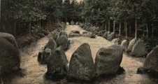
This cup and ring marked rock is featured on The Northern Antiquarian (TNA) - see their entry for Eller Edge (431), Pock Stones Moor, Thruscross, North Yorkshire, which has a photograph, directions for finding the stone nd a brief archaeology & history.
Boughey & Vickermann describe this stone as a “Large triangular rock of smooth gritstone, quarried at SE and sloping into ground at W and N. Three cups on top sloping face.”
England's Rock Art does not yet have any entry for this stone, but Pastscape Monument No. 48490 records three boulders at SE08956148, SE09046150 and SE08986148, the latter of which has cup marks with encircling channels.
See 'sites nearby' for other cup and cup and ring marked rocks in the same immediate area.
Note: Have you visited this site? Do you have any photographs or more information to add?
You may be viewing yesterday's version of this page. To see the most up to date information please register for a free account.
Do not use the above information on other web sites or publications without permission of the contributor.
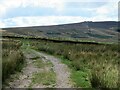
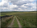
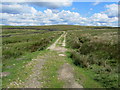
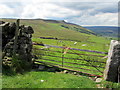
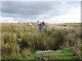
Nearby Images from Geograph Britain and Ireland:
©2022(licence)
©2012(licence)
©2011(licence)
©2011(licence)
©2006(licence)
The above images may not be of the site on this page, they are loaded from Geograph.
Please Submit an Image of this site or go out and take one for us!
Click here to see more info for this site
Nearby sites
Key: Red: member's photo, Blue: 3rd party photo, Yellow: other image, Green: no photo - please go there and take one, Grey: site destroyed
Download sites to:
KML (Google Earth)
GPX (GPS waypoints)
CSV (Garmin/Navman)
CSV (Excel)
To unlock full downloads you need to sign up as a Contributory Member. Otherwise downloads are limited to 50 sites.
Turn off the page maps and other distractions
Nearby sites listing. In the following links * = Image available
33m SE 145° Ellers Edge (432) Rock Art (SE0907861479)
39m W 261° Eller Edge (429) Rock Art (SE09026150)
71m WSW 254° Eller Edge (426) Rock Art (SE0899161486)
88m WSW 258° Eller Edge (424) Rock Art (SE0897361487)
953m W 270° Burnett's Ridge (Appletreewick)* Rock Art (SE0810361500)
1.3km WNW 283° Skyreholme Rock Art* Rock Art (SE078618)
1.3km WNW 285° Burhill Kiln (Appletreewick) Rock Art (SE0778761834)
1.6km WNW 302° Skyreholme Wall Stone (413) Rock Art (SE0772062322)
1.9km NW 305° High Green (407)* Rock Art (SE0751062601)
2.0km WNW 302° Nussey Green (404)* Rock Art (SE07396254)
2.0km WNW 300° Skyreholme (401)* Rock Art (SE07326251)
2.1km SW 215° Simon's Seat (Skyreholme) Natural Stone / Erratic / Other Natural Feature (SE07885981)
2.7km SW 216° The Devil's Apronful Cairn (SE0748759351)
3.0km WNW 301° Appletreewick* Stone Circle (SE0642863048)
4.5km SE 142° Raven Stones (559) Rock Art (SE1183558006)
4.5km SE 140° Rocking Moor Rock Art (SE1193458081)
4.7km E 91° Abbot's Hand* Marker Stone (SE138614)
4.9km WNW 297° Hartlington Pasture 02* Rock Art (SE04676373)
5.0km WNW 292° Hartlington Pasture 01* Rock Art (SE04396338)
5.8km W 270° Burnsall Crosses* Ancient Cross (SE032615)
6.0km NW 317° Blea Gill* Ancient Village or Settlement (SE04946588)
6.5km WNW 293° Dumpit Hill B (Hebden) Stone Circle (SE03076406)
6.5km WNW 292° Dumpit Hill* Stone Circle (SE02996399)
6.7km WNW 293° Dumpit Hill Enclosure Ancient Village or Settlement (SE0288464062)
6.8km WNW 295° Mossy Moor Reservoir* Ring Cairn (SE02866432)
View more nearby sites and additional images


 We would like to know more about this location. Please feel free to add a brief description and any relevant information in your own language.
 Wir möchten mehr über diese Stätte erfahren. Bitte zögern Sie nicht, eine kurze Beschreibung und relevante Informationen in Deutsch hinzuzufügen.
 Nous aimerions en savoir encore un peu sur les lieux. S'il vous plaît n'hesitez pas à ajouter une courte description et tous les renseignements pertinents dans votre propre langue.
 Quisieramos informarnos un poco más de las lugares. No dude en añadir una breve descripción y otros datos relevantes en su propio idioma.