 with our Megalithic Portal iPhone app")


<< Text Pages >> Fountains Earth 01 - Rock Art in England in Yorkshire (North)
Submitted by Anne T on Monday, 17 December 2018 Page Views: 611
Rock ArtSite Name: Fountains Earth 01 Alternative Name: IAG623aCountry: England
NOTE: This site is 1.349 km away from the location you searched for.
County: Yorkshire (North) Type: Rock Art
Nearest Town: Grassington / Ripley Nearest Village: Lofthouse / Ramsgill
Map Ref: SE1188572499
Latitude: 54.148182N Longitude: 1.819541W
Condition:
| 5 | Perfect |
| 4 | Almost Perfect |
| 3 | Reasonable but with some damage |
| 2 | Ruined but still recognisable as an ancient site |
| 1 | Pretty much destroyed, possibly visible as crop marks |
| 0 | No data. |
| -1 | Completely destroyed |
| 5 | Superb |
| 4 | Good |
| 3 | Ordinary |
| 2 | Not Good |
| 1 | Awful |
| 0 | No data. |
| 5 | Can be driven to, probably with disabled access |
| 4 | Short walk on a footpath |
| 3 | Requiring a bit more of a walk |
| 2 | A long walk |
| 1 | In the middle of nowhere, a nightmare to find |
| 0 | No data. |
| 5 | co-ordinates taken by GPS or official recorded co-ordinates |
| 4 | co-ordinates scaled from a detailed map |
| 3 | co-ordinates scaled from a bad map |
| 2 | co-ordinates of the nearest village |
| 1 | co-ordinates of the nearest town |
| 0 | no data |
Be the first person to rate this site - see the 'Contribute!' box in the right hand menu.
Internal Links:
External Links:
Rock Art in Yorkshire (North)
This rock art panel, previously on privately owned land, but now accessible thanks to 'Right To Roam' designations, is now one of two rock art panels found on a stretch of moorlands in the upper part of Nidderdale known as Fountains Earth. A possible three other panels in the vicinity have yet to be confirmed.
Now recorded in Boughey & Vickerman's "Prehistoric Rock Art of the West Riding Supplement (2018)", pages 207 and 208, IAG623a is "on the north eastern edge of Arna Knab Wood …. where the moorland terrace plateau drops off dramatically into the steeper slope of the dale below, with spectacular views of the valley to the north west". The rock measures approximately 1m x 0.75m x 0.3m at its highest point, and carries 4 clear cups in two groups of two. One of the cups on its eastern edge may carry a faint pecked partial ring. B&V also describe: "curiously, there is also an S-shaped groove, which may in fact be natural, that snakes around the eastern side of the more northern cup of the eastern-edge group and down towards the western side of the more easterly cup of the northern-edge group". B&V also describe another possible small cup near the southern edge of the eastern edge of the rock.
The Supplement includes a photograph of the panel in its landscape setting, plus close ups of the two groups of cups.
Note: Have you seen this rock art panel? Do you have any photographs or information to add?
You may be viewing yesterday's version of this page. To see the most up to date information please register for a free account.
Do not use the above information on other web sites or publications without permission of the contributor.
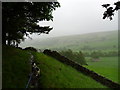
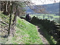
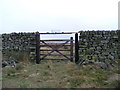
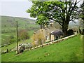
Nearby Images from Geograph Britain and Ireland:
©2011(licence)
©2007(licence)
©2007(licence)
©2016(licence)
©2007(licence)
The above images may not be of the site on this page, they are loaded from Geograph.
Please Submit an Image of this site or go out and take one for us!
Click here to see more info for this site
Nearby sites
Key: Red: member's photo, Blue: 3rd party photo, Yellow: other image, Green: no photo - please go there and take one, Grey: site destroyed
Download sites to:
KML (Google Earth)
GPX (GPS waypoints)
CSV (Garmin/Navman)
CSV (Excel)
To unlock full downloads you need to sign up as a Contributory Member. Otherwise downloads are limited to 50 sites.
Turn off the page maps and other distractions
Nearby sites listing. In the following links * = Image available
1.9km NNE 32° Jenny Twig and Tib* Rock Outcrop (SE129741)
3.1km WNW 302° St Chad (Middlesmoor)* Ancient Cross (SE09257414)
3.5km S 176° Gouthwaite Lodge Farm 03* Rock Art (SE1213568998)
3.5km S 176° Gouthwaite Lodge Farm 02* Rock Art (SE1213468996)
3.5km S 176° Gouthwaite Lodge Farm 01* Rock Art (SE1213168992)
4.1km S 177° Gouthwaite Lodge Farm* Rock Art (SE121684)
6.0km E 84° Fortress Dyke camp* Ancient Village or Settlement (SE1789173178)
6.0km ENE 74° Carle Tower* Marker Stone (SE177742)
7.3km E 95° Hell Holme Bank (Dallowgill) Rock Art (SE1917071909)
8.0km ESE 112° Pateley Moor* Standing Stone (Menhir) (SE193695)
8.3km NE 42° Swinton Druid's Temple* Modern Stone Circle etc (SE1746478713)
8.5km E 97° Cast Hills* Ancient Village or Settlement (SE20377147)
8.8km NE 51° Skew Skell Well* Holy Well or Sacred Spring (SE1876078084)
9.4km NNE 14° West Agra Carving 1 Rock Art (SE1406981627)
9.4km NNE 14° West Agra Carving 2b Rock Art (SE1412681669)
9.5km NNE 14° West Agra 3a and 3b* Rock Art (SE1423681675)
9.5km NNE 14° West Agra* Rock Art (SE14248175)
9.6km SW 226° Blea Gill* Ancient Village or Settlement (SE04946588)
9.7km NNE 18° Gollinglith Foot (West Agra) Standing Stone (Menhir) (SE149817)
9.8km SSE 155° Guisecliff Wood (626)* Rock Art (SE1607863641)
9.9km NNE 31° Healey Stone Circles (Masham) Stone Circle (SE170810)
10.0km SSE 153° Guisecliff Wood (629)* Rock Art (SE1641563565)
10.0km NE 44° Fearby, Masham* Stone Circle (SE188798)
10.1km N 9° Agra Moor Standing Stone* Standing Stone (Menhir) (SE1349982440)
10.2km SSE 155° Hayshaw Moor North (Dacre) Cairn (SE1621863253)
View more nearby sites and additional images


 We would like to know more about this location. Please feel free to add a brief description and any relevant information in your own language.
 Wir möchten mehr über diese Stätte erfahren. Bitte zögern Sie nicht, eine kurze Beschreibung und relevante Informationen in Deutsch hinzuzufügen.
 Nous aimerions en savoir encore un peu sur les lieux. S'il vous plaît n'hesitez pas à ajouter une courte description et tous les renseignements pertinents dans votre propre langue.
 Quisieramos informarnos un poco más de las lugares. No dude en añadir una breve descripción y otros datos relevantes en su propio idioma.