


<< Our Photo Pages >> Watchmoor Wood - Round Barrow(s) in England in Hampshire
Submitted by Gedv1 on Sunday, 06 February 2011 Page Views: 4630
Neolithic and Bronze AgeSite Name: Watchmoor WoodCountry: England County: Hampshire Type: Round Barrow(s)
Nearest Town: Ringwood Nearest Village: Ashley
Map Ref: SU131054
Latitude: 50.847974N Longitude: 1.815291W
Condition:
| 5 | Perfect |
| 4 | Almost Perfect |
| 3 | Reasonable but with some damage |
| 2 | Ruined but still recognisable as an ancient site |
| 1 | Pretty much destroyed, possibly visible as crop marks |
| 0 | No data. |
| -1 | Completely destroyed |
| 5 | Superb |
| 4 | Good |
| 3 | Ordinary |
| 2 | Not Good |
| 1 | Awful |
| 0 | No data. |
| 5 | Can be driven to, probably with disabled access |
| 4 | Short walk on a footpath |
| 3 | Requiring a bit more of a walk |
| 2 | A long walk |
| 1 | In the middle of nowhere, a nightmare to find |
| 0 | No data. |
| 5 | co-ordinates taken by GPS or official recorded co-ordinates |
| 4 | co-ordinates scaled from a detailed map |
| 3 | co-ordinates scaled from a bad map |
| 2 | co-ordinates of the nearest village |
| 1 | co-ordinates of the nearest town |
| 0 | no data |
Internal Links:
External Links:
")
They have both been recently cleared of the trees that grew on them, but to remove the stumps would completely destroy the mounds. The park management, West Moors Country Park will allow the stumps to rot in situ.
The northerly of the two has a deep depression caused by Victorian treasure hunters.
Both are victimns of outrageous neglect, which in part, is not too late to rectify by fencing.
You may be viewing yesterday's version of this page. To see the most up to date information please register for a free account.
")
")
")
Do not use the above information on other web sites or publications without permission of the contributor.
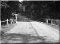
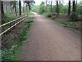
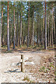
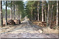
Nearby Images from Geograph Britain and Ireland:
©2015(licence)
©2017(licence)

©2007(licence)
©2011(licence)
©2010(licence)
The above images may not be of the site on this page, they are loaded from Geograph.
Please Submit an Image of this site or go out and take one for us!
Click here to see more info for this site
Nearby sites
Key: Red: member's photo, Blue: 3rd party photo, Yellow: other image, Green: no photo - please go there and take one, Grey: site destroyed
Download sites to:
KML (Google Earth)
GPX (GPS waypoints)
CSV (Garmin/Navman)
CSV (Excel)
To unlock full downloads you need to sign up as a Contributory Member. Otherwise downloads are limited to 50 sites.
Turn off the page maps and other distractions
Nearby sites listing. In the following links * = Image available
424m NW 315° Ashley Heath* Round Barrow(s) (SU128057)
670m NNW 334° Bakers Hanging* Round Barrow(s) (SU128060)
2.4km WNW 303° Ashley Heath North* Round Barrow(s) (SU111067)
3.2km WSW 242° Lions Hill Enclosure* Misc. Earthwork (SU103039)
3.3km NW 319° Ebblake Barrow* Round Barrow(s) (SU109079)
3.4km S 187° Barnsfield Heath (North)* Round Barrow(s) (SU127020)
4.5km NE 49° Moyles Court bowl barrow* Round Barrow(s) (SU16510833)
5.1km NNW 335° Plumley Wood* Barrow Cemetery (SU109100)
5.5km NNW 341° Sleep Valley Barrow* Round Barrow(s) (SU113106)
5.5km ESE 105° Knaves Ash barrow* Round Barrow(s) (SU18430396)
5.8km NE 38° South Gorley Bowl Barrow Round Barrow(s) (SU16640997)
5.9km NW 317° Stephen's Castle Tumulus* Round Barrow(s) (SU091097)
5.9km WNW 288° Horton Common Earthworks* Misc. Earthwork (SU075072)
5.9km SW 218° Trickett's Cross Barrow* Round Barrow(s) (SU095007)
6.0km NW 321° Verwood Stone* Standing Stone (Menhir) (SU09371005)
6.0km ESE 106° Strodgemoor Barrow* Round Barrow(s) (SU18910371)
6.2km S 188° Hurn Forest Barrow* Round Barrow(s) (SZ123993)
6.2km WNW 290° Redman's Hill Barrow* Round Barrow(s) (SU073075)
6.2km NW 322° Boveridge Heath* Round Barrow(s) (SU093103)
6.6km NE 38° Ibsley Common barrows* Barrow Cemetery (SU172106)
6.8km NNE 29° Gorley Hill* Hillfort (SU164113)
6.9km ESE 103° Castle Hill (Hampshire)* Hillfort (SU199039)
7.1km WNW 287° David's Cross* Round Barrow(s) (SU063074)
7.3km SE 128° Lugden Barrow* Round Barrow(s) (SU18920091)
7.5km WNW 298° Woodlands Common Barrow* Round Barrow(s) (SU065089)
View more nearby sites and additional images


 We would like to know more about this location. Please feel free to add a brief description and any relevant information in your own language.
 Wir möchten mehr über diese Stätte erfahren. Bitte zögern Sie nicht, eine kurze Beschreibung und relevante Informationen in Deutsch hinzuzufügen.
 Nous aimerions en savoir encore un peu sur les lieux. S'il vous plaît n'hesitez pas à ajouter une courte description et tous les renseignements pertinents dans votre propre langue.
 Quisieramos informarnos un poco más de las lugares. No dude en añadir una breve descripción y otros datos relevantes en su propio idioma.