


<< Our Photo Pages >> Jaizkibel 4 Trikuharria - Burial Chamber or Dolmen in Spain in Pais Vasco
Submitted by irundarra on Wednesday, 17 June 2009 Page Views: 2531
Neolithic and Bronze AgeSite Name: Jaizkibel 4 Trikuharria Alternative Name: Dolmen Jaizkibel IVCountry: Spain
NOTE: This site is 4.344 km away from the location you searched for.
Region: Pais Vasco Type: Burial Chamber or Dolmen
Nearest Town: San Sebastian Nearest Village: Fuenterrabia
Latitude: 43.359251N Longitude: 1.83371W
Condition:
| 5 | Perfect |
| 4 | Almost Perfect |
| 3 | Reasonable but with some damage |
| 2 | Ruined but still recognisable as an ancient site |
| 1 | Pretty much destroyed, possibly visible as crop marks |
| 0 | No data. |
| -1 | Completely destroyed |
| 5 | Superb |
| 4 | Good |
| 3 | Ordinary |
| 2 | Not Good |
| 1 | Awful |
| 0 | No data. |
| 5 | Can be driven to, probably with disabled access |
| 4 | Short walk on a footpath |
| 3 | Requiring a bit more of a walk |
| 2 | A long walk |
| 1 | In the middle of nowhere, a nightmare to find |
| 0 | No data. |
| 5 | co-ordinates taken by GPS or official recorded co-ordinates |
| 4 | co-ordinates scaled from a detailed map |
| 3 | co-ordinates scaled from a bad map |
| 2 | co-ordinates of the nearest village |
| 1 | co-ordinates of the nearest town |
| 0 | no data |
Internal Links:
External Links:
")
You may be viewing yesterday's version of this page. To see the most up to date information please register for a free account.
Do not use the above information on other web sites or publications without permission of the contributor.
Nearby Images from Flickr

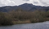
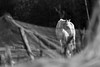
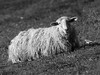
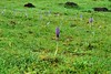
The above images may not be of the site on this page, but were taken nearby. They are loaded from Flickr so please click on them for image credits.
Click here to see more info for this site
Nearby sites
Click here to view sites on an interactive map of the areaKey: Red: member's photo, Blue: 3rd party photo, Yellow: other image, Green: no photo - please go there and take one, Grey: site destroyed
Download sites to:
KML (Google Earth)
GPX (GPS waypoints)
CSV (Garmin/Navman)
CSV (Excel)
To unlock full downloads you need to sign up as a Contributory Member. Otherwise downloads are limited to 50 sites.
Turn off the page maps and other distractions
Nearby sites listing. In the following links * = Image available
394m W 260° Jaizkibel 5 Harrespila Stone Circle
417m WSW 240° Jaizkibel 3 Trikuharria* Burial Chamber or Dolmen
429m WSW 256° Jaizkibel 2 Harrespila* Stone Circle
435m N 358° Zioso Trikuharria Burial Chamber or Dolmen
745m W 270° Atxiñar Trikuharria Burial Chamber or Dolmen
914m SW 225° Jaizkibel 1 Harrespila Stone Circle
1.4km SW 223° Iskulin Trikuharria* Burial Chamber or Dolmen
5.7km S 179° Algorrieta Harrespila Stone Circle
6.3km S 172° Guardiako Lepoa Harrespila Stone Circle
6.6km S 179° Egiar Harrespila 1-7* Stone Circle
6.6km S 179° Egiar Zutarria* Standing Stone (Menhir)
7.6km S 172° Urkullu Txiki Egia Harrespila Stone Circle
8.2km S 185° Gainzabal Trikuharria Burial Chamber or Dolmen
9.2km ESE 110° Rocher Des Perdrix Tumulus Round Barrow(s)
9.3km ESE 105° Galbario Dolmen 1* Burial Chamber or Dolmen
9.4km ESE 106° Galbario Dolmen 2* Burial Chamber or Dolmen
9.5km ESE 106° Galbario Tumulus Round Barrow(s)
9.6km ESE 106° Galbario Dolmen 4 Burial Chamber or Dolmen
9.7km ESE 123° Lizarlan Tumulus Round Barrow(s)
9.8km ESE 107° Usatuita Dolmen 1* Burial Chamber or Dolmen
9.8km ESE 107° Usatuita Dolmen 2 Burial Chamber or Dolmen
9.8km ESE 110° Xoldokozelai Cista Cist
9.8km ESE 110° Xoldokozelai Dolmen 2 Burial Chamber or Dolmen
9.8km SW 223° Berrozpin 3* Burial Chamber or Dolmen
9.8km ESE 110° Xoldokozelai Dolmen 1 Burial Chamber or Dolmen
View more nearby sites and additional images


 We would like to know more about this location. Please feel free to add a brief description and any relevant information in your own language.
 Wir möchten mehr über diese Stätte erfahren. Bitte zögern Sie nicht, eine kurze Beschreibung und relevante Informationen in Deutsch hinzuzufügen.
 Nous aimerions en savoir encore un peu sur les lieux. S'il vous plaît n'hesitez pas à ajouter une courte description et tous les renseignements pertinents dans votre propre langue.
 Quisieramos informarnos un poco más de las lugares. No dude en añadir una breve descripción y otros datos relevantes en su propio idioma.