 with our Megalithic Portal iPhone app")


<< Our Photo Pages >> Coalsgarth Edge - Rock Art in England in Yorkshire (North)
Submitted by Tenbar on Thursday, 30 June 2022 Page Views: 1021
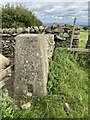
Rock ArtSite Name: Coalsgarth EdgeCountry: England
NOTE: This site is 0.388 km away from the location you searched for.
County: Yorkshire (North) Type: Rock Art
Nearest Town: Richmond
Map Ref: NZ149027
Latitude: 54.419525N Longitude: 1.77189W
Condition:
| 5 | Perfect |
| 4 | Almost Perfect |
| 3 | Reasonable but with some damage |
| 2 | Ruined but still recognisable as an ancient site |
| 1 | Pretty much destroyed, possibly visible as crop marks |
| 0 | No data. |
| -1 | Completely destroyed |
| 5 | Superb |
| 4 | Good |
| 3 | Ordinary |
| 2 | Not Good |
| 1 | Awful |
| 0 | No data. |
| 5 | Can be driven to, probably with disabled access |
| 4 | Short walk on a footpath |
| 3 | Requiring a bit more of a walk |
| 2 | A long walk |
| 1 | In the middle of nowhere, a nightmare to find |
| 0 | No data. |
| 5 | co-ordinates taken by GPS or official recorded co-ordinates |
| 4 | co-ordinates scaled from a detailed map |
| 3 | co-ordinates scaled from a bad map |
| 2 | co-ordinates of the nearest village |
| 1 | co-ordinates of the nearest town |
| 0 | no data |
Internal Links:
External Links:
")
Note: Rock art near Richmond, North Yorkshire, it's not coming up on the local HER so could well be a new discovery!
You may be viewing yesterday's version of this page. To see the most up to date information please register for a free account.
Do not use the above information on other web sites or publications without permission of the contributor.
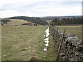
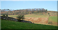
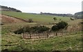
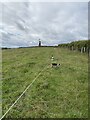
Nearby Images from Geograph Britain and Ireland:
©2010(licence)
©2016(licence)
©2017(licence)
©2022(licence)
©2022(licence)
The above images may not be of the site on this page, they are loaded from Geograph.
Please Submit an Image of this site or go out and take one for us!
Click here to see more info for this site
Nearby sites
Key: Red: member's photo, Blue: 3rd party photo, Yellow: other image, Green: no photo - please go there and take one, Grey: site destroyed
Download sites to:
KML (Google Earth)
GPX (GPS waypoints)
CSV (Garmin/Navman)
CSV (Excel)
To unlock full downloads you need to sign up as a Contributory Member. Otherwise downloads are limited to 50 sites.
Turn off the page maps and other distractions
Nearby sites listing. In the following links * = Image available
3.8km NW 317° Feldom Ranges 17b* Rock Art (NZ1229205448)
3.8km ESE 116° Scots Dyke (Easby)* Misc. Earthwork (NZ18360104)
3.8km E 84° Scots Dyke (Olliver)* Misc. Earthwork (NZ18720309)
3.9km NW 312° Gayles Moor Slab Rock Art (NZ1200005300)
4.5km NW 314° Feldom Ranges 5a* Rock Art (NZ1164405835)
4.7km NW 316° Feldom Ranges 6c* Rock Art (NZ1166906063)
4.7km NW 313° Feldom Ranges 15c* Rock Art (NZ1146905905)
4.7km NW 314° Feldom Ranges 15d* Rock Art (NZ1147105928)
4.7km NW 313° Feldom Ranges 15e* Rock Art (NZ1146105932)
4.8km NW 316° Feldom Ranges 6a* Rock Art (NZ1155506105)
4.8km NW 312° Feldom Ranges 14a* Rock Art (NZ1127405907)
4.9km NW 315° Feldom Ranges 12a* Rock Art (NZ1146406138)
4.9km NW 317° Feldom Ranges 8a* Rock Art (NZ1155606266)
5.0km NW 312° Feldom Ranges 13d* Rock Art (NZ1117706029)
5.3km NW 310° Feldom Ranges 20d* Rock Art (NZ1086106083)
5.8km N 5° Mainsgill Farm* Modern Stone Circle etc (NZ154085)
6.1km NW 323° Castle Steads* Hillfort (NZ112075)
6.5km NNW 338° The Dalton Stone Rock Art (NZ1240008700)
6.7km NNW 330° Dalton Portable 1 & 2 Rock Art (NZ1150008500)
7.6km WSW 254° Forty Acres 03 (Stelling) Rock Art (NZ07580058)
8.6km WSW 255° Whitton Burn(Rock Art) Rock Art (NZ066005)
8.8km ESE 102° Scorton Cursus Cursus (NZ235009)
8.8km ENE 66° Five Hills round barrow* Round Barrow(s) (NZ2293006325)
9.1km ESE 117° Catterick henge Henge (SE23049854)
9.2km SSE 168° St Oswald (East Hauxwell)* Ancient Cross (SE168937)
View more nearby sites and additional images


 We would like to know more about this location. Please feel free to add a brief description and any relevant information in your own language.
 Wir möchten mehr über diese Stätte erfahren. Bitte zögern Sie nicht, eine kurze Beschreibung und relevante Informationen in Deutsch hinzuzufügen.
 Nous aimerions en savoir encore un peu sur les lieux. S'il vous plaît n'hesitez pas à ajouter une courte description et tous les renseignements pertinents dans votre propre langue.
 Quisieramos informarnos un poco más de las lugares. No dude en añadir una breve descripción y otros datos relevantes en su propio idioma.