

<< Our Photo Pages >> St Michael's Well (Sopley) - Holy Well or Sacred Spring in England in Hampshire
Submitted by DavidCWoods on Saturday, 18 December 2004 Page Views: 11564
Springs and Holy WellsSite Name: St Michael's Well (Sopley)Country: England
NOTE: This site is 1.676 km away from the location you searched for.
County: Hampshire Type: Holy Well or Sacred Spring
Nearest Town: Bournmouth Nearest Village: Sopley
Map Ref: SZ1573596865
Latitude: 50.771159N Longitude: 1.778226W
Condition:
| 5 | Perfect |
| 4 | Almost Perfect |
| 3 | Reasonable but with some damage |
| 2 | Ruined but still recognisable as an ancient site |
| 1 | Pretty much destroyed, possibly visible as crop marks |
| 0 | No data. |
| -1 | Completely destroyed |
| 5 | Superb |
| 4 | Good |
| 3 | Ordinary |
| 2 | Not Good |
| 1 | Awful |
| 0 | No data. |
| 5 | Can be driven to, probably with disabled access |
| 4 | Short walk on a footpath |
| 3 | Requiring a bit more of a walk |
| 2 | A long walk |
| 1 | In the middle of nowhere, a nightmare to find |
| 0 | No data. |
| 5 | co-ordinates taken by GPS or official recorded co-ordinates |
| 4 | co-ordinates scaled from a detailed map |
| 3 | co-ordinates scaled from a bad map |
| 2 | co-ordinates of the nearest village |
| 1 | co-ordinates of the nearest town |
| 0 | no data |
Internal Links:
External Links:
 (PID:11040)")
You may be viewing yesterday's version of this page. To see the most up to date information please register for a free account.
Do not use the above information on other web sites or publications without permission of the contributor.
davidmorgan has found this location on Google Street View:
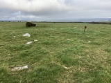
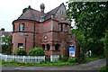
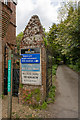
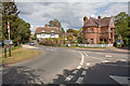
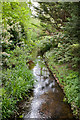
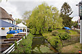
Nearby Images from Geograph Britain and Ireland:
©2016(licence)
©2010(licence)
©2010(licence)
©2010(licence)
©2010(licence)
The above images may not be of the site on this page, they are loaded from Geograph.
Please Submit an Image of this site or go out and take one for us!
Click here to see more info for this site
Nearby sites
Key: Red: member's photo, Blue: 3rd party photo, Yellow: other image, Green: no photo - please go there and take one, Grey: site destroyed
Download sites to:
KML (Google Earth)
GPX (GPS waypoints)
CSV (Garmin/Navman)
CSV (Excel)
To unlock full downloads you need to sign up as a Contributory Member. Otherwise downloads are limited to 50 sites.
Turn off the page maps and other distractions
Nearby sites listing. In the following links * = Image available
2.0km SW 227° St Catherine's Hill (Christchurch)* Barrow Cemetery (SZ143955)
2.5km W 271° Ramsdown Plantation / Sopley Common* Round Barrow(s) (SZ132969)
2.6km W 278° Sopley Common Tumulus* Round Barrow(s) (SZ132972)
4.2km NW 306° Hurn Forest Barrow* Round Barrow(s) (SZ123993)
4.3km S 178° The Red House Museum* Museum (SZ1588292577)
4.7km WSW 241° Holdenhurst Long Barrow* Long Barrow (SZ116946)
4.9km NE 55° All Saints Well* Holy Well or Sacred Spring (SZ197997)
5.1km NE 38° Lugden Barrow* Round Barrow(s) (SU18920091)
5.3km SE 140° Friars Cliff Tumulus* Round Barrow(s) (SZ1917492825)
5.9km S 172° Double Dykes Bowl Barrow* Round Barrow(s) (SZ16609102)
6.0km NNW 330° Barnsfield Heath (North)* Round Barrow(s) (SU127020)
6.3km SSE 168° Warren Hill Round Barrow 2* Round Barrow(s) (SZ1704090688)
6.3km SSE 167° Warren Hill Bowl Barrow Round Barrow(s) (SZ17199069)
6.4km SSE 166° Warren Hill Round Barrow 1 Round Barrow(s) (SZ17269069)
6.5km SSE 164° Hengistbury Head* Promontory Fort / Cliff Castle (SZ176906)
7.3km WNW 302° Trickett's Cross Barrow* Round Barrow(s) (SU095007)
7.4km WNW 285° Ralph's Barrow* Round Barrow(s) (SZ086988)
7.5km NNE 25° Strodgemoor Barrow* Round Barrow(s) (SU18910371)
7.6km NNE 21° Knaves Ash barrow* Round Barrow(s) (SU18430396)
8.0km WNW 283° Parley Barrow* Round Barrow(s) (SZ07909865)
8.1km W 278° Dudsbury Camp* Hillfort (SZ077979)
8.2km NNE 31° Castle Hill (Hampshire)* Hillfort (SU199039)
8.7km W 281° Dudsbury Hill Tumuli* Round Barrow(s) (SZ072985)
8.8km NNE 34° St Mary's Well (Hampshire)* Holy Well or Sacred Spring (SU2056304175)
8.9km NW 323° Lions Hill Enclosure* Misc. Earthwork (SU103039)
View more nearby sites and additional images


 We would like to know more about this location. Please feel free to add a brief description and any relevant information in your own language.
 Wir möchten mehr über diese Stätte erfahren. Bitte zögern Sie nicht, eine kurze Beschreibung und relevante Informationen in Deutsch hinzuzufügen.
 Nous aimerions en savoir encore un peu sur les lieux. S'il vous plaît n'hesitez pas à ajouter une courte description et tous les renseignements pertinents dans votre propre langue.
 Quisieramos informarnos un poco más de las lugares. No dude en añadir una breve descripción y otros datos relevantes en su propio idioma.