

<< Our Photo Pages >> Guisecliff Wood (626) - Rock Art in England in Yorkshire (North)
Submitted by Anne T on Thursday, 02 November 2017 Page Views: 1133
Rock ArtSite Name: Guisecliff Wood (626) Alternative Name: Boughey & Vickerman (626); Hogback Stone; Lower Intake CarvingCountry: England
NOTE: This site is 1.979 km away from the location you searched for.
County: Yorkshire (North) Type: Rock Art
Nearest Town: Pateley Bridge Nearest Village: Bewerley
Map Ref: SE1607863641
Latitude: 54.068458N Longitude: 1.755816W
Condition:
| 5 | Perfect |
| 4 | Almost Perfect |
| 3 | Reasonable but with some damage |
| 2 | Ruined but still recognisable as an ancient site |
| 1 | Pretty much destroyed, possibly visible as crop marks |
| 0 | No data. |
| -1 | Completely destroyed |
| 5 | Superb |
| 4 | Good |
| 3 | Ordinary |
| 2 | Not Good |
| 1 | Awful |
| 0 | No data. |
| 5 | Can be driven to, probably with disabled access |
| 4 | Short walk on a footpath |
| 3 | Requiring a bit more of a walk |
| 2 | A long walk |
| 1 | In the middle of nowhere, a nightmare to find |
| 0 | No data. |
| 5 | co-ordinates taken by GPS or official recorded co-ordinates |
| 4 | co-ordinates scaled from a detailed map |
| 3 | co-ordinates scaled from a bad map |
| 2 | co-ordinates of the nearest village |
| 1 | co-ordinates of the nearest town |
| 0 | no data |
Internal Links:
External Links:
")
The Northern Antiquarian (TNA) features a page for this cup and ring marked stone - see their entry for Guisecliff Wood (626), Bewerley, North Yorkshire.
The TNA entry gives directions for finding this stone, together with photographs, a copy of Boughey & Vickerman's drawing of the motifs, together with a brief archaeology & history.
This stone is also recorded as one of five on Pastscape's Monument No. 50680, their entry saying: "A partially overgrown boulder bearing numerous single cups, abutting a field boundary wall at SE 16086360."
Note: Have you visited this site? Do you have any photographs or information to add?
You may be viewing yesterday's version of this page. To see the most up to date information please register for a free account.
Do not use the above information on other web sites or publications without permission of the contributor.
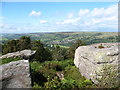
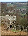
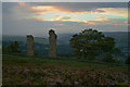
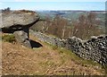
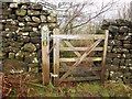
Nearby Images from Geograph Britain and Ireland:
©2008(licence)
©2012(licence)
©2013(licence)
©2012(licence)
©2012(licence)
The above images may not be of the site on this page, they are loaded from Geograph.
Please Submit an Image of this site or go out and take one for us!
Click here to see more info for this site
Nearby sites
Key: Red: member's photo, Blue: 3rd party photo, Yellow: other image, Green: no photo - please go there and take one, Grey: site destroyed
Download sites to:
KML (Google Earth)
GPX (GPS waypoints)
CSV (Garmin/Navman)
CSV (Excel)
To unlock full downloads you need to sign up as a Contributory Member. Otherwise downloads are limited to 50 sites.
Turn off the page maps and other distractions
Nearby sites listing. In the following links * = Image available
344m ESE 103° Guisecliff Wood (629)* Rock Art (SE1641563565)
412m SSE 160° Hayshaw Moor North (Dacre) Cairn (SE1621863253)
2.8km ESE 120° Eastwoods Farm 01 (Heyshaw) Rock Art (SE1855662240)
2.8km ESE 120° Fertility Stone (CR-638)* Rock Art (SE1855262228)
2.9km ESE 121° Eastwoods Farm 02 (Heyshaw) Rock Art (SE1857262168)
2.9km ESE 118° Bryan's Wood 01 Rock Art (SE1866362280)
2.9km SE 124° Eastwoods Cross Base (Summerbridge) Rock Art (SE1850662013)
2.9km SE 124° Eastwoods Farm Cup (Heyshaw)* Rock Art (SE1852062010)
3.1km SE 128° Eastwoods Rough 3 (Dacre) Rock Art (SE18506177)
3.1km SE 127° Morphing Stone (Dacre)* Rock Art (SE1855961795)
3.2km SW 226° Abbot's Hand* Marker Stone (SE138614)
3.2km SE 129° Tadpole Stone (Eastwoods Rough)* Rock Art (SE1860161644)
4.2km SSE 154° Dacre Top* Ancient Village or Settlement (SE179599)
4.5km ENE 75° Brimham Rocks Rock Art Rock Art (SE2039764782)
4.7km ENE 72° Brimham Rocks Circle Stone Circle (SE20566507)
5.0km E 84° Graffa Plain (Hartwith) Cairn (SE211642)
5.1km ENE 76° Brimham Rocks* Rock Outcrop (SE210649)
5.2km E 100° Hartwith Moor* Standing Stone (Menhir) (SE2123362737)
6.2km NW 320° Gouthwaite Lodge Farm* Rock Art (SE121684)
6.6km NW 324° Gouthwaite Lodge Farm 01* Rock Art (SE1213168992)
6.6km NW 324° Gouthwaite Lodge Farm 02* Rock Art (SE1213468996)
6.6km NW 324° Gouthwaite Lodge Farm 03* Rock Art (SE1213568998)
6.7km NNE 29° Pateley Moor* Standing Stone (Menhir) (SE193695)
6.9km SW 217° Rocking Moor Rock Art (SE1193458081)
7.0km SW 217° Raven Stones (559) Rock Art (SE1183558006)
View more nearby sites and additional images


 We would like to know more about this location. Please feel free to add a brief description and any relevant information in your own language.
 Wir möchten mehr über diese Stätte erfahren. Bitte zögern Sie nicht, eine kurze Beschreibung und relevante Informationen in Deutsch hinzuzufügen.
 Nous aimerions en savoir encore un peu sur les lieux. S'il vous plaît n'hesitez pas à ajouter une courte description et tous les renseignements pertinents dans votre propre langue.
 Quisieramos informarnos un poco más de las lugares. No dude en añadir una breve descripción y otros datos relevantes en su propio idioma.