

<< Text Pages >> Spink Well (Bradford) - Holy Well or Sacred Spring in England in Yorkshire (West)
Submitted by Anne T on Sunday, 07 January 2018 Page Views: 2132
Springs and Holy WellsSite Name: Spink Well (Bradford)Country: England
NOTE: This site is 2.606 km away from the location you searched for.
County: Yorkshire (West) Type: Holy Well or Sacred Spring
Nearest Town: Bradford
Map Ref: SE16533410
Latitude: 53.802940N Longitude: 1.750497W
Condition:
| 5 | Perfect |
| 4 | Almost Perfect |
| 3 | Reasonable but with some damage |
| 2 | Ruined but still recognisable as an ancient site |
| 1 | Pretty much destroyed, possibly visible as crop marks |
| 0 | No data. |
| -1 | Completely destroyed |
| 5 | Superb |
| 4 | Good |
| 3 | Ordinary |
| 2 | Not Good |
| 1 | Awful |
| 0 | No data. |
| 5 | Can be driven to, probably with disabled access |
| 4 | Short walk on a footpath |
| 3 | Requiring a bit more of a walk |
| 2 | A long walk |
| 1 | In the middle of nowhere, a nightmare to find |
| 0 | No data. |
| 5 | co-ordinates taken by GPS or official recorded co-ordinates |
| 4 | co-ordinates scaled from a detailed map |
| 3 | co-ordinates scaled from a bad map |
| 2 | co-ordinates of the nearest village |
| 1 | co-ordinates of the nearest town |
| 0 | no data |
Be the first person to rate this site - see the 'Contribute!' box in the right hand menu.
Internal Links:
External Links:
Holy Well or Sacred Spring in Yorkshire (West)
The Northern Antiquarian (TNA) features a page for this healing well - see their entry for the Spink Well, Bradford, West Yorkshire, which gives directions for finding this site, together with photographs, a description and local folklore.
Sited not far from Bradford City Centre, the well now offers only a muddy trickle of water which flows into a trough. TNA adds: "The Spink Well was highlighted on the 1832 boundary commission report map of Bradford; then listed in the 1850 Tithe Awards; and of course featured on the earliest Ordnance Survey map a few years later. In 1788, below the spring itself, a Spinkwell House was built which advertised health-giving cold baths and used the waters from this well to supply people with its health-giving virtues. This Spink Well house also had a most curious history: the gravestones of those who died in the plague of 1645 were built into the walls of the well-house here! They were uncovered during the construction of Peel Park in the 19th century, a short distance away."
Note: Have you visited this site? Do you have any photographs or information to add?
You may be viewing yesterday's version of this page. To see the most up to date information please register for a free account.
Do not use the above information on other web sites or publications without permission of the contributor.
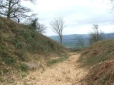
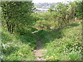
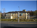
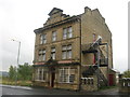
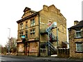
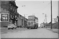
Nearby Images from Geograph Britain and Ireland:
©2011(licence)
©2010(licence)
©2014(licence)
©2023(licence)
©2023(licence)
The above images may not be of the site on this page, they are loaded from Geograph.
Please Submit an Image of this site or go out and take one for us!
Click here to see more info for this site
Nearby sites
Key: Red: member's photo, Blue: 3rd party photo, Yellow: other image, Green: no photo - please go there and take one, Grey: site destroyed
Download sites to:
KML (Google Earth)
GPX (GPS waypoints)
CSV (Garmin/Navman)
CSV (Excel)
To unlock full downloads you need to sign up as a Contributory Member. Otherwise downloads are limited to 50 sites.
Turn off the page maps and other distractions
Nearby sites listing. In the following links * = Image available
306m N 349° Boar Well Holy Well or Sacred Spring (SE16473440)
540m WNW 282° Holy Ash Well (Bradford) Holy Well or Sacred Spring (SE16003421)
748m W 272° Wart Stone (Bradford) Standing Stone (Menhir) (SE15783412)
2.3km N 1° Sweet Willy Well (Wrose) Holy Well or Sacred Spring (SE1656136440)
3.1km NE 47° Holy Well (Eccleshill) Holy Well or Sacred Spring (SE18783622)
3.8km NW 311° Northcliffe Woods (Shipley) Rock Art (SE1364236608)
4.0km NNW 329° Bowling Green Rock Rock Art (SE1448437520)
4.4km NE 43° West Woods 2 (Calverley) Rock Art (SE195373)
4.5km NE 45° West Woods 1 (Calverley) Rock Art (SE19703731)
4.5km NE 50° Calverley Woods Stone Circle (Leeds) Stone Circle (SE200370)
4.9km NNW 338° Baildon Green 01* Rock Art (SE1469038690)
4.9km NNW 338° Crutch Well (Baildon) Holy Well or Sacred Spring (SE1467838688)
5.0km NNW 338° Baildon Green 02* Rock Art (SE1469038702)
5.0km N 7° Buck Woods 7 Rock Art (SE1711039037)
5.1km N 11° Buck Woods 9* Rock Art (SE1744239101)
5.1km N 359° Hoyle Court 01* Rock Art (SE1639839185)
5.1km N 8° Buck Woods 8 Rock Art (SE1718839154)
5.1km N 11° Buck Woods 1* Rock Art (SE1745639155)
5.1km N 10° Buck Woods 4* Rock Art (SE1741839163)
5.1km N 11° Buck Woods 3* Rock Art (SE1745639162)
5.2km N 11° Buck Woods 2* Rock Art (SE17473921)
5.2km NE 43° Calverley Woods 1 (Leeds) Rock Art (SE20083791)
5.2km NW 317° Hirst Woods (Saltaire) Rock Art (SE129379)
5.3km NE 54° St Wilfrid (Calverley) Sculptured Stone (SE208372)
5.3km N 11° Buck Woods 10* Rock Art (SE1751239296)
View more nearby sites and additional images


 We would like to know more about this location. Please feel free to add a brief description and any relevant information in your own language.
 Wir möchten mehr über diese Stätte erfahren. Bitte zögern Sie nicht, eine kurze Beschreibung und relevante Informationen in Deutsch hinzuzufügen.
 Nous aimerions en savoir encore un peu sur les lieux. S'il vous plaît n'hesitez pas à ajouter une courte description et tous les renseignements pertinents dans votre propre langue.
 Quisieramos informarnos un poco más de las lugares. No dude en añadir una breve descripción y otros datos relevantes en su propio idioma.