


<< Text Pages >> Ravenscliffe Cave - Cave or Rock Shelter in England in Derbyshire
Submitted by vicky on Monday, 14 October 2002 Page Views: 8007
Natural PlacesSite Name: Ravenscliffe CaveCountry: England
NOTE: This site is 0.709 km away from the location you searched for.
County: Derbyshire Type: Cave or Rock Shelter
Nearest Town: Bakewell Nearest Village: Little Longstone
Map Ref: SK174736 Landranger Map Number: 119
Latitude: 53.259121N Longitude: 1.740628W
Condition:
| 5 | Perfect |
| 4 | Almost Perfect |
| 3 | Reasonable but with some damage |
| 2 | Ruined but still recognisable as an ancient site |
| 1 | Pretty much destroyed, possibly visible as crop marks |
| 0 | No data. |
| -1 | Completely destroyed |
| 5 | Superb |
| 4 | Good |
| 3 | Ordinary |
| 2 | Not Good |
| 1 | Awful |
| 0 | No data. |
| 5 | Can be driven to, probably with disabled access |
| 4 | Short walk on a footpath |
| 3 | Requiring a bit more of a walk |
| 2 | A long walk |
| 1 | In the middle of nowhere, a nightmare to find |
| 0 | No data. |
| 5 | co-ordinates taken by GPS or official recorded co-ordinates |
| 4 | co-ordinates scaled from a detailed map |
| 3 | co-ordinates scaled from a bad map |
| 2 | co-ordinates of the nearest village |
| 1 | co-ordinates of the nearest town |
| 0 | no data |
Internal Links:
External Links:
Cave or Rock Shelter in Derbyshire
Have you visited this site? Please add a comment below.
You may be viewing yesterday's version of this page. To see the most up to date information please register for a free account.
Do not use the above information on other web sites or publications without permission of the contributor.
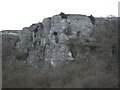
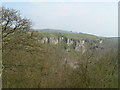
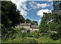
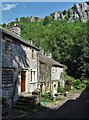
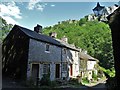
Nearby Images from Geograph Britain and Ireland:
©2009(licence)
©2005(licence)
©2019(licence)
©2019(licence)
©2019(licence)
The above images may not be of the site on this page, they are loaded from Geograph.
Please Submit an Image of this site or go out and take one for us!
Click here to see more info for this site
Nearby sites
Key: Red: member's photo, Blue: 3rd party photo, Yellow: other image, Green: no photo - please go there and take one, Grey: site destroyed
Download sites to:
KML (Google Earth)
GPX (GPS waypoints)
CSV (Garmin/Navman)
CSV (Excel)
To unlock full downloads you need to sign up as a Contributory Member. Otherwise downloads are limited to 50 sites.
Turn off the page maps and other distractions
Nearby sites listing. In the following links * = Image available
581m NE 51° Wardlow Hay Cop* Round Barrow(s) (SK17857397)
1.0km E 89° Rolley Low* Round Barrow(s) (SK18447362)
1.2km SE 135° Castlegate Lane* Round Barrow(s) (SK18267276)
1.5km ESE 102° Longstone Moor* Round Barrow(s) (SK18887328)
1.6km N 360° Peter's Stone* Natural Stone / Erratic / Other Natural Feature (SK17387525)
2.3km S 178° Hob’s House Cave* Cave or Rock Shelter (SK175713)
2.6km S 178° Fin Cop* Hillfort (SK175710)
2.7km ENE 64° White Rake* Long Barrow (SK198748)
3.2km S 189° Demons Dale Cave* Cave or Rock Shelter (SK16897045)
3.5km E 93° Longstone Edge barrows* Round Barrow(s) (SK20887341)
3.7km S 176° Skinner's Well* Holy Well or Sacred Spring (SK177699)
4.1km SW 227° Taddington High Well* Holy Well or Sacred Spring (SK1442470824)
4.2km NW 313° The Dor Well* Holy Well or Sacred Spring (SK143765)
4.2km SW 221° Taddington Barrow* Round Barrow(s) (SK146704)
4.3km WSW 247° Priestcliffe Low* Round Barrow(s) (SK13497190)
4.4km S 188° Sheldon 2 (Derbyshire) Round Barrow(s) (SK16836925)
4.4km ENE 73° Poss. Stone circles/barrow, 615m SW of Highfields Farm Stone Circle (SK21617488)
4.5km SE 146° Sheepwash Well Holy Well or Sacred Spring (SK199699)
4.5km NW 312° Ebbing and Flowing well* Holy Well or Sacred Spring (SK140766)
4.6km N 6° Burr Tor* Hillfort (SK179782)
4.6km S 186° Sheldon 1 (Derbyshire)* Round Barrow(s) (SK16926898)
4.8km ENE 60° Eyam Delf* Cave or Rock Shelter (SK21577598)
4.9km NW 305° Wishing Well* Ancient Cross (SK134764)
4.9km NNW 331° Tideslow* Chambered Cairn (SK150779)
5.0km WSW 250° Blackwell* Modern Stone Circle etc (SK127719)
View more nearby sites and additional images


 We would like to know more about this location. Please feel free to add a brief description and any relevant information in your own language.
 Wir möchten mehr über diese Stätte erfahren. Bitte zögern Sie nicht, eine kurze Beschreibung und relevante Informationen in Deutsch hinzuzufügen.
 Nous aimerions en savoir encore un peu sur les lieux. S'il vous plaît n'hesitez pas à ajouter une courte description et tous les renseignements pertinents dans votre propre langue.
 Quisieramos informarnos un poco más de las lugares. No dude en añadir una breve descripción y otros datos relevantes en su propio idioma.