


<< Our Photo Pages >> Hazlebadge Round Barrow 1 - Round Barrow(s) in England in Derbyshire
Submitted by twentytrees on Saturday, 25 March 2006 Page Views: 3580
Neolithic and Bronze AgeSite Name: Hazlebadge Round Barrow 1Country: England County: Derbyshire Type: Round Barrow(s)
Nearest Town: Bradwell Nearest Village: Bradwell
Map Ref: SK17268034
Latitude: 53.319709N Longitude: 1.742363W
Condition:
| 5 | Perfect |
| 4 | Almost Perfect |
| 3 | Reasonable but with some damage |
| 2 | Ruined but still recognisable as an ancient site |
| 1 | Pretty much destroyed, possibly visible as crop marks |
| 0 | No data. |
| -1 | Completely destroyed |
| 5 | Superb |
| 4 | Good |
| 3 | Ordinary |
| 2 | Not Good |
| 1 | Awful |
| 0 | No data. |
| 5 | Can be driven to, probably with disabled access |
| 4 | Short walk on a footpath |
| 3 | Requiring a bit more of a walk |
| 2 | A long walk |
| 1 | In the middle of nowhere, a nightmare to find |
| 0 | No data. |
| 5 | co-ordinates taken by GPS or official recorded co-ordinates |
| 4 | co-ordinates scaled from a detailed map |
| 3 | co-ordinates scaled from a bad map |
| 2 | co-ordinates of the nearest village |
| 1 | co-ordinates of the nearest town |
| 0 | no data |
Internal Links:
External Links:
")
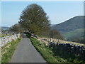
Nice round barrow - probably a bowl barrow. Prominent on top of the hill behind Hazlebury Farm. Nearest parking in the layby here.
You may be viewing yesterday's version of this page. To see the most up to date information please register for a free account.
")
Do not use the above information on other web sites or publications without permission of the contributor.
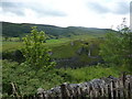
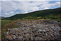
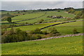
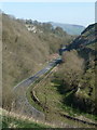
Nearby Images from Geograph Britain and Ireland:
©2010(licence)
©2014(licence)
©2019(licence)
©2012(licence)
©2012(licence)
The above images may not be of the site on this page, they are loaded from Geograph.
Please Submit an Image of this site or go out and take one for us!
Click here to see more info for this site
Nearby sites
Key: Red: member's photo, Blue: 3rd party photo, Yellow: other image, Green: no photo - please go there and take one, Grey: site destroyed
Download sites to:
KML (Google Earth)
GPX (GPS waypoints)
CSV (Garmin/Navman)
CSV (Excel)
To unlock full downloads you need to sign up as a Contributory Member. Otherwise downloads are limited to 50 sites.
Turn off the page maps and other distractions
Nearby sites listing. In the following links * = Image available
430m S 182° Hazlebadge Round Barrow 2* Round Barrow(s) (SK17257991)
858m W 268° Fissure Cave Cave or Rock Shelter (SK164803)
1.2km SSW 198° Stan Low* Round Barrow(s) (SK169792)
1.3km NE 48° The Grey Ditch* Misc. Earthwork (SK182812)
1.4km SSW 208° Cop Low* Round Barrow(s) (SK16627912)
1.7km N 5° Bath Spring Holy Well or Sacred Spring (SK174820)
1.8km SSE 150° Crow Chin cairns* Cairn (SK1815578818)
2.1km E 83° Burton Bole* Round Barrow(s) (SK194806)
2.2km SSE 164° Burr Tor* Hillfort (SK179782)
2.6km N 350° The Folly Round Barrow(s) (SK168829)
2.9km E 91° Abney Moor I* Stone Circle (SK202803)
3.0km E 89° Smelting Hill* Stone Circle (SK203804)
3.1km N 0° St Peter (Hope)* Ancient Cross (SK1725583445)
3.2km NW 315° Cave Dale 2* Cave or Rock Shelter (SK150826)
3.3km SW 223° Tideslow* Chambered Cairn (SK150779)
3.5km NW 315° Lady's well (Cavedale) Holy Well or Sacred Spring (SK148828)
3.9km E 87° Offerton Moor West Ring Cairn Ring Cairn (SK2115580550)
3.9km ESE 124° Derwic Well* Holy Well or Sacred Spring (SK2054978171)
4.0km E 88° Offerton Moor* Stone Circle (SK213805)
4.0km E 87° Offerton Moor East Cairn (SK213806)
4.2km E 93° Highlow Bank* Standing Stone (Menhir) (SK215801)
4.3km W 272° Ox Low* Round Barrow(s) (SK130805)
4.5km NW 306° Treak Cliff Sepulchral Cave* Cave or Rock Shelter (SK136830)
4.5km ESE 111° Stanage* Cairn (SK215787)
4.8km SW 218° The Dor Well* Holy Well or Sacred Spring (SK143765)
View more nearby sites and additional images


 We would like to know more about this location. Please feel free to add a brief description and any relevant information in your own language.
 Wir möchten mehr über diese Stätte erfahren. Bitte zögern Sie nicht, eine kurze Beschreibung und relevante Informationen in Deutsch hinzuzufügen.
 Nous aimerions en savoir encore un peu sur les lieux. S'il vous plaît n'hesitez pas à ajouter une courte description et tous les renseignements pertinents dans votre propre langue.
 Quisieramos informarnos un poco más de las lugares. No dude en añadir una breve descripción y otros datos relevantes en su propio idioma.