

, Aubrey Burl")
<< Other Photo Pages >> Buztizko Lepoa Menhir - Standing Stone (Menhir) in Spain in Navarra
Submitted by AlexHunger on Monday, 22 September 2008 Page Views: 1677
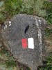
Neolithic and Bronze AgeSite Name: Buztizko Lepoa MenhirCountry: Spain
NOTE: This site is 0.409 km away from the location you searched for.
Region: Navarra Type: Standing Stone (Menhir)
Nearest Town: Baztan Nearest Village: Ituren
Latitude: 43.158157N Longitude: 1.723493W
Condition:
| 5 | Perfect |
| 4 | Almost Perfect |
| 3 | Reasonable but with some damage |
| 2 | Ruined but still recognisable as an ancient site |
| 1 | Pretty much destroyed, possibly visible as crop marks |
| 0 | No data. |
| -1 | Completely destroyed |
| 5 | Superb |
| 4 | Good |
| 3 | Ordinary |
| 2 | Not Good |
| 1 | Awful |
| 0 | No data. |
| 5 | Can be driven to, probably with disabled access |
| 4 | Short walk on a footpath |
| 3 | Requiring a bit more of a walk |
| 2 | A long walk |
| 1 | In the middle of nowhere, a nightmare to find |
| 0 | No data. |
| 5 | co-ordinates taken by GPS or official recorded co-ordinates |
| 4 | co-ordinates scaled from a detailed map |
| 3 | co-ordinates scaled from a bad map |
| 2 | co-ordinates of the nearest village |
| 1 | co-ordinates of the nearest town |
| 0 | no data |
Be the first person to rate this site - see the 'Contribute!' box in the right hand menu.
Internal Links:
External Links:
")
Have you visited this site? Please add a comment below.
You may be viewing yesterday's version of this page. To see the most up to date information please register for a free account.
Do not use the above information on other web sites or publications without permission of the contributor.
Nearby Images from Flickr
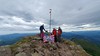
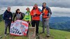
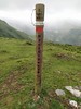
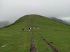
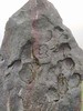
The above images may not be of the site on this page, but were taken nearby. They are loaded from Flickr so please click on them for image credits.
Click here to see more info for this site
Nearby sites
Click here to view sites on an interactive map of the areaKey: Red: member's photo, Blue: 3rd party photo, Yellow: other image, Green: no photo - please go there and take one, Grey: site destroyed
Download sites to:
KML (Google Earth)
GPX (GPS waypoints)
CSV (Garmin/Navman)
CSV (Excel)
To unlock full downloads you need to sign up as a Contributory Member. Otherwise downloads are limited to 50 sites.
Turn off the page maps and other distractions
Nearby sites listing. In the following links * = Image available
881m S 173° Erdiko Xenda Dolmen* Burial Chamber or Dolmen
1.7km SSW 206° Baikuntzeko Etxola Dolmen* Burial Chamber or Dolmen
1.8km SSW 200° Iruñaga Menhir Standing Stone (Menhir)
1.9km SE 146° Aitzurra Dolmen* Burial Chamber or Dolmen
2.0km SSE 149° Aitzurrako Lepoa Dolmen* Burial Chamber or Dolmen
2.3km ESE 120° Ugatza Dolmen 1 Burial Chamber or Dolmen
2.3km SE 143° Goiko Borda Dolmen 1 Burial Chamber or Dolmen
2.4km ESE 120° Ugatza Dolmen 2 Burial Chamber or Dolmen
2.4km SSE 148° Arrutala Dolmen Burial Chamber or Dolmen
2.5km ESE 123° Malkorgaña Túmulo Round Barrow(s)
2.5km SE 142° Goiko Borda Dolmen 2 Burial Chamber or Dolmen
2.5km ESE 123° Malkorgaña Dolmen Burial Chamber or Dolmen
2.6km SSE 149° Epeintzako Kaskua Dolmen* Burial Chamber or Dolmen
2.8km SW 228° Makillipurdi Dolmen Burial Chamber or Dolmen
2.8km ESE 110° Bostorratz Dolmen Burial Chamber or Dolmen
2.8km ESE 104° Oiantzar Dolmen* Burial Chamber or Dolmen
2.9km SW 222° Learra Menhir Standing Stone (Menhir)
2.9km SSE 155° Garatama Dolmen Burial Chamber or Dolmen
3.0km SW 228° Pagazelaieta Dolmen Burial Chamber or Dolmen
3.3km ESE 110° Zumaleku Dolmen* Burial Chamber or Dolmen
3.5km WNW 285° Ibintza Cromlechs 1-6* Stone Circle
3.8km NW 310° Sorageta Cromlechs 1-3 Stone Circle
3.8km WNW 296° Gerasunko Ataka Cromlechs 1-12* Stone Circle
4.1km WNW 300° Mustriña Chromlech Stone Circle
4.1km NNE 29° Bulatsegi Túmulo 1-6 Barrow Cemetery
View more nearby sites and additional images


 We would like to know more about this location. Please feel free to add a brief description and any relevant information in your own language.
 Wir möchten mehr über diese Stätte erfahren. Bitte zögern Sie nicht, eine kurze Beschreibung und relevante Informationen in Deutsch hinzuzufügen.
 Nous aimerions en savoir encore un peu sur les lieux. S'il vous plaît n'hesitez pas à ajouter une courte description et tous les renseignements pertinents dans votre propre langue.
 Quisieramos informarnos un poco más de las lugares. No dude en añadir una breve descripción y otros datos relevantes en su propio idioma.