


<< Text Pages >> Bryan's Wood 01 - Rock Art in England in Yorkshire (North)
Submitted by Anne T on Wednesday, 19 December 2018 Page Views: 825
Rock ArtSite Name: Bryan's Wood 01 Alternative Name: IAG638e (formerly IAG638c/IAG638d)Country: England
NOTE: This site is 1.478 km away from the location you searched for.
County: Yorkshire (North) Type: Rock Art
Nearest Village: Dacre / Dacre Banks / Summerbridge
Map Ref: SE1866362280
Latitude: 54.056140N Longitude: 1.7164W
Condition:
| 5 | Perfect |
| 4 | Almost Perfect |
| 3 | Reasonable but with some damage |
| 2 | Ruined but still recognisable as an ancient site |
| 1 | Pretty much destroyed, possibly visible as crop marks |
| 0 | No data. |
| -1 | Completely destroyed |
| 5 | Superb |
| 4 | Good |
| 3 | Ordinary |
| 2 | Not Good |
| 1 | Awful |
| 0 | No data. |
| 5 | Can be driven to, probably with disabled access |
| 4 | Short walk on a footpath |
| 3 | Requiring a bit more of a walk |
| 2 | A long walk |
| 1 | In the middle of nowhere, a nightmare to find |
| 0 | No data. |
| 5 | co-ordinates taken by GPS or official recorded co-ordinates |
| 4 | co-ordinates scaled from a detailed map |
| 3 | co-ordinates scaled from a bad map |
| 2 | co-ordinates of the nearest village |
| 1 | co-ordinates of the nearest town |
| 0 | no data |
Be the first person to rate this site - see the 'Contribute!' box in the right hand menu.
Internal Links:
External Links:
Rock Art in Yorkshire (North)
This rock art panel (formerly recorded as IAG638c/IAG638d) was discovered in Bryan's Wood, adjacent to Eastwoods Farm. Now recorded as IAG638e in Boughey & Vickerman's "Prehistoric Rock Art of the West Riding Supplement (2018)", page 224, this rock is described as being "a large slab of rock dressed along its slightly curving western side up to 4m long, 1.5-2.0m wide and 0.76m high, forming part of a collapsed drystone wall that runs north-south close to the western perimeter of the wood. The remains of an uprooted birch tree and debris … partly obscure some of the carvings on its flat horizontal face".
Motifs include a clear cup and ring; a cluster of six small cups and a small groove; a cup and larger ring (much worn); a small cup and a cluster of up to 9-10 mostly small cups. The Supplement includes a photograph of the rock in its landscape context, together with photographs of the motifs.
Please note Bryan's Wood is privately owned and permission must be sought from the owners before entering the wood.
Note: Have you seen this rock art panel? Do you have any photographs or information to add?
You may be viewing yesterday's version of this page. To see the most up to date information please register for a free account.
Do not use the above information on other web sites or publications without permission of the contributor.
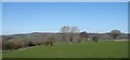
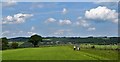
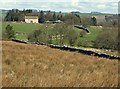
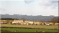
Nearby Images from Geograph Britain and Ireland:
©2019(licence)
©2019(licence)
©2012(licence)
©2008(licence)
©2012(licence)
The above images may not be of the site on this page, they are loaded from Geograph.
Please Submit an Image of this site or go out and take one for us!
Click here to see more info for this site
Nearby sites
Key: Red: member's photo, Blue: 3rd party photo, Yellow: other image, Green: no photo - please go there and take one, Grey: site destroyed
Download sites to:
KML (Google Earth)
GPX (GPS waypoints)
CSV (Garmin/Navman)
CSV (Excel)
To unlock full downloads you need to sign up as a Contributory Member. Otherwise downloads are limited to 50 sites.
Turn off the page maps and other distractions
Nearby sites listing. In the following links * = Image available
114m WSW 250° Eastwoods Farm 01 (Heyshaw) Rock Art (SE1855662240)
122m WSW 245° Fertility Stone (CR-638)* Rock Art (SE1855262228)
144m SW 219° Eastwoods Farm 02 (Heyshaw) Rock Art (SE1857262168)
305m SSW 208° Eastwoods Farm Cup (Heyshaw)* Rock Art (SE1852062010)
309m SSW 211° Eastwoods Cross Base (Summerbridge) Rock Art (SE1850662013)
496m SSW 192° Morphing Stone (Dacre)* Rock Art (SE1855961795)
535m SSW 198° Eastwoods Rough 3 (Dacre) Rock Art (SE18506177)
639m S 186° Tadpole Stone (Eastwoods Rough)* Rock Art (SE1860161644)
2.5km SSW 198° Dacre Top* Ancient Village or Settlement (SE179599)
2.6km WNW 300° Guisecliff Wood (629)* Rock Art (SE1641563565)
2.6km E 80° Hartwith Moor* Standing Stone (Menhir) (SE2123362737)
2.6km WNW 292° Hayshaw Moor North (Dacre) Cairn (SE1621863253)
2.9km WNW 298° Guisecliff Wood (626)* Rock Art (SE1607863641)
3.0km NE 35° Brimham Rocks Rock Art Rock Art (SE2039764782)
3.1km NE 52° Graffa Plain (Hartwith) Cairn (SE211642)
3.4km NE 34° Brimham Rocks Circle Stone Circle (SE20566507)
3.5km NE 42° Brimham Rocks* Rock Outcrop (SE210649)
4.9km W 260° Abbot's Hand* Marker Stone (SE138614)
6.6km E 89° Cowgate Manor Barn (Shaw Mills) Rock Art (SE2525562397)
6.9km NE 42° Wine Wife Well* Holy Well or Sacred Spring (SE23216742)
7.2km N 5° Pateley Moor* Standing Stone (Menhir) (SE193695)
7.4km SSE 163° Long Stoop* Standing Stones (SE209552)
7.8km S 180° Busky Dike (Fewston) Natural Stone / Erratic / Other Natural Feature (SE187545)
7.9km WSW 238° Rocking Moor Rock Art (SE1193458081)
8.0km E 99° Deb Well* Holy Well or Sacred Spring (SE266611)
View more nearby sites and additional images


 We would like to know more about this location. Please feel free to add a brief description and any relevant information in your own language.
 Wir möchten mehr über diese Stätte erfahren. Bitte zögern Sie nicht, eine kurze Beschreibung und relevante Informationen in Deutsch hinzuzufügen.
 Nous aimerions en savoir encore un peu sur les lieux. S'il vous plaît n'hesitez pas à ajouter une courte description et tous les renseignements pertinents dans votre propre langue.
 Quisieramos informarnos un poco más de las lugares. No dude en añadir una breve descripción y otros datos relevantes en su propio idioma.