


<< Our Photo Pages >> Fairy Well (Roberttown) - Holy Well or Sacred Spring in England in Yorkshire (West)
Submitted by coldrum on Saturday, 16 July 2011 Page Views: 5748
Springs and Holy WellsSite Name: Fairy Well (Roberttown)Country: England
NOTE: This site is 0.86 km away from the location you searched for.
County: Yorkshire (West) Type: Holy Well or Sacred Spring
Nearest Town: Roberttown
Map Ref: SE19812308
Latitude: 53.703779N Longitude: 1.701398W
Condition:
| 5 | Perfect |
| 4 | Almost Perfect |
| 3 | Reasonable but with some damage |
| 2 | Ruined but still recognisable as an ancient site |
| 1 | Pretty much destroyed, possibly visible as crop marks |
| 0 | No data. |
| -1 | Completely destroyed |
| 5 | Superb |
| 4 | Good |
| 3 | Ordinary |
| 2 | Not Good |
| 1 | Awful |
| 0 | No data. |
| 5 | Can be driven to, probably with disabled access |
| 4 | Short walk on a footpath |
| 3 | Requiring a bit more of a walk |
| 2 | A long walk |
| 1 | In the middle of nowhere, a nightmare to find |
| 0 | No data. |
| 5 | co-ordinates taken by GPS or official recorded co-ordinates |
| 4 | co-ordinates scaled from a detailed map |
| 3 | co-ordinates scaled from a bad map |
| 2 | co-ordinates of the nearest village |
| 1 | co-ordinates of the nearest town |
| 0 | no data |
Be the first person to rate this site - see the 'Contribute!' box in the right hand menu.
Internal Links:
External Links:
 (PID:56919)")
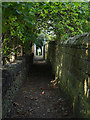
Fairy Well near Roberttown.
Source: Living Spring
You may be viewing yesterday's version of this page. To see the most up to date information please register for a free account.
Do not use the above information on other web sites or publications without permission of the contributor.
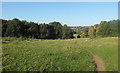
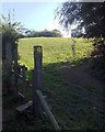
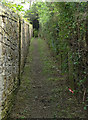
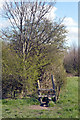
Nearby Images from Geograph Britain and Ireland:
©2019(licence)
©2019(licence)
©2019(licence)
©2020(licence)
©2019(licence)
The above images may not be of the site on this page, they are loaded from Geograph.
Please Submit an Image of this site or go out and take one for us!
Click here to see more info for this site
Nearby sites
Key: Red: member's photo, Blue: 3rd party photo, Yellow: other image, Green: no photo - please go there and take one, Grey: site destroyed
Download sites to:
KML (Google Earth)
GPX (GPS waypoints)
CSV (Garmin/Navman)
CSV (Excel)
To unlock full downloads you need to sign up as a Contributory Member. Otherwise downloads are limited to 50 sites.
Turn off the page maps and other distractions
Nearby sites listing. In the following links * = Image available
2.0km WNW 282° Lady Well (Hartshead) Holy Well or Sacred Spring (SE1788423487)
2.3km NNE 32° Doidy Poidy Well (Gomersal) Holy Well or Sacred Spring (SE210250)
2.3km WNW 288° The Walton Cross* Ancient Cross (SE1761423792)
2.4km NNE 32° Mannerly Well (Gomersal) Holy Well or Sacred Spring (SE21072515)
3.8km NNE 14° Moor Lane Well (Gomersal) Holy Well or Sacred Spring (SE20712677)
3.8km NNE 32° Pickel Well (Birstall) Holy Well or Sacred Spring (SE21802633)
4.9km ESE 109° Dewsbury Minster Ancient Cross (SE245215)
6.1km WSW 256° St Matthew (Rastrick)* Ancient Cross (SE1383121596)
6.9km SE 128° St Michael and All Angels (Thornhill)* Ancient Cross (SE25341885)
7.3km WNW 296° Priestly Green Holy Well Holy Well or Sacred Spring (SE13202632)
10.0km SSW 207° Castle Hill (West Yorkshire)* Hillfort (SE153141)
10.5km W 275° Shaw Hill (Skircoat) Cairn (SE09372401)
10.7km SW 226° Crosland Moor Holy Well* Holy Well or Sacred Spring (SE121156)
11.3km WNW 283° Stannary (Halifax) Stone Circle (SE088256)
11.5km NNW 344° Spink Well (Bradford) Holy Well or Sacred Spring (SE16533410)
11.7km NNW 340° Wart Stone (Bradford) Standing Stone (Menhir) (SE15783412)
11.8km NNW 341° Holy Ash Well (Bradford) Holy Well or Sacred Spring (SE16003421)
11.8km WSW 249° St Helen's Well (Stainland) Holy Well or Sacred Spring (SE088188)
11.8km NNW 344° Boar Well Holy Well or Sacred Spring (SE16473440)
13.2km N 356° Holy Well (Eccleshill) Holy Well or Sacred Spring (SE18783622)
13.5km SSW 201° Hagg Woods (Thornbridge) Cairn (SE1493410443)
13.7km NNW 347° Sweet Willy Well (Wrose) Holy Well or Sacred Spring (SE1656136440)
13.8km NE 45° St Helen's Well (Holbeck) Holy Well or Sacred Spring (SE295329)
13.8km W 279° Warley Edge (Halifax)* Rock Art (SE061252)
13.8km WSW 241° Whole Stone (Golcar) Natural Stone / Erratic / Other Natural Feature (SE077163)
View more nearby sites and additional images


 We would like to know more about this location. Please feel free to add a brief description and any relevant information in your own language.
 Wir möchten mehr über diese Stätte erfahren. Bitte zögern Sie nicht, eine kurze Beschreibung und relevante Informationen in Deutsch hinzuzufügen.
 Nous aimerions en savoir encore un peu sur les lieux. S'il vous plaît n'hesitez pas à ajouter une courte description et tous les renseignements pertinents dans votre propre langue.
 Quisieramos informarnos un poco más de las lugares. No dude en añadir una breve descripción y otros datos relevantes en su propio idioma.