 with our Megalithic Portal iPhone app")


<< Text Pages >> Kandaraitz Cista - Cist in Spain in Navarra
Submitted by holger_rix on Sunday, 22 November 2015 Page Views: 819
Neolithic and Bronze AgeSite Name: Kandaraitz CistaCountry: Spain
NOTE: This site is 8.814 km away from the location you searched for.
Region: Navarra Type: Cist
Latitude: 42.512212N Longitude: 1.750114W
Condition:
| 5 | Perfect |
| 4 | Almost Perfect |
| 3 | Reasonable but with some damage |
| 2 | Ruined but still recognisable as an ancient site |
| 1 | Pretty much destroyed, possibly visible as crop marks |
| 0 | No data. |
| -1 | Completely destroyed |
| 5 | Superb |
| 4 | Good |
| 3 | Ordinary |
| 2 | Not Good |
| 1 | Awful |
| 0 | No data. |
| 5 | Can be driven to, probably with disabled access |
| 4 | Short walk on a footpath |
| 3 | Requiring a bit more of a walk |
| 2 | A long walk |
| 1 | In the middle of nowhere, a nightmare to find |
| 0 | No data. |
| 5 | co-ordinates taken by GPS or official recorded co-ordinates |
| 4 | co-ordinates scaled from a detailed map |
| 3 | co-ordinates scaled from a bad map |
| 2 | co-ordinates of the nearest village |
| 1 | co-ordinates of the nearest town |
| 0 | no data |
Be the first person to rate this site - see the 'Contribute!' box in the right hand menu.
Internal Links:
External Links:
Cist in Navarra
You may be viewing yesterday's version of this page. To see the most up to date information please register for a free account.
Do not use the above information on other web sites or publications without permission of the contributor.
Nearby Images from Flickr
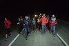
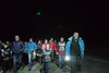
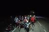
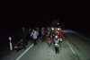
The above images may not be of the site on this page, but were taken nearby. They are loaded from Flickr so please click on them for image credits.
Click here to see more info for this site
Nearby sites
Click here to view sites on an interactive map of the areaKey: Red: member's photo, Blue: 3rd party photo, Yellow: other image, Green: no photo - please go there and take one, Grey: site destroyed
Download sites to:
KML (Google Earth)
GPX (GPS waypoints)
CSV (Garmin/Navman)
CSV (Excel)
To unlock full downloads you need to sign up as a Contributory Member. Otherwise downloads are limited to 50 sites.
Turn off the page maps and other distractions
Nearby sites listing. In the following links * = Image available
635m WNW 302° Kandaraitz Dolmen Burial Chamber or Dolmen
4.3km WNW 303° Biorrada Menhir Standing Stone (Menhir)
4.6km NW 318° Jugondo Dolmen Burial Chamber or Dolmen
5.1km NW 311° Las Cabras 3 Cista Cist
5.1km NW 312° Las Cabras 2 Cista Cist
6.0km NNW 344° Genzelaia Túmulo 1-3 Round Barrow(s)
6.1km NNW 334° Genzelaia Cabezón Túmulo Round Barrow(s)
6.1km NNW 344° Genzelaia Menhir Standing Stone (Menhir)
6.9km WNW 284° Museo Arqueológico Las Eretas* Ancient Village or Settlement
7.5km N 8° San Bartolomé Dolmen Burial Chamber or Dolmen
9.9km NNE 18° Soplahogueras Menhir Standing Stone (Menhir)
10.4km NNE 11° Karakidoia Dolmen Burial Chamber or Dolmen
11.8km N 10° Andiuz Dolmen Burial Chamber or Dolmen
12.3km N 1° La Mina Menhir* Standing Stone (Menhir)
12.3km N 2° La Mina de Farangortea Dolmen* Burial Chamber or Dolmen
12.5km N 0° Legastiaga Menhir Standing Stone (Menhir)
12.6km N 360° Farangortea Dolmen* Burial Chamber or Dolmen
12.8km N 1° Legastiaga Menhir Standing Stone (Menhir)
12.8km N 360° Farangortea Dolmen Burial Chamber or Dolmen
13.3km NW 316° Andelos* Ancient Village or Settlement
16.1km WNW 299° Kortabairrieta Túmulo Round Barrow(s)
16.4km WNW 301° Labóriz Petroglifo Rock Art
16.5km NNW 333° Soto Aldea Dolmen Burial Chamber or Dolmen
18.2km WNW 302° Lauzola Menhir Standing Stone (Menhir)
19.1km WNW 290° El Cascajillo Petroglifo Rock Art
View more nearby sites and additional images


 We would like to know more about this location. Please feel free to add a brief description and any relevant information in your own language.
 Wir möchten mehr über diese Stätte erfahren. Bitte zögern Sie nicht, eine kurze Beschreibung und relevante Informationen in Deutsch hinzuzufügen.
 Nous aimerions en savoir encore un peu sur les lieux. S'il vous plaît n'hesitez pas à ajouter une courte description et tous les renseignements pertinents dans votre propre langue.
 Quisieramos informarnos un poco más de las lugares. No dude en añadir una breve descripción y otros datos relevantes en su propio idioma.