


<< Our Photo Pages >> Calton Pasture II - Round Barrow(s) in England in Derbyshire
Submitted by Infinite_Fate on Monday, 29 May 2006 Page Views: 4343
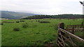
Neolithic and Bronze AgeSite Name: Calton Pasture II Alternative Name: Manners Wood Goddess MoundCountry: England
NOTE: This site is 1.381 km away from the location you searched for.
County: Derbyshire Type: Round Barrow(s)
Nearest Town: Bakewell
Map Ref: SK24136805
Latitude: 53.208973N Longitude: 1.640163W
Condition:
| 5 | Perfect |
| 4 | Almost Perfect |
| 3 | Reasonable but with some damage |
| 2 | Ruined but still recognisable as an ancient site |
| 1 | Pretty much destroyed, possibly visible as crop marks |
| 0 | No data. |
| -1 | Completely destroyed |
| 5 | Superb |
| 4 | Good |
| 3 | Ordinary |
| 2 | Not Good |
| 1 | Awful |
| 0 | No data. |
| 5 | Can be driven to, probably with disabled access |
| 4 | Short walk on a footpath |
| 3 | Requiring a bit more of a walk |
| 2 | A long walk |
| 1 | In the middle of nowhere, a nightmare to find |
| 0 | No data. |
| 5 | co-ordinates taken by GPS or official recorded co-ordinates |
| 4 | co-ordinates scaled from a detailed map |
| 3 | co-ordinates scaled from a bad map |
| 2 | co-ordinates of the nearest village |
| 1 | co-ordinates of the nearest town |
| 0 | no data |
Internal Links:
External Links:
I have visited· I would like to visit
Couplands saw from a distance on 10th Jun 2023 - their rating: Cond: 2 Amb: 3 Access: 3
")
It looks as if it has been opened but... it also looks to my rather untutored and fanciful eye like the Goddess opening herself to welcome, um, visitors. I shall say no more other than, having thanked Her for the rain that had just started to fall that day, I kissed an amusingly placed tussock of grass. Ten days later and it has only just stopped raining.
You may be viewing yesterday's version of this page. To see the most up to date information please register for a free account.
")
")
Do not use the above information on other web sites or publications without permission of the contributor.
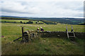
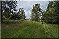
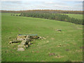
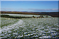
Nearby Images from Geograph Britain and Ireland:
©2020(licence)
©2020(licence)
©2017(licence)
©2015(licence)
©2012(licence)
The above images may not be of the site on this page, they are loaded from Geograph.
Please Submit an Image of this site or go out and take one for us!
Click here to see more info for this site
Nearby sites
Key: Red: member's photo, Blue: 3rd party photo, Yellow: other image, Green: no photo - please go there and take one, Grey: site destroyed
Download sites to:
KML (Google Earth)
GPX (GPS waypoints)
CSV (Garmin/Navman)
CSV (Excel)
To unlock full downloads you need to sign up as a Contributory Member. Otherwise downloads are limited to 50 sites.
Turn off the page maps and other distractions
Nearby sites listing. In the following links * = Image available
694m NW 311° Calton Pasture* Round Barrow(s) (SK236685)
1.7km NW 309° Ball Cross* Hillfort (SK228691)
2.0km W 270° St Peter's Well (Bakewell)* Holy Well or Sacred Spring (SK2209768025)
2.4km WNW 284° Bath House Spring* Holy Well or Sacred Spring (SK218686)
2.6km W 279° Bakewell Churchyard* Ancient Cross (SK2154768458)
3.1km SW 232° Haddon Fields Bowl Barrow 2* Round Barrow(s) (SK21726617)
3.6km E 83° Beeley Moor Bronze Age Enclosure* Misc. Earthwork (SK27756850)
3.7km E 80° Beeley Warren 1 Ring Cairn (SK278687)
3.8km SW 225° Haddon Fields Bowl Barrow 1* Round Barrow(s) (SK21486535)
3.9km ENE 78° Beeley Warren 2 Ring Cairn (SK279689)
3.9km E 84° Park Gate* Stone Circle (SK2804868513)
4.1km ESE 108° Beeley Triple Cairn* Ring Cairn (SK2800366824)
4.1km ESE 120° Fallinge Edge* Ring Cairn (SK277660)
4.3km S 173° Stanton Moor Cairn T2* Round Cairn (SK247638)
4.4km NE 38° Dobb Edge Cup and Ring* Rock Art (SK268715)
4.4km E 95° Beeley Moor South* Ring Cairn (SK285677)
4.4km E 95° Beeley Moor North Ring Cairn (SK285677)
4.4km WSW 241° Cranes Fort* Hillfort (SK203659)
4.4km S 170° Stanton Moor 1* Stone Circle (SK249637)
4.6km ENE 61° Gibbet Moor North* Stone Circle (SK281703)
4.6km NE 55° Gibbet Moor 1 Cairn (SK279707)
4.6km WNW 294° Sheepwash Well Holy Well or Sacred Spring (SK199699)
4.6km S 171° Nine Ladies* Stone Circle (SK24916349)
4.6km S 171° The King (Stanton Moor)* Standing Stone (Menhir) (SK24876347)
4.7km NE 56° Gibbet Moor 3 Cairn (SK280707)
View more nearby sites and additional images


 We would like to know more about this location. Please feel free to add a brief description and any relevant information in your own language.
 Wir möchten mehr über diese Stätte erfahren. Bitte zögern Sie nicht, eine kurze Beschreibung und relevante Informationen in Deutsch hinzuzufügen.
 Nous aimerions en savoir encore un peu sur les lieux. S'il vous plaît n'hesitez pas à ajouter une courte description et tous les renseignements pertinents dans votre propre langue.
 Quisieramos informarnos un poco más de las lugares. No dude en añadir una breve descripción y otros datos relevantes en su propio idioma.