


<< Other Photo Pages >> Idbury Camp - Hillfort in England in Oxfordshire
Submitted by coldrum on Monday, 05 October 2009 Page Views: 5431
Iron Age and Later PrehistorySite Name: Idbury CampCountry: England
NOTE: This site is 2.821 km away from the location you searched for.
County: Oxfordshire Type: Hillfort
Nearest Town: Chipping Norton Nearest Village: Idbury
Map Ref: SP22871954
Latitude: 51.873966N Longitude: 1.669211W
Condition:
| 5 | Perfect |
| 4 | Almost Perfect |
| 3 | Reasonable but with some damage |
| 2 | Ruined but still recognisable as an ancient site |
| 1 | Pretty much destroyed, possibly visible as crop marks |
| 0 | No data. |
| -1 | Completely destroyed |
| 5 | Superb |
| 4 | Good |
| 3 | Ordinary |
| 2 | Not Good |
| 1 | Awful |
| 0 | No data. |
| 5 | Can be driven to, probably with disabled access |
| 4 | Short walk on a footpath |
| 3 | Requiring a bit more of a walk |
| 2 | A long walk |
| 1 | In the middle of nowhere, a nightmare to find |
| 0 | No data. |
| 5 | co-ordinates taken by GPS or official recorded co-ordinates |
| 4 | co-ordinates scaled from a detailed map |
| 3 | co-ordinates scaled from a bad map |
| 2 | co-ordinates of the nearest village |
| 1 | co-ordinates of the nearest town |
| 0 | no data |
Be the first person to rate this site - see the 'Contribute!' box in the right hand menu.
Internal Links:
External Links:
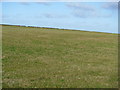
Iron Age univallate hillfort situated on the east side of Westcote Hill 500 metres south west of the present Idbury Village (an Anglo Saxon place name).
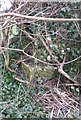
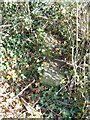
It's roughly oval rampart is aligned north east to south west and now survives as a low earthwork enclosing about 9 acres. The rampart was rivetted with limestone dry walling and originally stood much higher. Beyond the rampart is a deep defensive quarry ditch seen as a darker band of soil.
Finds of Iron Age and Romano British pottery, coins, weapons and bone have been made within and around the monument. Inhumations have also been found in a nearby stone quarry which date to the Romano British or Anglo-Saxon period. Scheduled."
Above from Pastscape site:
http://www.pastscape.org.uk/hob.aspx?hob_id=332307
You may be viewing yesterday's version of this page. To see the most up to date information please register for a free account.
")
")
Do not use the above information on other web sites or publications without permission of the contributor.
coldrum has found this location on Google Street View:
Nearby Images from Geograph Britain and Ireland:
©2012(licence)
©2019(licence)
©2012(licence)

©2011(licence)
©2012(licence)
The above images may not be of the site on this page, they are loaded from Geograph.
Please Submit an Image of this site or go out and take one for us!
Click here to see more info for this site
Nearby sites
Key: Red: member's photo, Blue: 3rd party photo, Yellow: other image, Green: no photo - please go there and take one, Grey: site destroyed
Download sites to:
KML (Google Earth)
GPX (GPS waypoints)
CSV (Garmin/Navman)
CSV (Excel)
To unlock full downloads you need to sign up as a Contributory Member. Otherwise downloads are limited to 50 sites.
Turn off the page maps and other distractions
Nearby sites listing. In the following links * = Image available
1.3km SW 236° Fifield Chambered Cairn (SP218188)
3.0km WNW 295° Wyck Beacon bowl barrow* Round Barrow(s) (SP20182078)
4.4km NW 325° Icomb Camp* Hillfort (SP20352315)
5.5km WNW 283° Salmonsbury Camp* Hillfort (SP175208)
5.7km SE 135° Shipton Barrow* Barrow Cemetery (SP269155)
6.2km NW 323° St Edwards well* Holy Well or Sacred Spring (SP191245)
7.0km ENE 61° Old Vicarage* Standing Stone (Menhir) (SP290230)
7.0km ENE 78° Lyneham Long Barrow* Long Barrow (SP29752107)
7.2km NE 51° Churchill* Stone Circle (SP284241)
7.2km ESE 107° Coldwell Bridge Long Barrow 2* Long Barrow (SP29751745)
7.3km ENE 75° Lyneham Camp* Hillfort (SP299214)
7.3km NNW 332° Stow Camp* Hillfort (SP19442595)
7.3km ESE 106° Ascott under Wychwood* Chambered Tomb (SP299176)
7.4km NNW 332° St Edwards (Stow Well) Well* Holy Well or Sacred Spring (SP1931126039)
7.9km NW 313° The Horestone (Lower Swell)* Standing Stone (Menhir) (SP170249)
8.1km NW 321° Our Lady's Well (near Stow)* Holy Well or Sacred Spring (SP177258)
8.2km NW 318° Whittlestone* Standing Stone (Menhir) (SP174256)
8.4km NNW 334° Broadwell Chambered Tomb (SP191270)
8.5km SE 132° Ladihame* Long Barrow (SP293139)
8.5km NW 317° Lower Swell barrow* Chambered Tomb (SP17032580)
8.6km E 97° Smallstones Farm Long Barrow (SP31411852)
8.6km W 278° Cold Aston* Chambered Tomb (SP14342065)
8.7km SSW 214° Windrush Camp* Hillfort (SP181123)
8.9km NW 316° The Tump* Round Barrow(s) (SP166259)
8.9km NE 47° Churchill Standing Stone* Standing Stone (Menhir) (SP29372568)
View more nearby sites and additional images


 We would like to know more about this location. Please feel free to add a brief description and any relevant information in your own language.
 Wir möchten mehr über diese Stätte erfahren. Bitte zögern Sie nicht, eine kurze Beschreibung und relevante Informationen in Deutsch hinzuzufügen.
 Nous aimerions en savoir encore un peu sur les lieux. S'il vous plaît n'hesitez pas à ajouter une courte description et tous les renseignements pertinents dans votre propre langue.
 Quisieramos informarnos un poco más de las lugares. No dude en añadir una breve descripción y otros datos relevantes en su propio idioma.