


<< Our Photo Pages >> Buckwood Long Barrow - Long Barrow in England in Wiltshire
Submitted by SolarMegalith on Thursday, 21 June 2012 Page Views: 3295
Neolithic and Bronze AgeSite Name: Buckwood Long BarrowCountry: England
NOTE: This site is 0.82 km away from the location you searched for.
County: Wiltshire Type: Long Barrow
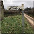
Nearest Village: Bedwyn
Map Ref: SU26176593
Latitude: 51.391811N Longitude: 1.625268W
Condition:
| 5 | Perfect |
| 4 | Almost Perfect |
| 3 | Reasonable but with some damage |
| 2 | Ruined but still recognisable as an ancient site |
| 1 | Pretty much destroyed, possibly visible as crop marks |
| 0 | No data. |
| -1 | Completely destroyed |
| 5 | Superb |
| 4 | Good |
| 3 | Ordinary |
| 2 | Not Good |
| 1 | Awful |
| 0 | No data. |
| 5 | Can be driven to, probably with disabled access |
| 4 | Short walk on a footpath |
| 3 | Requiring a bit more of a walk |
| 2 | A long walk |
| 1 | In the middle of nowhere, a nightmare to find |
| 0 | No data. |
| 5 | co-ordinates taken by GPS or official recorded co-ordinates |
| 4 | co-ordinates scaled from a detailed map |
| 3 | co-ordinates scaled from a bad map |
| 2 | co-ordinates of the nearest village |
| 1 | co-ordinates of the nearest town |
| 0 | no data |
Internal Links:
External Links:
I have visited· I would like to visit
SolarMegalith visited on 20th Jun 2012 - their rating: Cond: 3 Amb: 4 Access: 4
")
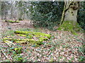
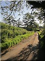
This mound is a probable Neolithic long barrow. It is 28 m long, 17 m wide and tree-covered. There are no traces of side ditches, but it could be a short long barrow. The mound has never been excavated.
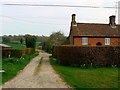
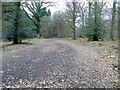
The monument is located SE of Chisbury Lane Farm and West of Buckwood Farm. There is a footpath leading from the road towards the NW, the mound is on its left.
Pastscape entry.
You may be viewing yesterday's version of this page. To see the most up to date information please register for a free account.
")
")
Do not use the above information on other web sites or publications without permission of the contributor.
Nearby Images from Geograph Britain and Ireland:
©2011(licence)
©2007(licence)
©2020(licence)
©2011(licence)
©2014(licence)
The above images may not be of the site on this page, they are loaded from Geograph.
Please Submit an Image of this site or go out and take one for us!
Click here to see more info for this site
Nearby sites
Key: Red: member's photo, Blue: 3rd party photo, Yellow: other image, Green: no photo - please go there and take one, Grey: site destroyed
Download sites to:
KML (Google Earth)
GPX (GPS waypoints)
CSV (Garmin/Navman)
CSV (Excel)
To unlock full downloads you need to sign up as a Contributory Member. Otherwise downloads are limited to 50 sites.
Turn off the page maps and other distractions
Nearby sites listing. In the following links * = Image available
202m SSE 147° Bedwyn Common Bowl Barrows* Round Barrow(s) (SU26286576)
1.7km E 90° Chisbury Camp* Hillfort (SU27906595)
2.2km SE 132° Great Bedwyn Puddingstone* Marker Stone (SU278645)
2.9km E 89° Little Bedwyn Puddingstones Natural Stone / Erratic / Other Natural Feature (SU291660)
3.2km W 279° Monument 224730* Round Barrow(s) (SU23036640)
3.7km WNW 292° Savernake Forest Iron Age Temple Enclosure Ancient Temple (SU227673)
3.9km S 171° Dodsdown Bowl Barrow Round Barrow(s) (SU2677862069)
4.1km NW 306° East Croft Coppice Enclosure* Misc. Earthwork (SU2279968329)
4.6km W 274° Monument 1469430* Round Barrow(s) (SU21556625)
4.7km W 270° Monument 224718* Round Barrow(s) (SU21446591)
4.9km WSW 244° Square Copse Barrow Cemetery* Barrow Cemetery (SU2179463760)
5.8km NNE 12° Ramsbury Crosses* Ancient Cross (SU2738271592)
6.2km E 86° Standon Manor Puddingstone Natural Stone / Erratic / Other Natural Feature (SU324664)
7.9km ENE 66° Charnham Lane Timber Circle (SU334692)
8.2km SSE 167° Tidcombe and Fosbury Mound Round Barrow(s) (SU2804957991)
8.2km WNW 290° Merlin's Mount* Artificial Mound (SU18366865)
8.3km S 172° Tow Barrow* Long Barrow (SU27425775)
8.4km SW 218° Easton Clump Disc Barrow Round Barrow(s) (SU21085927)
8.5km NNE 20° Ballard's Copse Long Barrow (SU29067389)
8.7km WSW 257° Martinshill Fort* Hillfort (SU1767563970)
8.9km NNE 26° Membury Bowl Barrow* Round Barrow(s) (SU30047391)
8.9km SSE 160° Tidcombe Long Barrow* Long Barrow (SU2924957610)
9.1km WNW 298° Marlborough Common Barrows* Barrow Cemetery (SU1806770169)
9.2km S 184° Collingbourne Kingston 21 Long Barrow* Long Barrow (SU25645671)
9.3km WNW 295° Seorfon Long Barrow (SU177699)
View more nearby sites and additional images


 We would like to know more about this location. Please feel free to add a brief description and any relevant information in your own language.
 Wir möchten mehr über diese Stätte erfahren. Bitte zögern Sie nicht, eine kurze Beschreibung und relevante Informationen in Deutsch hinzuzufügen.
 Nous aimerions en savoir encore un peu sur les lieux. S'il vous plaît n'hesitez pas à ajouter une courte description et tous les renseignements pertinents dans votre propre langue.
 Quisieramos informarnos un poco más de las lugares. No dude en añadir una breve descripción y otros datos relevantes en su propio idioma.