


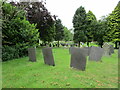
<< Our Photo Pages >> Stone in Croxall Churchyard - Marker Stone in England in Staffordshire
Submitted by Andy B on Thursday, 27 July 2023 Page Views: 312
Date UncertainSite Name: Stone in Croxall ChurchyardCountry: England
NOTE: This site is 5.619 km away from the location you searched for.
County: Staffordshire Type: Marker Stone
Nearest Town: Tamworth Nearest Village: Croxall
Map Ref: SK2140512127
Latitude: 52.706392N Longitude: 1.684639W
Condition:
| 5 | Perfect |
| 4 | Almost Perfect |
| 3 | Reasonable but with some damage |
| 2 | Ruined but still recognisable as an ancient site |
| 1 | Pretty much destroyed, possibly visible as crop marks |
| 0 | No data. |
| -1 | Completely destroyed |
| 5 | Superb |
| 4 | Good |
| 3 | Ordinary |
| 2 | Not Good |
| 1 | Awful |
| 0 | No data. |
| 5 | Can be driven to, probably with disabled access |
| 4 | Short walk on a footpath |
| 3 | Requiring a bit more of a walk |
| 2 | A long walk |
| 1 | In the middle of nowhere, a nightmare to find |
| 0 | No data. |
| 5 | co-ordinates taken by GPS or official recorded co-ordinates |
| 4 | co-ordinates scaled from a detailed map |
| 3 | co-ordinates scaled from a bad map |
| 2 | co-ordinates of the nearest village |
| 1 | co-ordinates of the nearest town |
| 0 | no data |
Internal Links:
External Links:
")
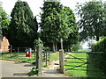
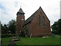
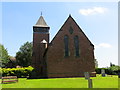
A stone in the churchyard, used as a boundary stone.
You may be viewing yesterday's version of this page. To see the most up to date information please register for a free account.
Do not use the above information on other web sites or publications without permission of the contributor.
Nearby Images from Geograph Britain and Ireland:
©2021(licence)
©2021(licence)
©2016(licence)
©2021(licence)
©2021(licence)
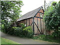
The above images may not be of the site on this page, they are loaded from Geograph.
Please Submit an Image of this site or go out and take one for us!
Click here to see more info for this site
Nearby sites
Key: Red: member's photo, Blue: 3rd party photo, Yellow: other image, Green: no photo - please go there and take one, Grey: site destroyed
Download sites to:
KML (Google Earth)
GPX (GPS waypoints)
CSV (Garmin/Navman)
CSV (Excel)
To unlock full downloads you need to sign up as a Contributory Member. Otherwise downloads are limited to 50 sites.
Turn off the page maps and other distractions
Nearby sites listing. In the following links * = Image available
3.8km NW 311° National Memorial Arboretum* Henge (SK18531459)
4.6km NW 307° Alrewas Cursus* Cursus (SK177149)
4.6km NW 307° Alrewas and Fradley Cursus Cursus (SK177149)
4.9km NNW 339° Catholme 01* Timber Circle (SK19621666)
5.0km NNW 337° Catholme 02 Henge (SK19431670)
5.3km NNW 337° Barton Under Needwood Cursus Cursus (SK19301697)
5.4km NNW 340° Efflinch Cursus (SK19521724)
6.4km WNW 291° Alrewas Causewayed Enclosure* Causewayed Enclosure (SK15351436)
8.4km S 185° St Ruffin's Well (Tamworth)* Holy Well or Sacred Spring (SK207038)
9.4km W 259° St Chad's Well (Lichfield)* Holy Well or Sacred Spring (SK122103)
10.3km N 356° Holy Well (Tatenhill)* Holy Well or Sacred Spring (SK20572236)
10.4km WNW 290° King's Bromley Cursus Cursus (SK116157)
11.2km NNE 20° St Andrew's Well (Burton on Trent)* Holy Well or Sacred Spring (SK25212266)
11.5km N 350° Wishing Well (nr Tatenhill) Holy Well or Sacred Spring (SK19272346)
11.6km ENE 65° Blackfordby Spring* Holy Well or Sacred Spring (SK3217)
12.8km WSW 245° Wall Roman sites (Letocetum)* Ancient Village or Settlement (SK0977506660)
13.1km ENE 63° Blackfordby Spring* Holy Well or Sacred Spring (SK331182)
13.2km SSW 210° St Modwen's Well (Canwell) Holy Well or Sacred Spring (SK14890058)
13.7km WNW 290° Mavesyn Ridware* Causewayed Enclosure (SK0853816800)
14.0km WNW 293° Hill Ridware* Cursus (SK08471759)
14.0km WNW 293° Mavesyn Ridware Cursus Cursus (SK08471759)
15.7km N 8° St Mary (Rolleston on Dove)* Ancient Cross (SK23542771)
16.1km WNW 292° Cawarden Spring Holy Well or Sacred Spring (SK064181)
16.9km W 273° Castle Ring (Staffordshire)* Hillfort (SK045128)
16.9km NNE 29° St Ann's Well (Repton)* Holy Well or Sacred Spring (SK29442699)
View more nearby sites and additional images


 We would like to know more about this location. Please feel free to add a brief description and any relevant information in your own language.
 Wir möchten mehr über diese Stätte erfahren. Bitte zögern Sie nicht, eine kurze Beschreibung und relevante Informationen in Deutsch hinzuzufügen.
 Nous aimerions en savoir encore un peu sur les lieux. S'il vous plaît n'hesitez pas à ajouter une courte description et tous les renseignements pertinents dans votre propre langue.
 Quisieramos informarnos un poco más de las lugares. No dude en añadir una breve descripción y otros datos relevantes en su propio idioma.