

<< Text Pages >> Clanfield Cursus - Cursus in England in Oxfordshire
Submitted by EssexMan on Wednesday, 07 April 2010 Page Views: 2889
Neolithic and Bronze AgeSite Name: Clanfield CursusCountry: England
NOTE: This site is 0.644 km away from the location you searched for.
County: Oxfordshire Type: Cursus
Nearest Town: Witney Nearest Village: Clanfield
Map Ref: SP279017 Landranger Map Number: 163
Latitude: 51.713343N Longitude: 1.597579W
Condition:
| 5 | Perfect |
| 4 | Almost Perfect |
| 3 | Reasonable but with some damage |
| 2 | Ruined but still recognisable as an ancient site |
| 1 | Pretty much destroyed, possibly visible as crop marks |
| 0 | No data. |
| -1 | Completely destroyed |
| 5 | Superb |
| 4 | Good |
| 3 | Ordinary |
| 2 | Not Good |
| 1 | Awful |
| 0 | No data. |
| 5 | Can be driven to, probably with disabled access |
| 4 | Short walk on a footpath |
| 3 | Requiring a bit more of a walk |
| 2 | A long walk |
| 1 | In the middle of nowhere, a nightmare to find |
| 0 | No data. |
| 5 | co-ordinates taken by GPS or official recorded co-ordinates |
| 4 | co-ordinates scaled from a detailed map |
| 3 | co-ordinates scaled from a bad map |
| 2 | co-ordinates of the nearest village |
| 1 | co-ordinates of the nearest town |
| 0 | no data |
Internal Links:
External Links:
Cruciform Long Enclosure in Oxfordshire
Status: Doubtful
Extent: 180mx30m
You may be viewing yesterday's version of this page. To see the most up to date information please register for a free account.
Do not use the above information on other web sites or publications without permission of the contributor.
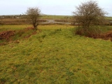
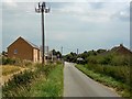
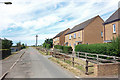
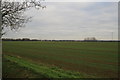
Nearby Images from Geograph Britain and Ireland:

©2008(licence)
©2008(licence)
©2020(licence)
©2007(licence)
©2006(licence)
The above images may not be of the site on this page, they are loaded from Geograph.
Please Submit an Image of this site or go out and take one for us!
Click here to see more info for this site
Nearby sites
Key: Red: member's photo, Blue: 3rd party photo, Yellow: other image, Green: no photo - please go there and take one, Grey: site destroyed
Download sites to:
KML (Google Earth)
GPX (GPS waypoints)
CSV (Garmin/Navman)
CSV (Excel)
To unlock full downloads you need to sign up as a Contributory Member. Otherwise downloads are limited to 50 sites.
Turn off the page maps and other distractions
Nearby sites listing. In the following links * = Image available
6.5km WSW 241° Buscot B Cursus Cursus (SU222985)
6.6km WSW 243° Buscot A Cursus Cursus (SU22009867)
6.7km WSW 257° Lechlade Cursus Cursus (SP214002)
6.8km W 260° Lechlade Cursus Cursus (SP21240048)
6.8km WSW 246° Buscot B Cursus Cursus (SU217989)
6.8km W 260° Lechlade Cursus Cursus (SP212005)
6.9km SW 220° Bury Hill (Oxfordshire)* Hillfort (SU235964)
7.3km SSW 194° Badbury Hill* Hillfort (SU262946)
8.5km N 7° Asthall Barrow* Barrow Cemetery (SP289101)
9.0km S 174° Lower Coxwell Camp* Hillfort (SU289928)
10.8km ENE 74° Standlake 20 Timber Circle (SP383047)
10.9km ESE 120° Cherbury Camp* Hillfort (SU374963)
11.2km NNE 31° Churchill Plain Chambered Tomb (SP33711129)
12.0km WNW 282° Barrow Elm* Round Barrow(s) (SP16110420)
12.3km N 7° Ladihame* Long Barrow (SP293139)
12.5km E 92° Northmoor Linear Ditches* Barrow Cemetery (SP40390142)
13.0km ENE 74° Gravelly Guy Timber Circle (SP404054)
13.3km WNW 302° Ladborough Camp* Hillfort (SP16540870)
13.5km ENE 77° Devils Quoits* Stone Circle (SP41120476)
13.8km NW 306° Lad Barrow* Chambered Tomb (SP166097)
13.8km N 356° Shipton Barrow* Barrow Cemetery (SP269155)
14.3km ENE 74° Stanton Harcourt Church Cross* Ancient Cross (SP4164305666)
14.4km SSE 163° Fawler Modern Stone Circle* Modern Stone Circle etc (SU323880)
14.4km NW 318° Windrush Camp* Hillfort (SP181123)
14.9km NE 50° Eynsham Park Camp Hillfort (SP393114)
View more nearby sites and additional images


 We would like to know more about this location. Please feel free to add a brief description and any relevant information in your own language.
 Wir möchten mehr über diese Stätte erfahren. Bitte zögern Sie nicht, eine kurze Beschreibung und relevante Informationen in Deutsch hinzuzufügen.
 Nous aimerions en savoir encore un peu sur les lieux. S'il vous plaît n'hesitez pas à ajouter une courte description et tous les renseignements pertinents dans votre propre langue.
 Quisieramos informarnos un poco más de las lugares. No dude en añadir una breve descripción y otros datos relevantes en su propio idioma.